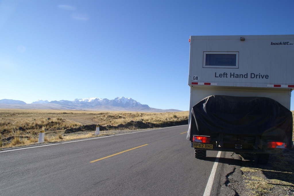
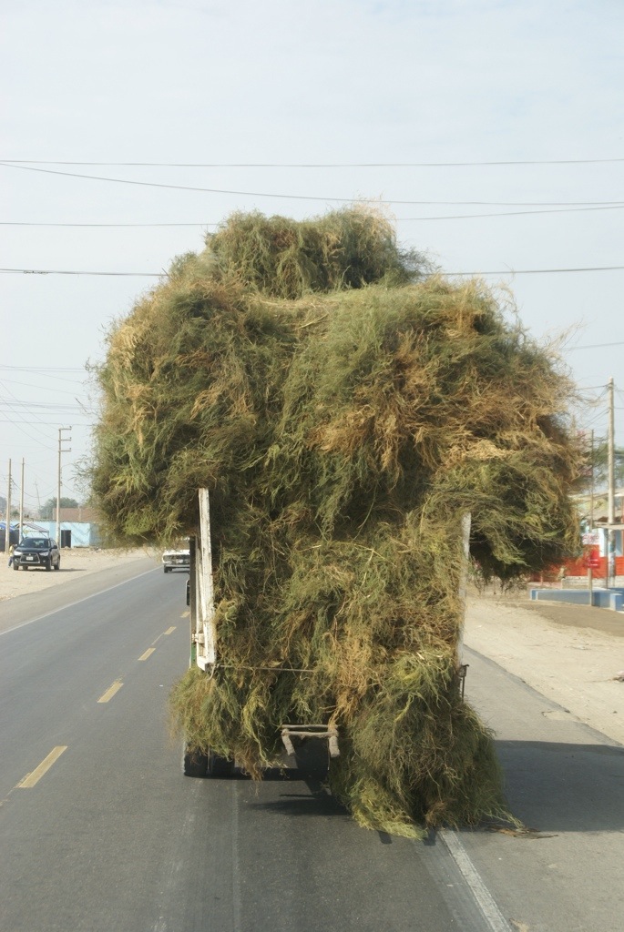
Being a morning person, Steve is always keen for a challenge first thing. So he was up for our first task before we could even leave Huaraz, we had to squeeze under the entrance gate of the hotel we parked up on. We’d noticed many people had not been successful with a multitude of different coloured scratches already on the top. Even with lining the truck up completely straight and stopping the traffic so we could exit straight, we just managed with less than an inch on the back corner. Phew!
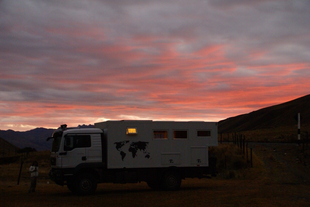
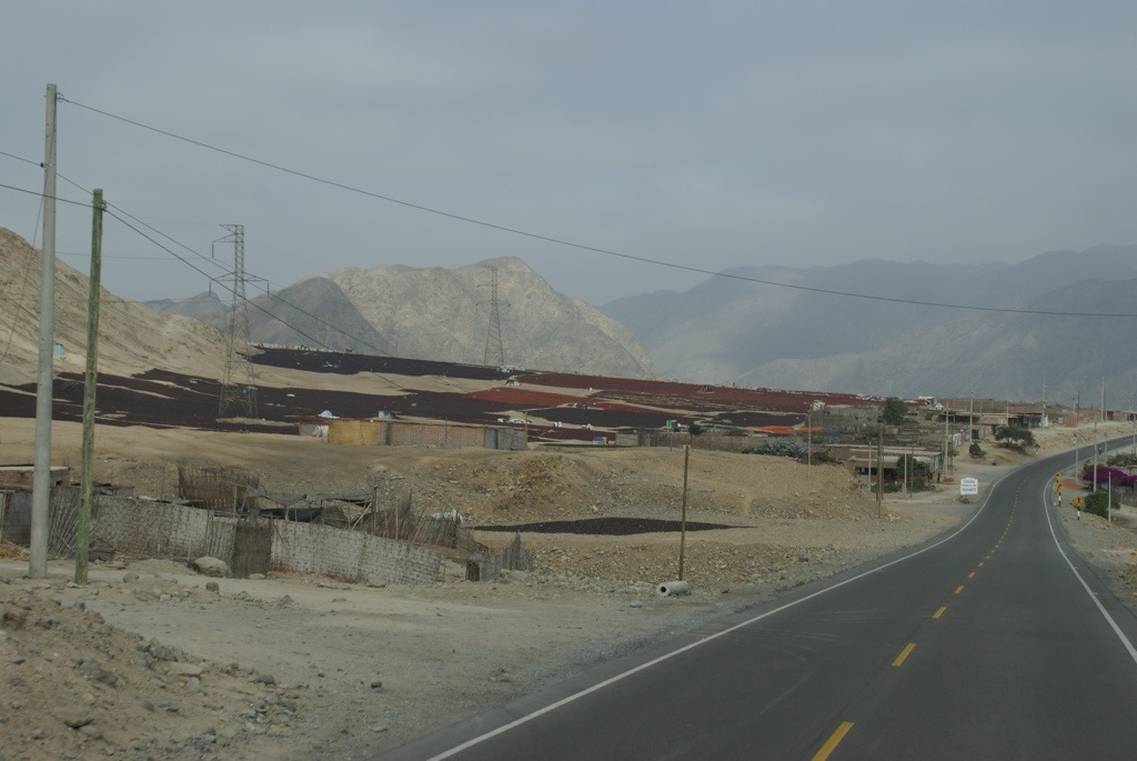
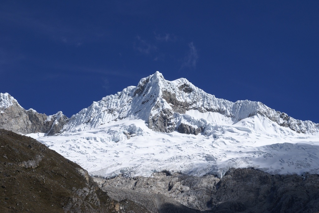
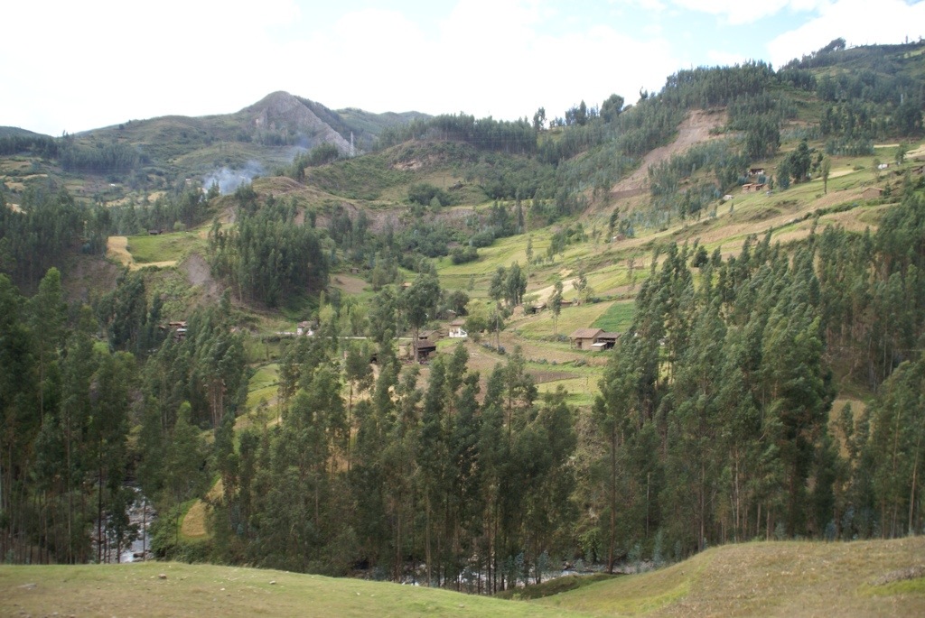
The view of the mountains from our parking spot in Huaraz
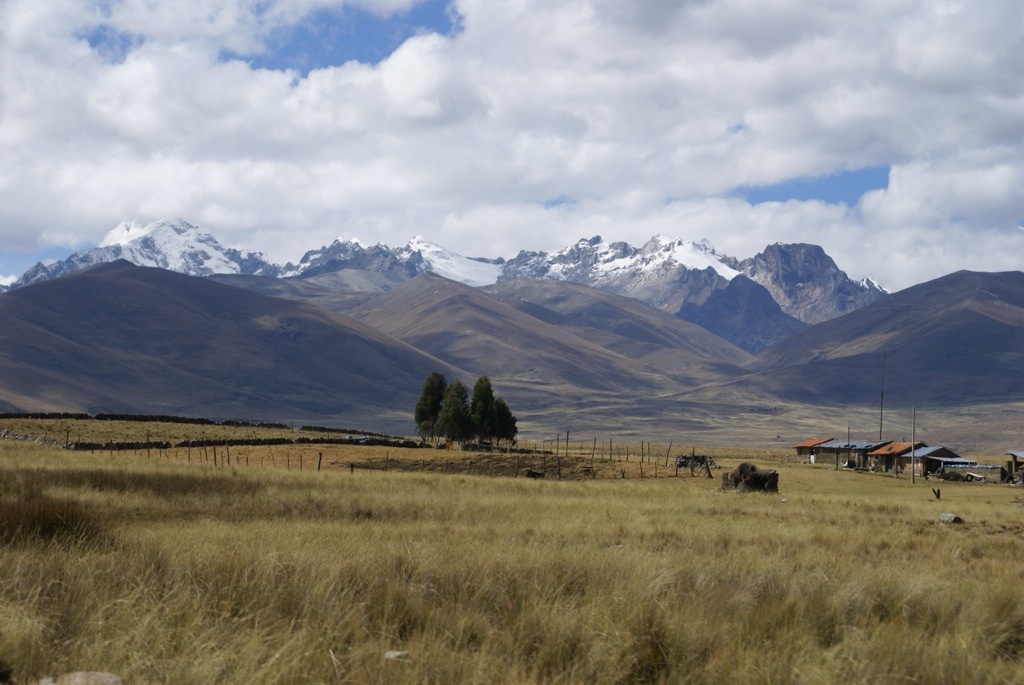
We were heading back into the mountains again to the ancient ruins of Chavín de Huántar over another pass of 4535m. We are getting quite blasé about these high altitude passes now. Luckily the road up was lovely smooth tar and the views were stunning. The good tar ran out the other side but it was a picturesque drive into a steep valley patch worked with gold and green fields on impossibly angled slopes.
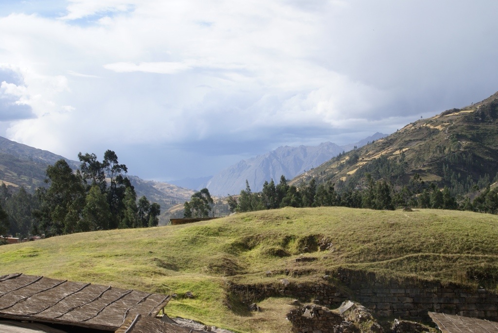
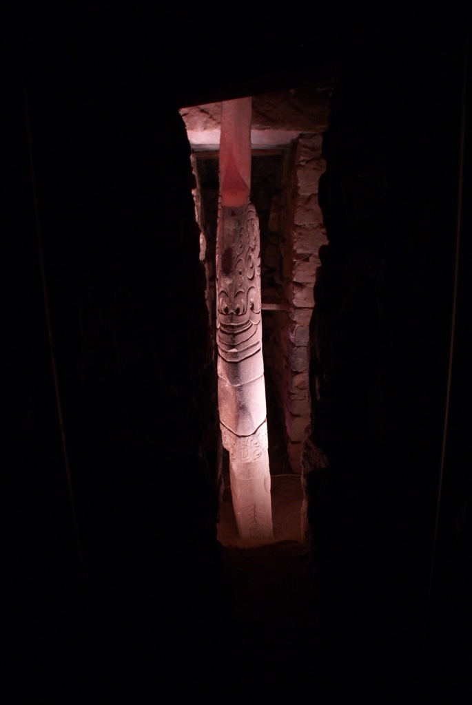
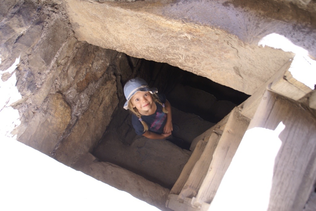
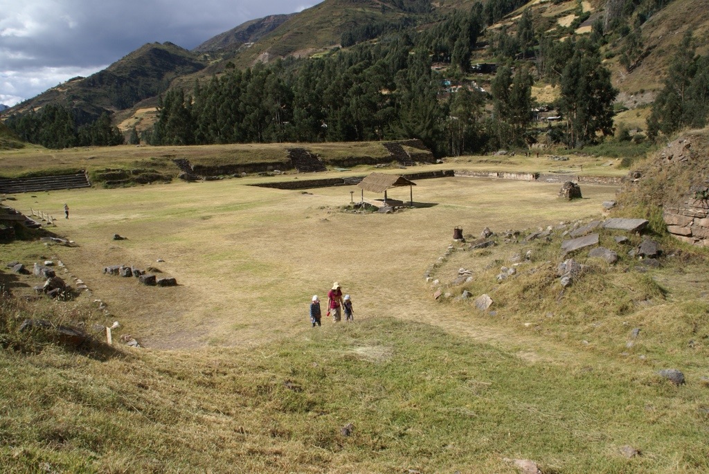
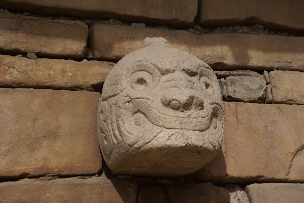
Chavín de Huántar is a temple complex built about 800 BC. Apart from a large plaza where they used to hold ceremonies most of the ruins are underground tunnels. Archeologists believe that priests worshiping a feline idol held most of the power in Chavín society. To consolidate this the priests used to scare the pants off of the locals by drugging them up with hallucinogenic cacti before taking them into the dark labyrinth of tunnels. Once down there they blew shell trumpets which echoed through the maze. The tunnels were constructed to amplify the sound of water running through them and reflected sunlight from ventilation shafts using mineral mirrors. Once the non-believers were completely freaked out, the priests brought them before the terrifyingly carved idol of Lanzón de Chavin, a semi human carving with snakes radiating from its head also lit in the dark from a strategically placed ventilation shaft. Unsurprisingly perhaps the population was kowtowed and the Chavín influence spread through the Andes. We had the complex almost to ourselves and had a good look around as the girls and Clare made up stories about life there (minus the cacti;)
,
Not finding an ideal place to park for the night we decided to head back up the pass. The weather had changed though with dark clouds, sleet and snow closing in as we headed up. On the other side we parked up in a kindly ranger’s station a bit further down with the hope that the views would be clear the following morning.
It was, what nice view to see from bed.
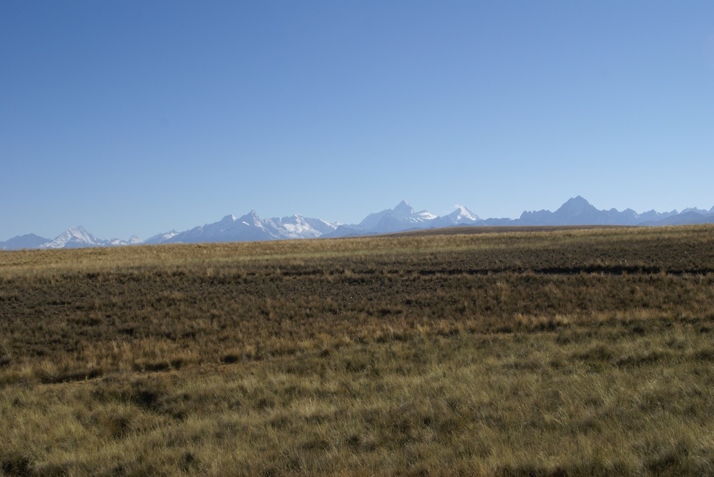
As we drove down to the coast we got a wonderful farewell from the Cordillera Blanca, the sky cleared and we got a 180 degree view of the mountains of about 100km long.
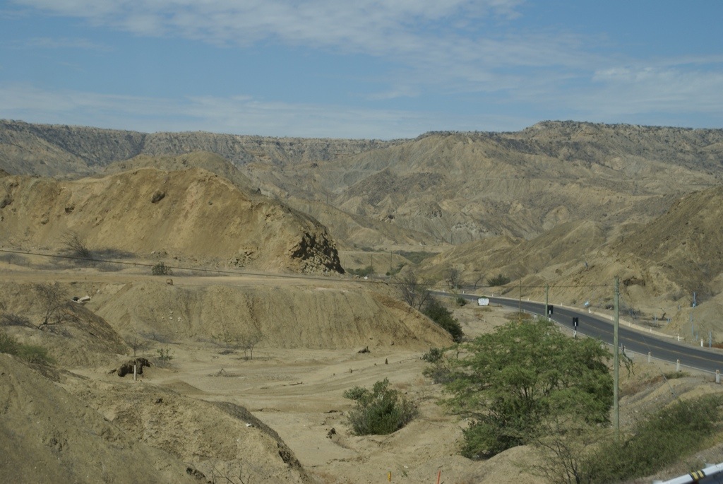
The road descended rapidly as it wiggled first through a valley of golden green pasture rippling in the wind, then back into steep dry craggy dun coloured slopes. There was a narrow river running through the canyon, an oasis of green in the arid landscape, where they were growing maize and chillies.
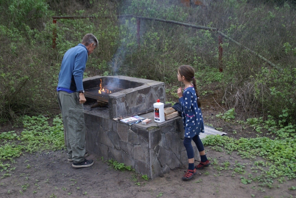
We could see the sea mist for miles before we hit the coastal road and then we were back at sea level speeding through the desert plains of gravel and dunes. We headed just a short way into the hills to Parque National de Lachay and were amazed to see the hills covered in soft fuzzy green. The sea fog creates a microclimate, just enough for the first hills it hits inland to have a sparse covering of greenery. While climbing up the huge boulders at the top of the hill, we got great views of the coast every time the sun managed to burn through the fog. It was lovely spot to have a campfire curry.
The drive round Lima on the Panamerican highway was an absolute nightmare. He who dared definitely won and size mattered. We have found Peruvian driving in general to be some of the worst we have encountered with lots of bullying tactics to get you to move, it is far scarier on foot than in the truck though. Steve did a fantastic drive keeping his nerve. It was like being back driving in rush hour Moscow traffic but this time driving a massive truck. We stayed in the smart district of Miraflores for the night, so Clare could fly out the next morning. After a relaxed evening wander around it was time to say goodbye.
It has been lovely having Clare here. We’ve definitely plunged her in at the deep end with two weeks of difficult roads, high altitudes, a horrible cold but she has seen some fantastic alpine scenery and hiked some great mountains. She has been a trooper, sleeping many nights in the truck’s cab and telling the girls hundreds of stories whilst walking. I think we can say that she has been fully converted to travelling.
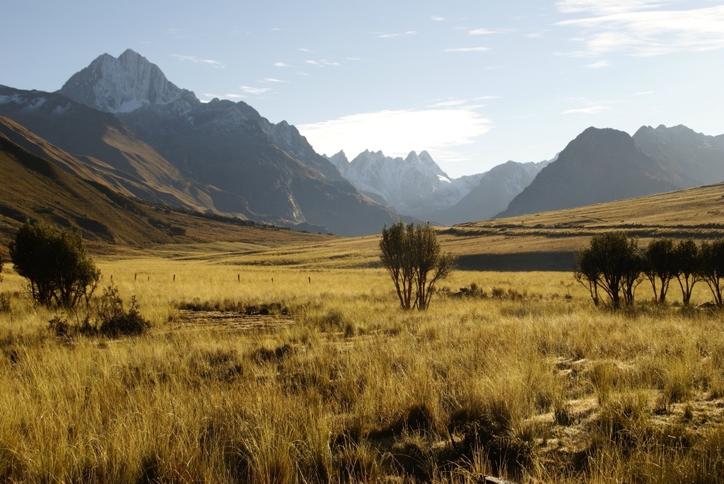
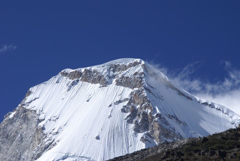
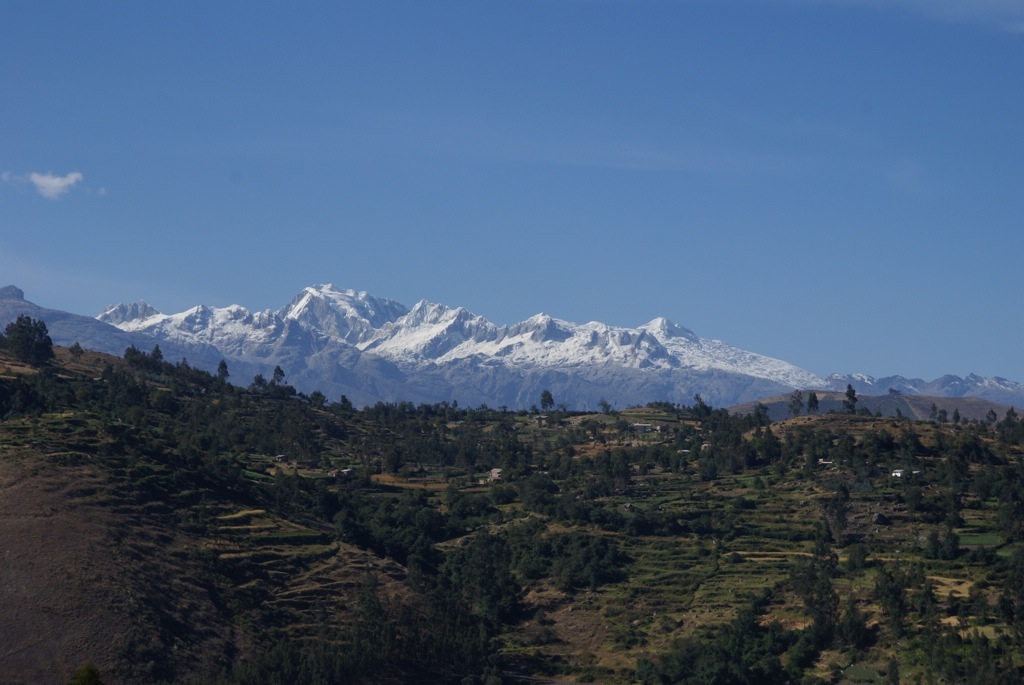
From the coast at Trujillo we wanted to drive up into the Andes along the Cordillera Blanca range. The Cordillera Blanca mountain range is 180kms long by 20kms wide and has numerous snow capped mountain tops in excess of 6000m including Peru’s highest mountain, Huascaran at 6768m. It is the highest mountain in the tropics in the world. Gilly and I had hiked in this area 15 years ago and remembered the wonderful snowy mountain peaks set against beautiful blue skies and were keen to go there again.
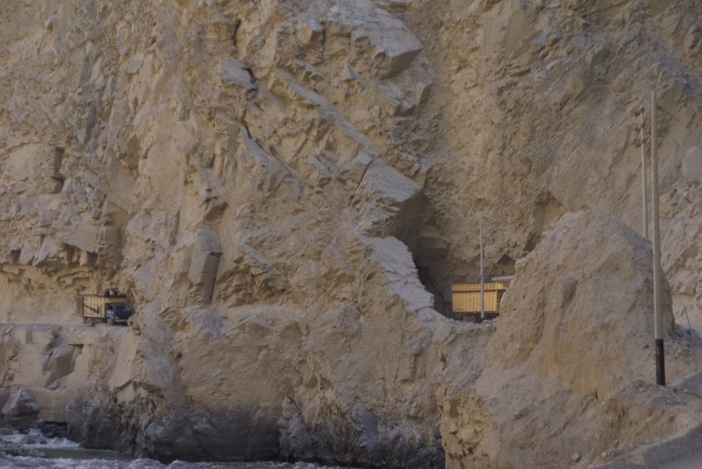
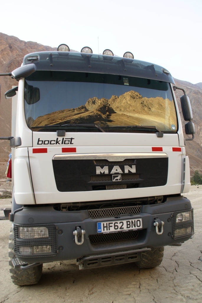
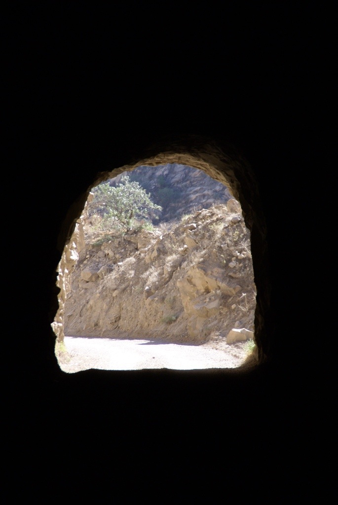
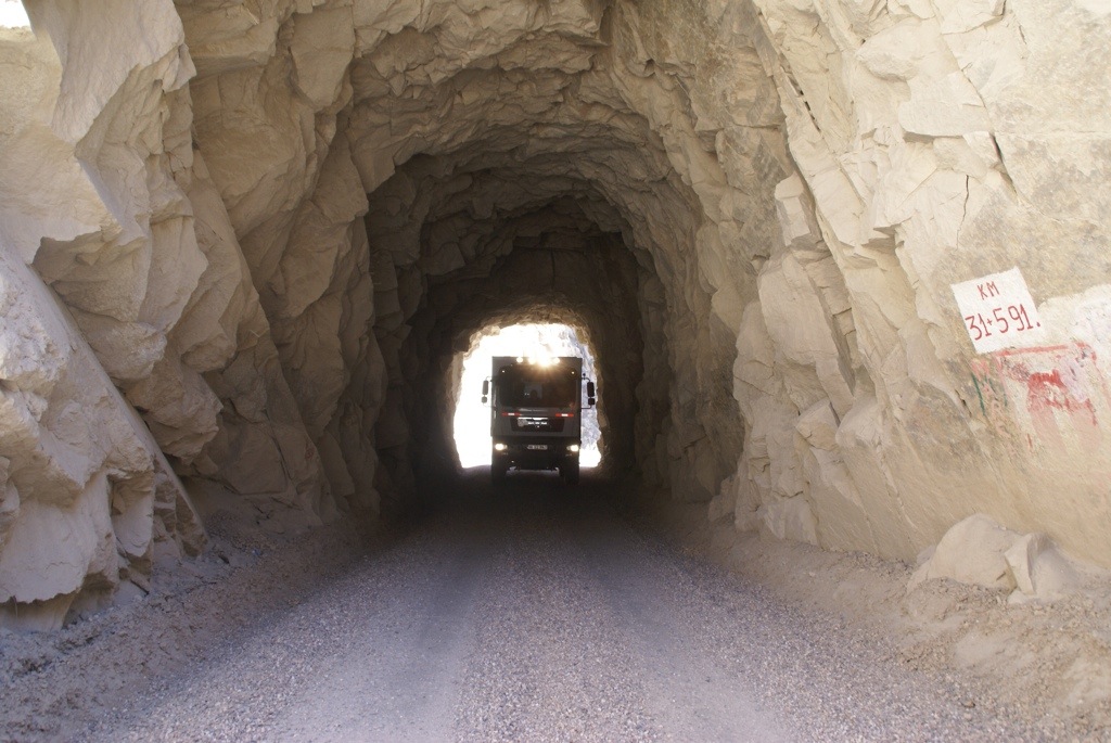
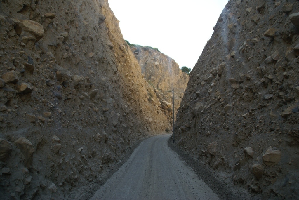
We also knew that there was a spectacular drive to get there along the Canon del Pato. This is a canyon where two mountain ranges, the Cordillera Blanca and the Cordillera Negra come literally within touching (15m) distance of each other. The Canyon has sheer walls of over a 1000 feet that have been carved by the river rushing below. Through this canyon a dirt road has been constructed to service the hydro electric dam which had also involved blasting through lots of rock to form 40 odd, rough strewn tunnels. We had heard a lot about the drive from other travellers and were keen to do it ourselves. However we were a little concerned whether we would fit through the tunnels. We had heard of one truck that had hit its box and had to go back. After talking with a few people who said we should be ok we decided to give it a go.
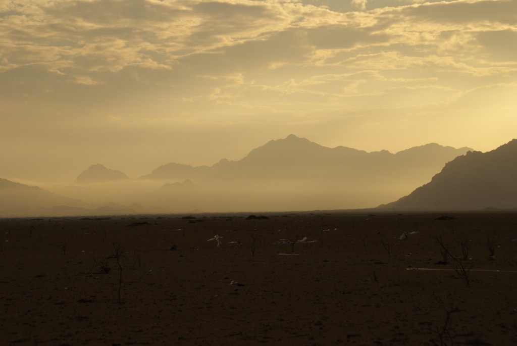
So after stocking up with food we left Trujillo. At first the main road hugged the coast and it was all coastal desert. We then turned inland heading for the mountains. The road at first was good and tarred and the landscape turned quite green. We then passed a police checkpoint and from then on it was dirt road and the stark barren mountains reared up around us.
The road snaked along the side of the river and the views just got better and better. We successfully got through our first tunnel and then as it was getting late looked for somewhere to camp for the night.
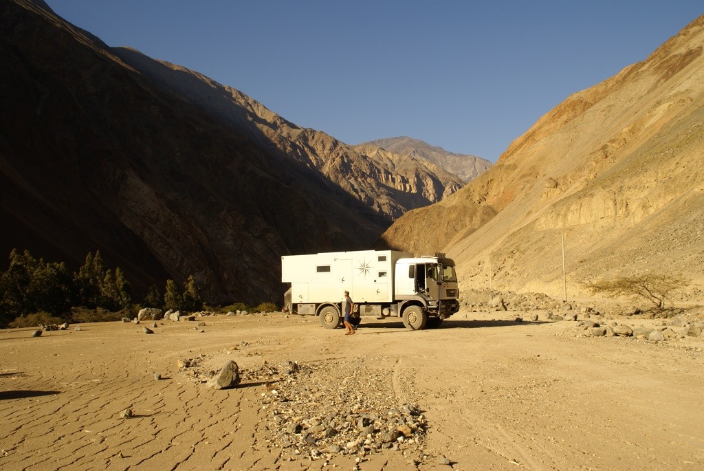
We found a large former landslide that had been flattened by bulldozers which made a great camping spot as it was far enough from the sheer rock faces to avoid rockfalls. We parked up just before the sun disappeared behind the mountains. It was a gorgeous spot.
The next day was going to be the real drive. Just over 80km was all we needed to cover but it would take us 4 hours. Suffice to say the drive was epic. The scenery was jaw dropping, the weather absolutely perfect, and although a little scary in parts we made it safely and unscathed.
If you want to see a quick video clip of the drive follow this link. Let us know what you think.
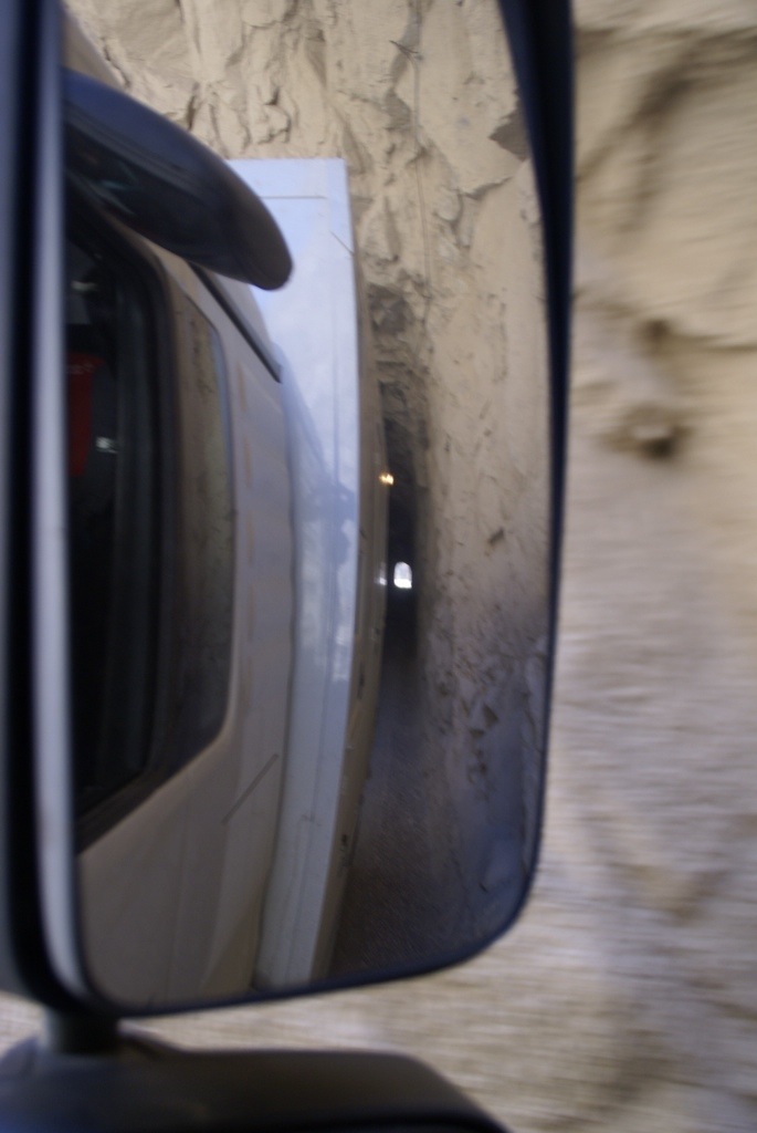
As you can see the tunnels were single track so you had to use your horn before entering and hope no one was coming the other way. We did pass a number of other vehicles but were able to use the passing points. In only one tunnel did we meet someone coming the other way. As it was a car and we were much bigger than them they had to back up.
I had to focus on the driving but it was hard as the views were so spectacular. Gilly also needed to focus hard as the tunnel walls closed in on both sides of the truck. Along the canyon we started to see the snow topped mountains of the Cordillera Blanca set against the deep blue sky.
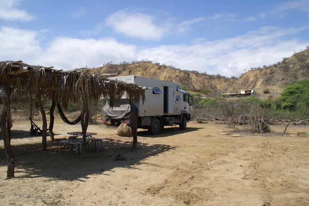
Finally we arrived in the small town on Caraz after a truly memorable morning. Definitely one of the worlds great drives. We were a bit too big to park up at the hostel we were planning at staying at but the owner directed us to a small farm a couple of kilometres outside town that had just opened as a campground. The owners were very friendly and as we had arrived just in time to see the England v Uruguay World Cup match, they kindly brought their TV out onto the veranda so I could watch the match. After such a fantastic morning, the afternoon watching the football was a real downer.
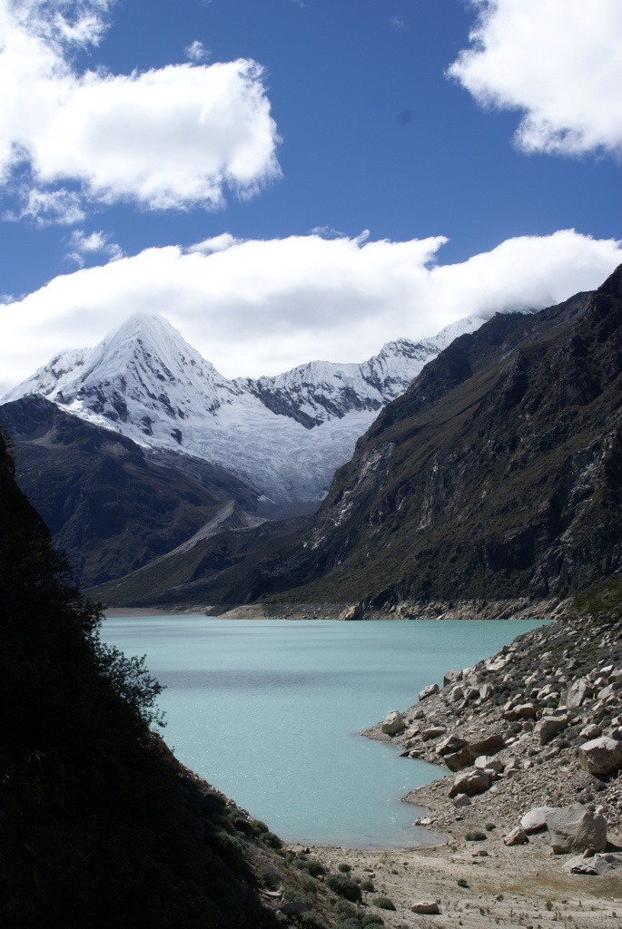
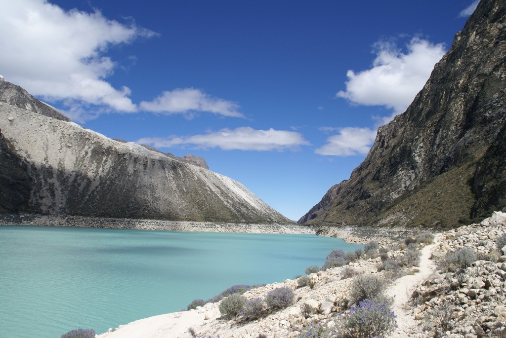
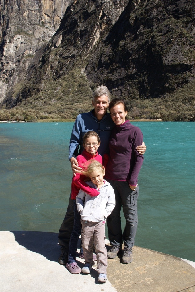
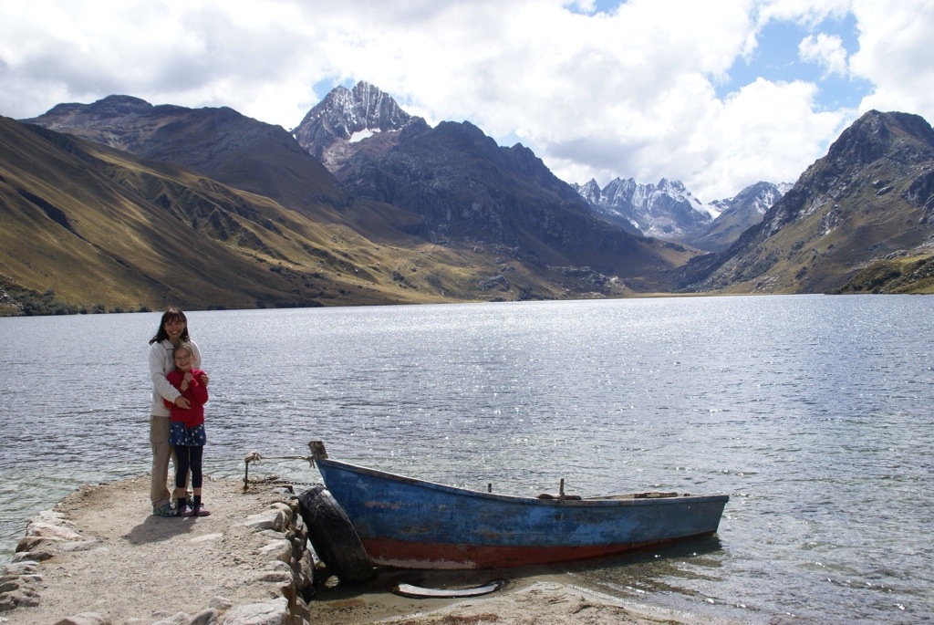
That evening we headed into Caraz to wonder around the small town square overlooked by the mountains and to grab dinner. We also asked whether we could drive up to Laguna Peron the lake outside Caraz which is at 4200m but were advised we would not make it in the truck.
The campsite owner though agreed to drive us up to the lake in his pick up. On seeing the road, I was glad we left the truck behind. The hairpin turns were very tight and some sections of the road really narrow, I am not sure we could have passed. Then at the park entrance there was a boon gate which I doubt we would have fitted under. Anyway it was nice for someone else to do the driving as I could then enjoy the scenery which was again spectacular.
The lake is set high up in the Andes and is towered over by a number of amazing peaks. We could definitely feel the altitude up here but nevertheless set off for a hike along the lake shore.
When we returned to the campsite that night we met up with the French family we keep meeting. They had camped at the lake and said it had been freezing during the night.
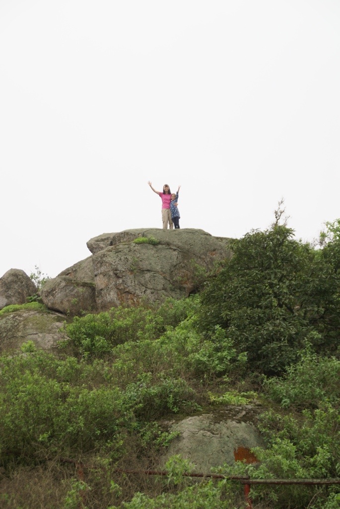
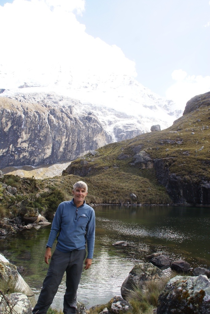
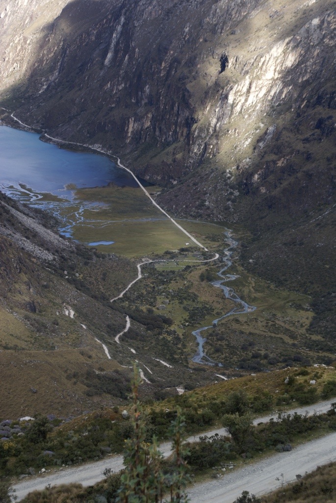
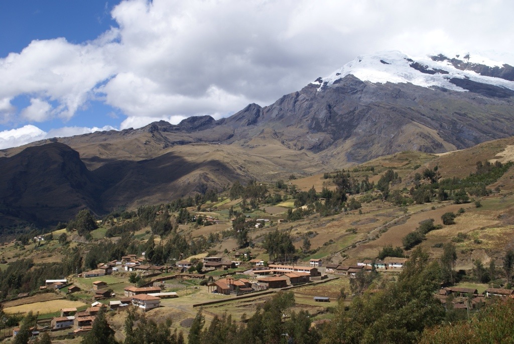
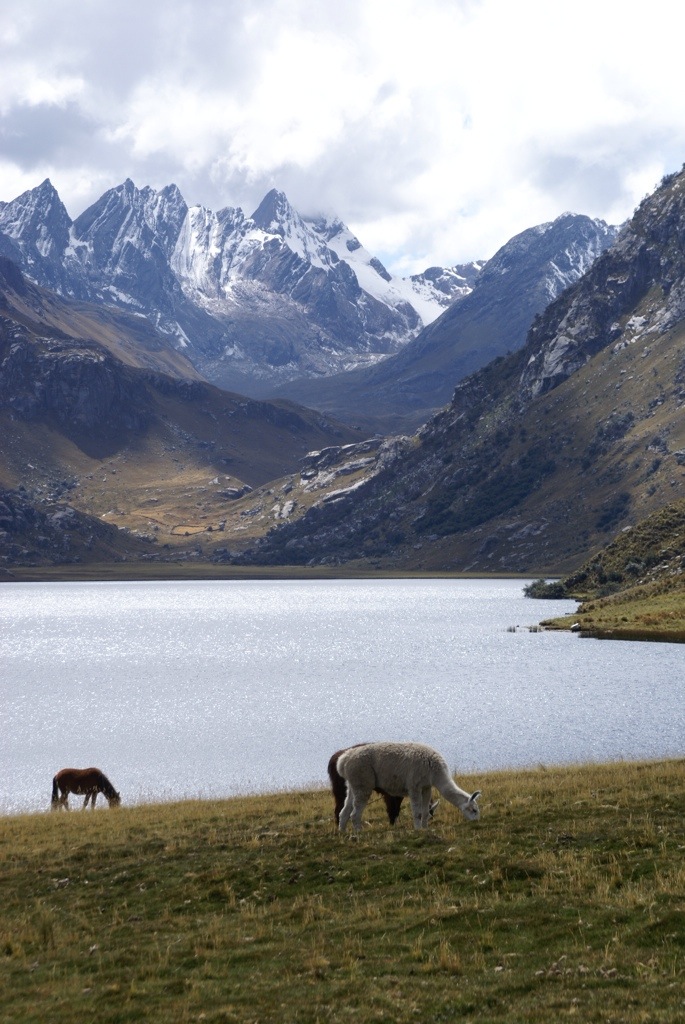
The next day we wanted to drive further up into the mountains so we headed to the village of Yangay and then turned up the dirt track that twisted its way up to Lake Llanganuco at 3850m. There are actually two lakes set in an alpine meadow surrounded by towering cliff walls. We were able to camp next to one of the lakes and enjoyed the scenery by taking a long walk. Whilst it gets cold at night the sky is really clear and we had a great view of the stars with no artificial light to spoil the view.
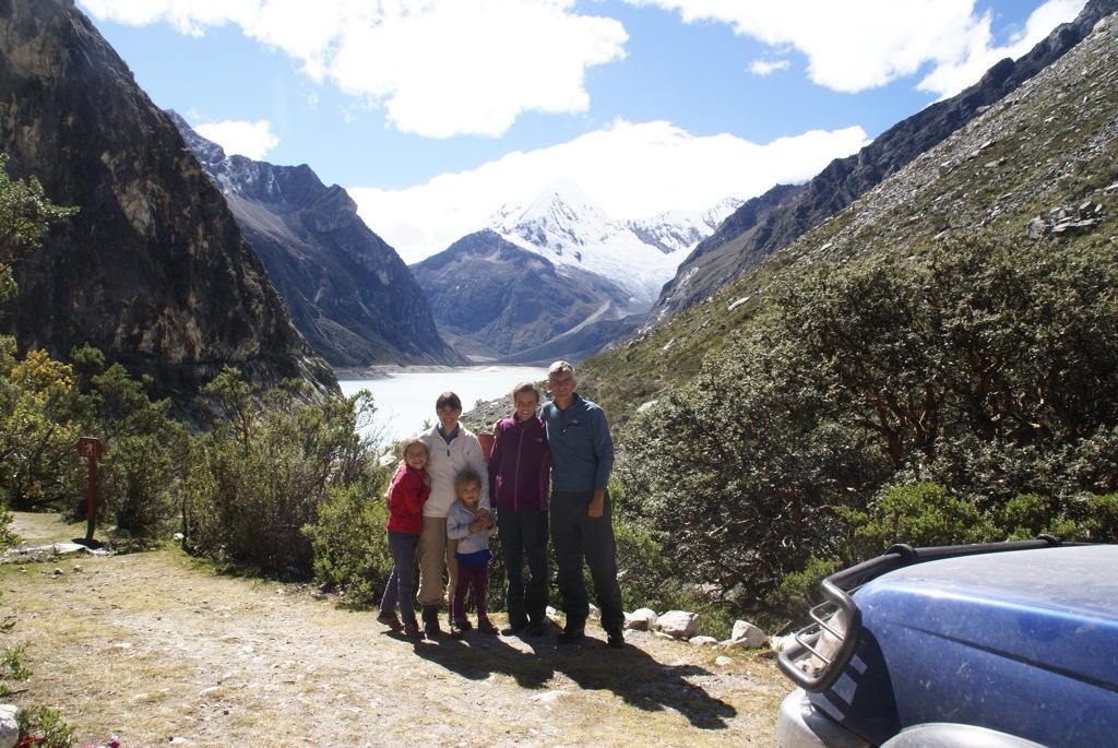
We wanted to do some real hiking while we were in the mountains. Unfortunately Lucy had picked up a cold, which we all had to varying degrees. Undeterred we set off on the hike to Laguna 69 which is meant to be one of the prettiest lakes in the Cordillera Blanca. We were told it was a 3 hour trek up from 3850m to 4400m. However with Lucy’s cold we were never going to make it, so after an hour and a half we stopped. Gilly stayed with Alisha and Lucy and Clare and I pushed on. I got to within 40 minutes of Laguna 69, to a smaller lake nestling in amongst the mountains before deciding I had better turn back.
The views were spectacular as we had another day of perfect weather. There were waterfalls as well as the magnificent mountains. On the way back down we had amazing views of Huascaran set in perfect light.
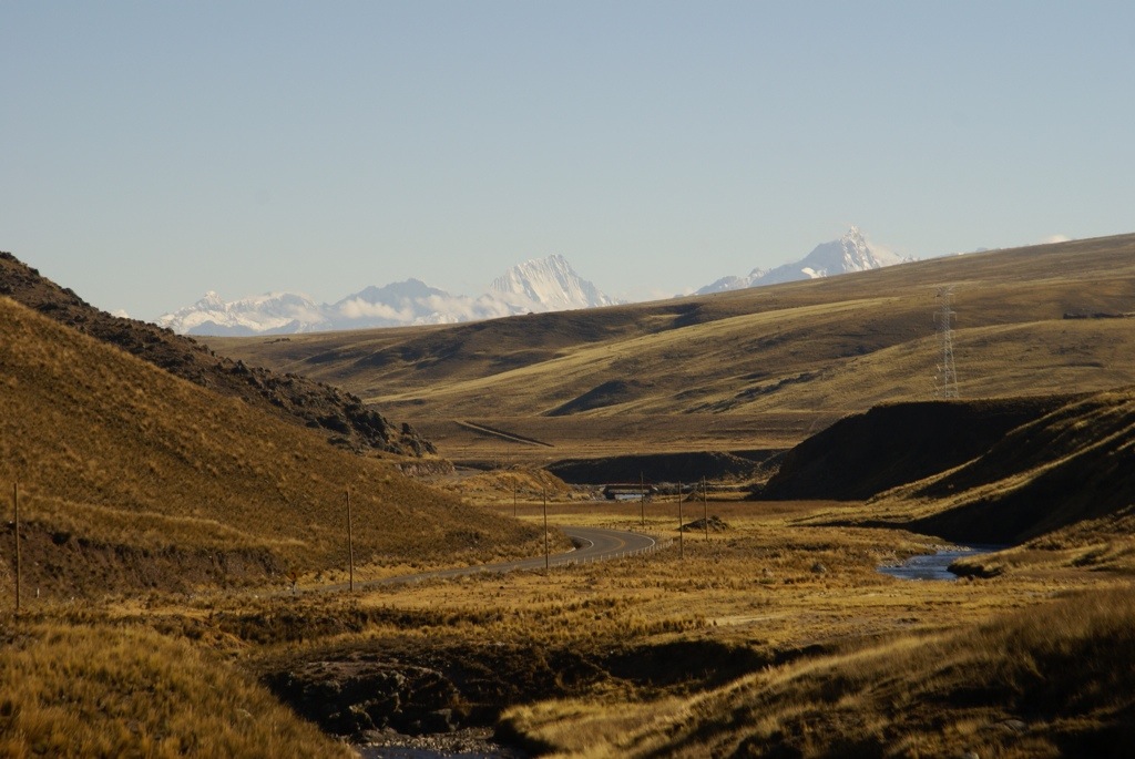
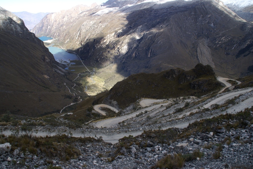
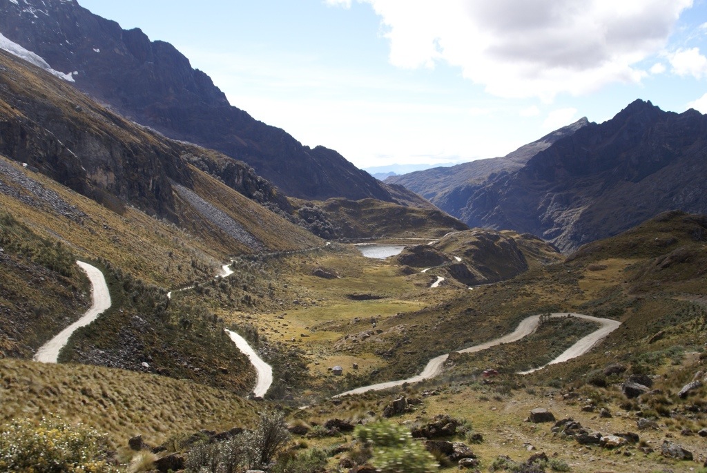
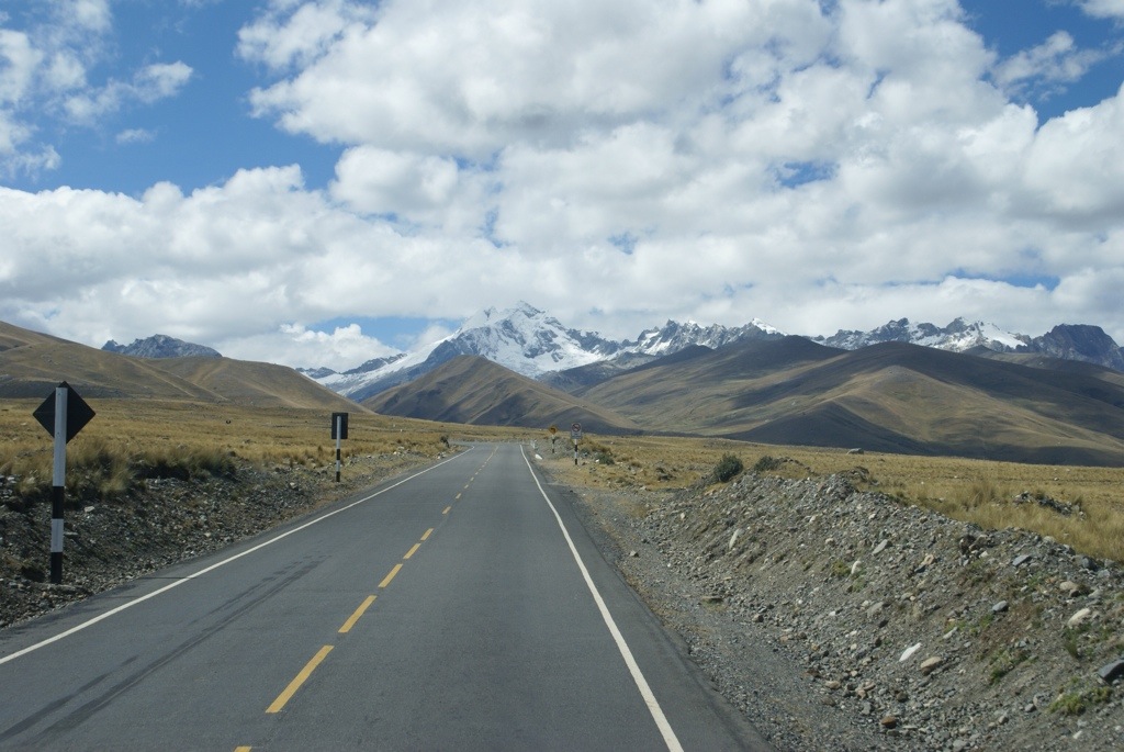
From our campsite we could see the road snaked its way up the mountain to a high mountain pass. We had read from other travellers that it was a tough drive but doing a loop from where we were over 2 passes over 4700m was spectacular. We had been joined that evening by the French family again. Andreas decided to cycle up to the path. He returned with the news that he thought we could do it in our truck so the next morning we decided to give it a go.
The road was rough and there were lots of very tight hairpins but the views were amazing. It’s hard to put into words the views so I will just let the pictures and video, which is at the bottom of this blog, do the talking.
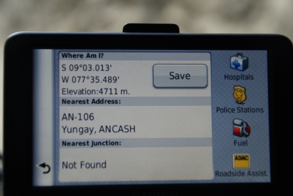
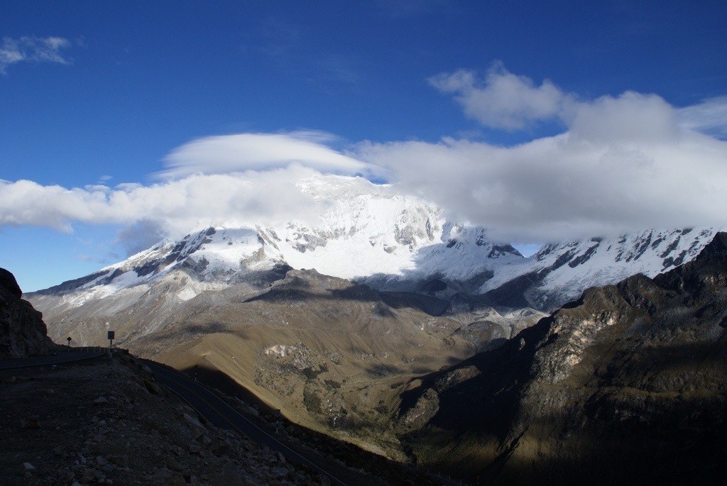
Eventually after one and a half hours we had driven the 15kms to the top of Portachuelo Pass which according to the guide books is at 4760m. We had reached a new high point on the trip although our GPS only recorded us at 4711m.
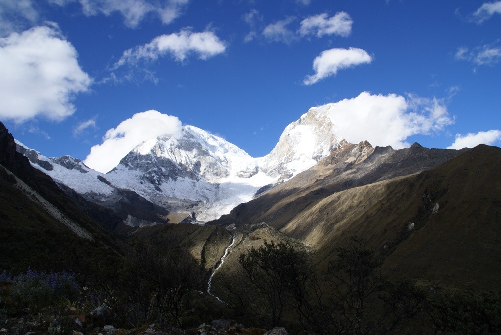
From here we had killer views of Huscaran (6748m) and Chopicalqui (6345m) as well as other mountains plus an amazing, vertigo inducing, view back to the lake.
We crossed over the pass and started descending, the road improved a bit and the hairpins were not so tight. We arrived in the village of Yanama and I thought the hard work was over, boy was I wrong! The drive from here was on a really bad road. It may not have had the hairpins we had going over the pass but there were loads of pot holes and rock slides and it was really slow going. When we reached 20km an hour we were lucky. Eventually we stopped for lunch by a small river and on checking the GPS I found we had descended to 2450m. As I knew we needed to go over another 4700m pass we now had a lot of climbing to do again.
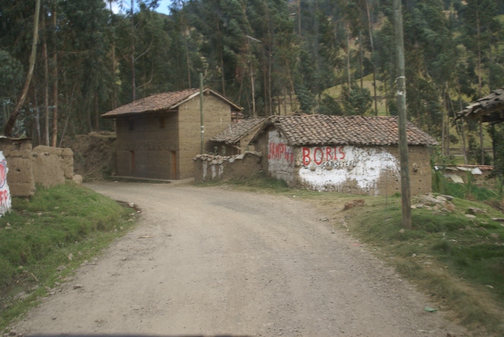
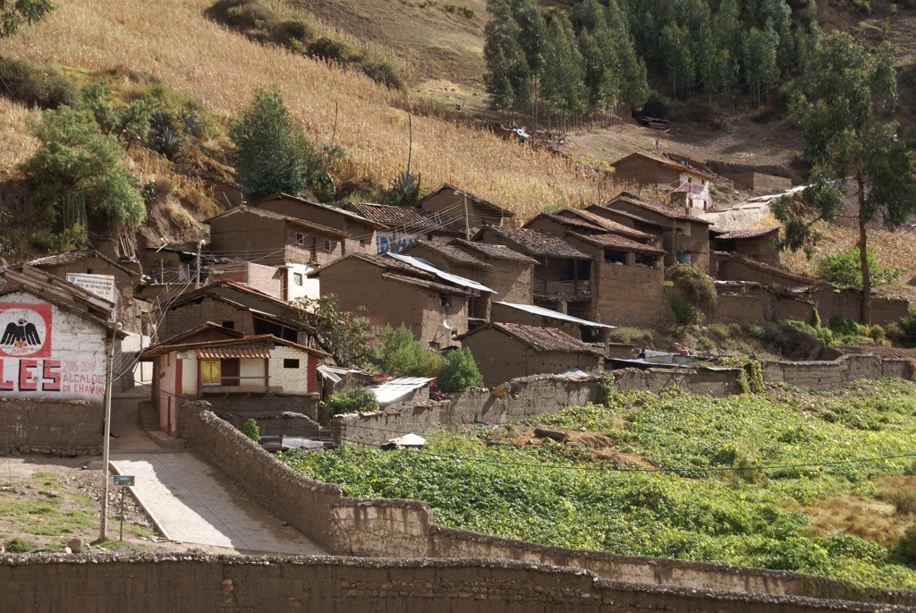
Along the way we passed little villages where the people were all dressed in indigenous costume, there was maize out to dry and animals in pens. The fields were spread out like patchwork across the mountainside and they were still been ploughed with horses. The scenes could have been from many years ago. However many of the houses were painted with the banners of various candidates in upcoming/already held elections.
After lunch the bad road continued but then 20kms before Chacas the road turned to tar. What a relief! There were still some landslides that meant it was one lane in places but we were moving again. We stopped in Chacas and had a wander around the pretty square before heading back on the tar road to cross the next pass.
As it was getting late we decided to stop before the pass, back at 3800m, on a pull out next to the river. As the road was tar we were less worried about crossing this pass the following morning.
All in all we may only have driven 125kms that day but we had gone up nearly 2500m and also down 2500m in that distance. It had been worth it but it was one hell of a drive.
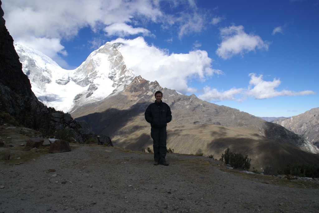
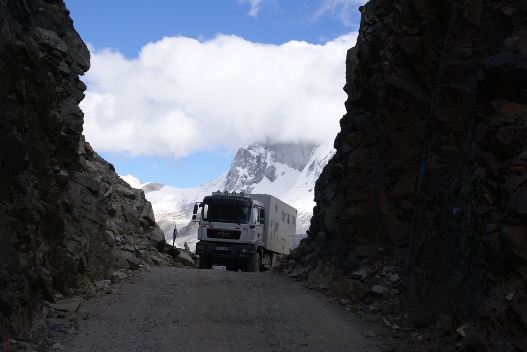
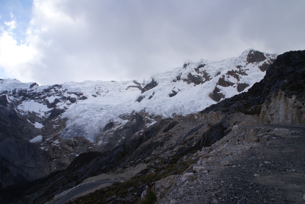
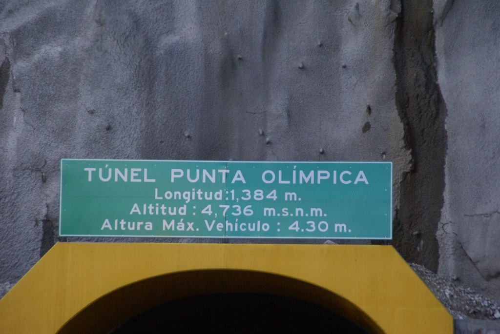
The next morning it looked as though our luck had changed as it was pretty grey outside when we set off. However the road was smooth and traffic free and we still had some pretty good views. The road no longer goes right over Punta Olympica pass as they have dug a tunnel through the mountain that is over one kilometre long. Mind you it is still pretty high as we reached 4,738m, a new high for the trip. As we came out of the tunnel we again had great views of the mountain. It was zero degrees at the top so we did not stay long to take pictures. I also left the truck engine running as it struggles at that altitude. See the video below that shows our crossings of both passes.
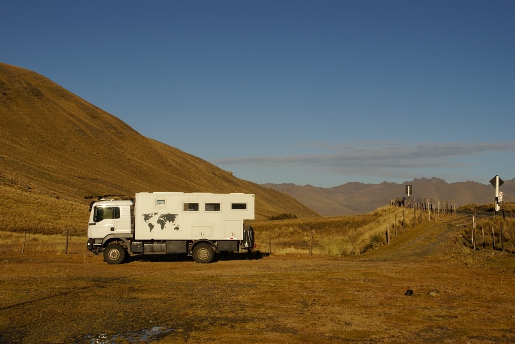
We descended quickly through a beautiful valley, first to give the truck a well deserved wash and then to spend a few days in the town of Huaraz.
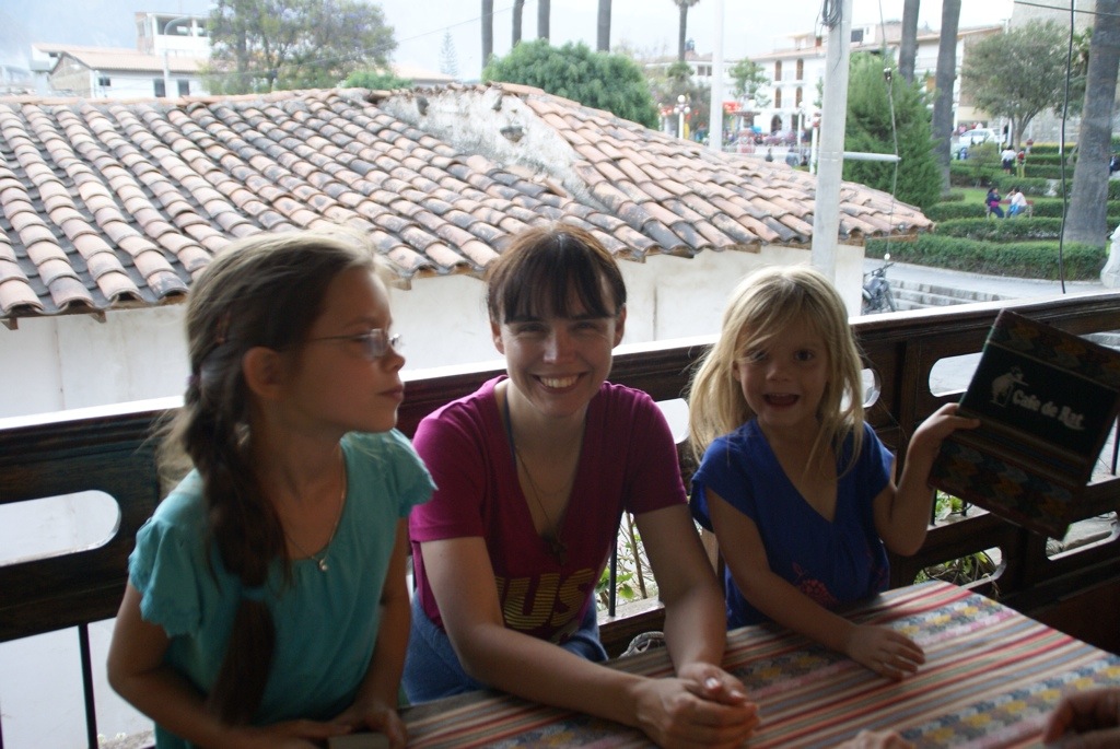
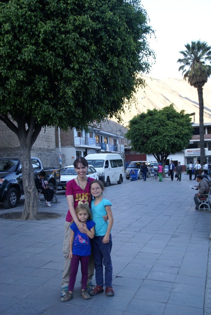
I’ve always been jealous of my big sister Clare’s exotic start in life. She was born in the edge of the Rift Valley in Kenya, while my parents were working as a teacher and doctor there. I on the other hand, was the baby they had once home, in the same village my Mum still lives in. Perhaps that’s the reason why I’ve inherited the family wanderlust gene, while my sister, although very adventurous, prefers staying closer to home. So I was absolutely thrilled when I got her message that she would like to come and visit us somewhere in South America. The girls were even more excited than me, as she is an absolutely fabulous Aunt (and they are blessed with two great other ones too). All the things that Mummy doesn’t have time/patience/tolerance for is enjoyed with relish with Auntie Clare. So it was with high excitement that we picked her up at Trujillo airport.
Three days before we had exited Ecuador and entered Peru at. We’d come down from the mountains via the jungle to the costal desert, all in a 5 hour drive. The countries had conveniently placed both their migration departments in the same building, as well as the Peruvian customs. However the Ecuadorians still had their customs post 5km before the border in an unsignposted building just off the highway. We had been warned that this might happen but still managed to sail past it, as it looked closed. After a quick backtrack to deposit our Ecuadorian temporary import permit for the truck, we returned for one of the fastest border crossings so far.
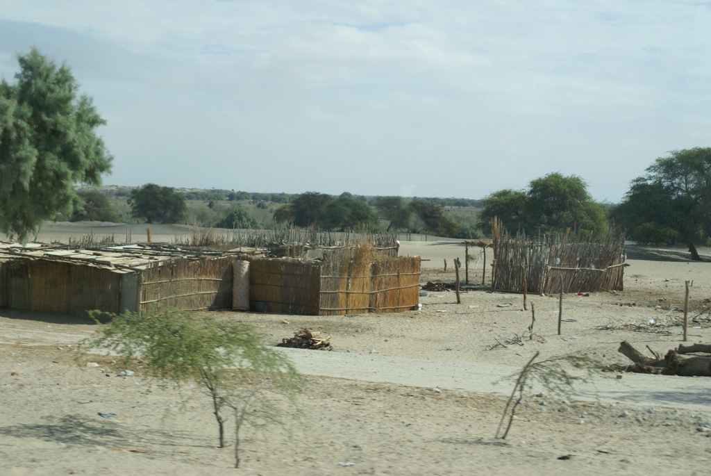
The town of Tumbes (100,000 inhabitants) was our first port of call to restock our food and buy a data card. We try not to cross borders with an excess amount of food, as some countries have issues with you importing fresh produce. We tend to shop for a week or so, as it gives us more opportunities to get away from towns. However as much as we asked around Tumbes didn’t seem to have any large food shops, just a couple of tiny mini-marts. Steve did eventually find the market and managed to ferry back several loads of fruit and veg, while the girls were doing school on a quiet side street. He managed to get enough to keep us going for a few days anyway.
After a seriously tiring day for Steve with an 8 hour drive, a border crossing and an shopping trip that involved a lot of exploration, he was ready to put his feet up with a beer to watch the sunset at our beach campsite. Unfortunately it was not to be, as we crossed the seemly solid dirt towards the beach the front tyres started to dig in. Then the back tyres did, underneath the crust there was just soft, soft sand. With our weight, we just went down. As Steve tried to reverse back with four wheel drive, we managed to dig ourselves in. It was so soft, that within a matter of seconds we were dug in almost up to the axles. Steve’s beer was starting to look very distant. Out came the sand ladders (for the first time this trip), shovels and luckily several pairs of extra hands. We all shovelled like crazy, carefully placing the ladders under the back wheels and large stones under the front. After about an hour Steve managed to reverse back onto the stone and ladders. But where to go from there? We’d turned into that spot and there was now a large 2m high thorn bush right behind us. We couldn’t turn at all as soft sand was all around apart from directly behind us. So unfortunately, the bush drew the shortest straw as Steve reversed straight over it. Parked up on firmer ground and once everything was sorted, Steve eventually got the beer he so deserved.
We were too busy digging to get a photo but the sand on the right was where we go struck, it looks harmless, doesn’t it.
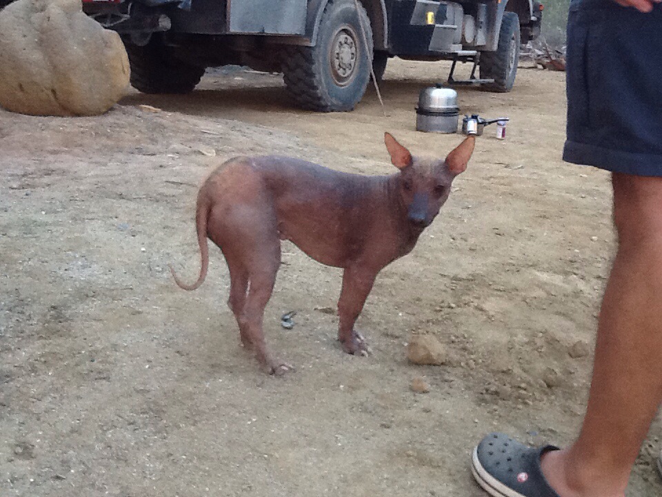
The following day we did jobs, relaxed on the beach and Steve found somewhere to watch the first game of the World Cup. Maybe we’ve been spoilt by Central America but the desert backed beach won’t get on any of our highlights list. However we did get to see some of Peru’s hairless dogs. Mmm…..not what I’d call cute!
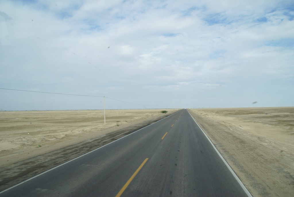
The 650km drive to Trujillo was too long to tackle in one day, so we split into two chunks. The driving was easy and the desert scenery although impressive became a little monotonous. Unlike Ecuador the roadsides were filled with rubbish, blowing across the sand and gravel and it was a lot poorer.
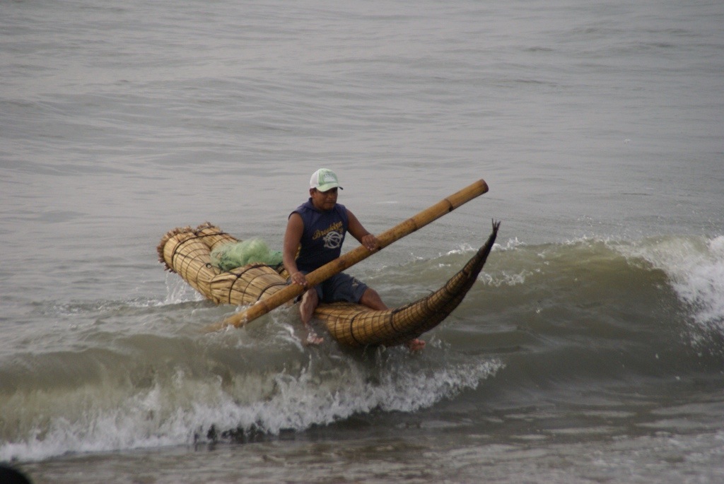
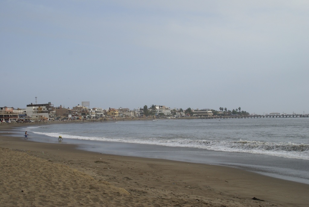
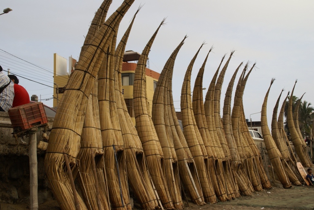
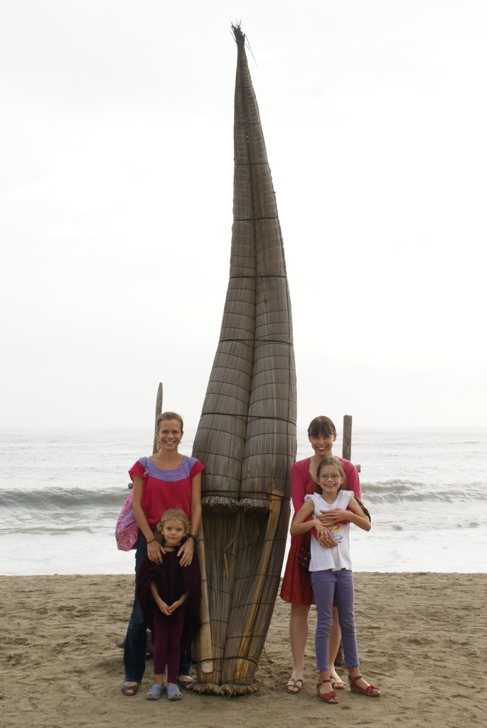
Eventually, we pulled into the desert seaside village of Huanchaco. Although pleasantly warm for us, it is winter here, so it had that out of season emptiness to it. Fishermen here use small reed boats and line them up on the beach to dry afterwards. It is impressive to see them battling the big surf in their tiny, seemingly fragile boats with just a split bamboo pole to paddle them.
Whilst the town had an out of season feel to it, it was a relaxing place to base ourselves for a few days. There were some nice seafood restaurants, the beer was cold and all the bars were showing the football so Steve was happy. He made us all go to see the England v Italy game but the girls soon got bored and obviously the result did not go our way.
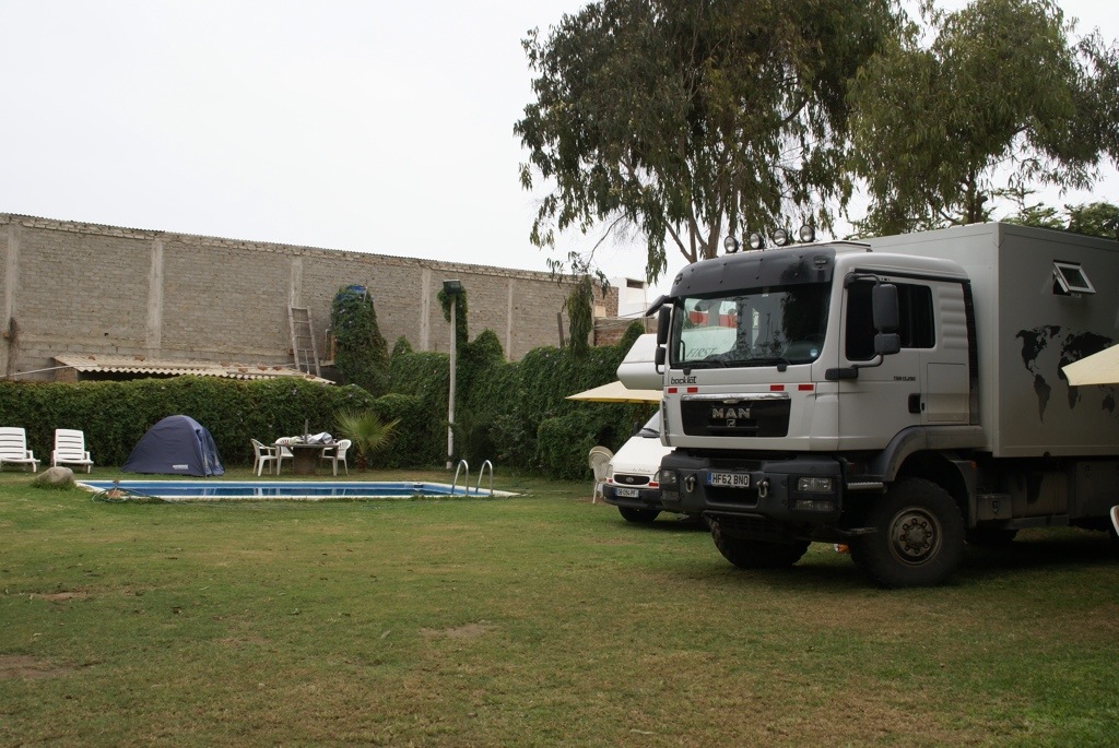
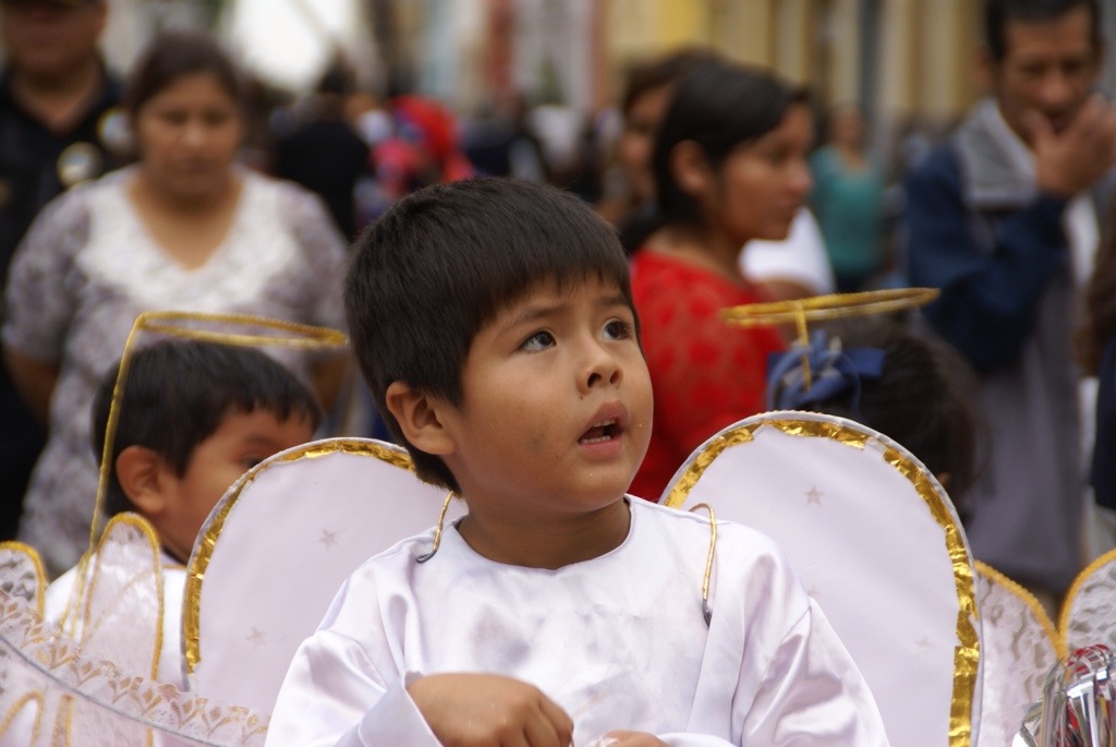
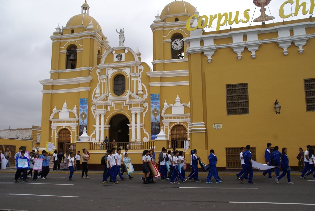
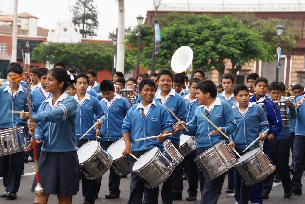
My sister arrived the following day and we happily ensconced ourselves at the pleasant green RV park there. It was a great place to relax and catch up. Several other overlanders were staying, including the French family we’ve bumped into 6 times since Mexico. All the kids made the most to their time together in the pool. We did a couple of day trips from there to the nearby town of Trujillo where they were preparing for the festival of Corpus Christi in a few days time and also to the ruined desert city of Chan Chan.
Trujillo is another Colonial town with some fine buildings and a pleasant square which we wandered around for a few hours before heading back.
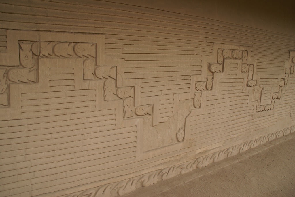
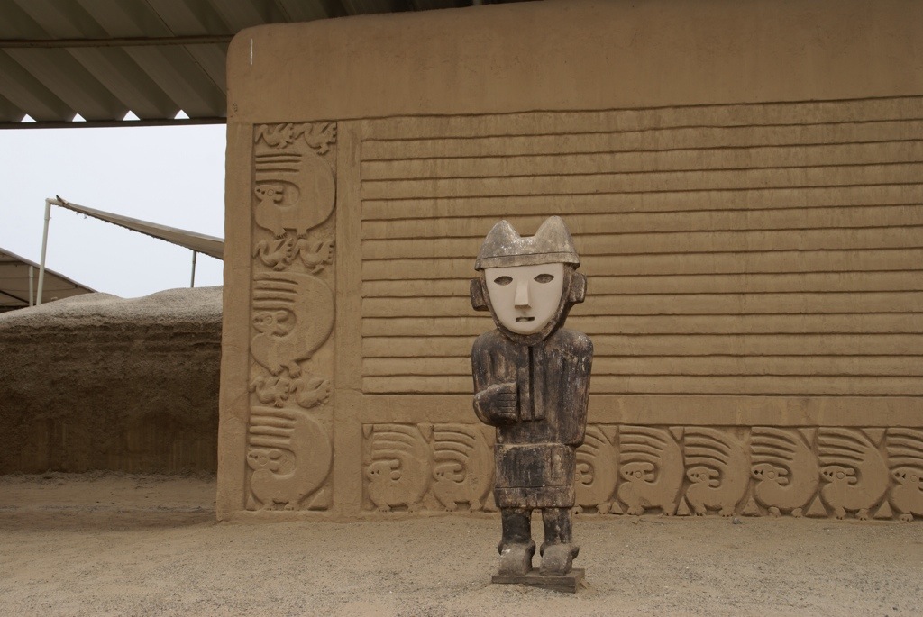
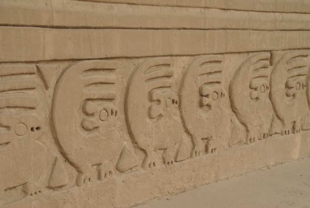
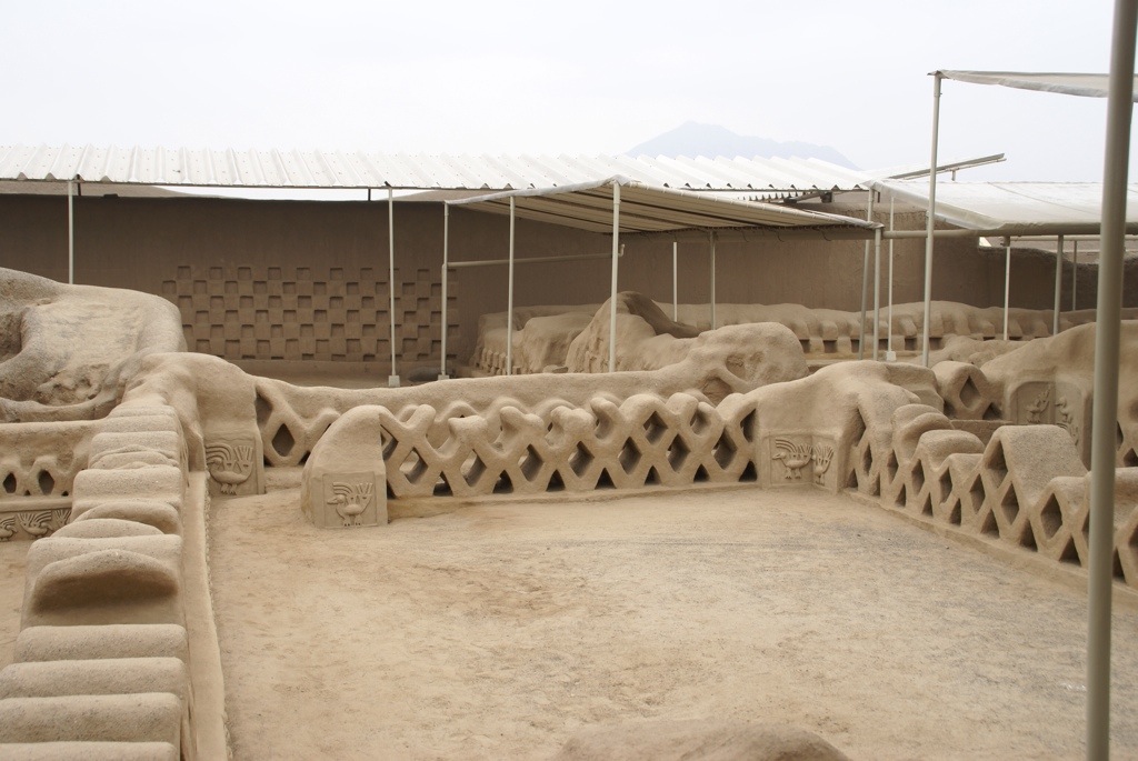
Chan Chan is the largest adobe city in the world and dates back to the 1300s. With it been adobe a lot of it has been washed away by the rain over the years but an area has been preserved/rebuilt and it was pretty impressive.


 ,
,