Thunder crashed and lightening lit up the dark sky. The rain that had been lashing down turned to hail, an inauspicious start to our 12 day trek in the Nepali Himalayas. Fortunately we had just secured the last room in a very basic lodge so could watch it from inside but there was no escaping the noise as the hail pelted down on the tin roof.
After watching the weather forecast closely for nearly a week we decided we would just have to go. The forecast was for a mixture of clear days and days with unseasonable snow. Still we were itching to go and had all been looking forward to trekking for weeks. We wanted to trek into the Annapurna Sanctuary and to base camp at over 4,100m where we would be surrounded by the magnificent Annapurna mountains. To be able to get up there though we needed good weather. An hour into our trek we heard the news that the trek to Annapurna base camp had been closed due to snow and avalanches and with the current weather conditions it was likely to be closed for some time.
Now what to do? We stopped for a late lunch and made the mistake of selecting what we wanted off the menu rather than asking what would be ready quickly. Still the one and a half hour wait for lunch allowed us to reconsider our options. We decided we would trek to Muktinath up the Kali Gandikhi valley over 120kms away. Gilly and I had both trekked in the Kali Gandaki valley before separately over 20 years ago. We had heard that as a rough road had now been built things had changed and it wasn't the same but we were interested to see and the glorious mountain views would still be there.
If only we had known before though we could have done what Gilly and I had done before, fly up the valley and walk down, instead we were going to be walking up the valley and flying down. Still Gil, our guide/porter was confident it would be a great hike and so refuelled by lunch we set out.
The next 11 days we walked nearly 150kms and saw stunning scenery. Whilst the weather was a bit hit and miss at the start it cleared up after a few days to give us great walking weather and outstanding views. We were staying in tea houses along the way and the ancient medieval Nepali villages were just as fascinating as the stunning views.
For a change in blog style and so we can recall each wonderful day it's easier for me to write this as a diary.
Day One - Phedi (1130m) to Deurali (2150m) - 9kms
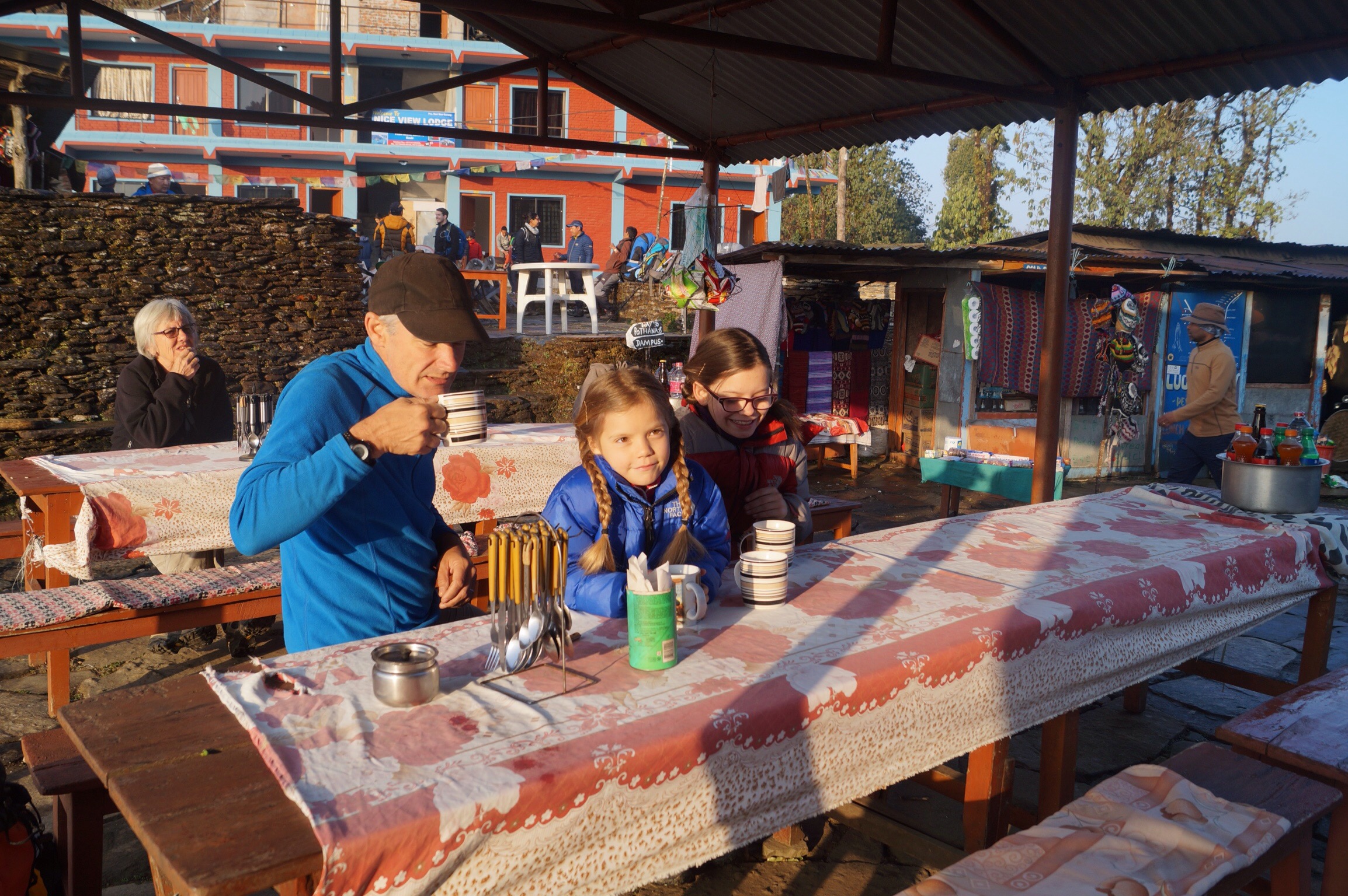
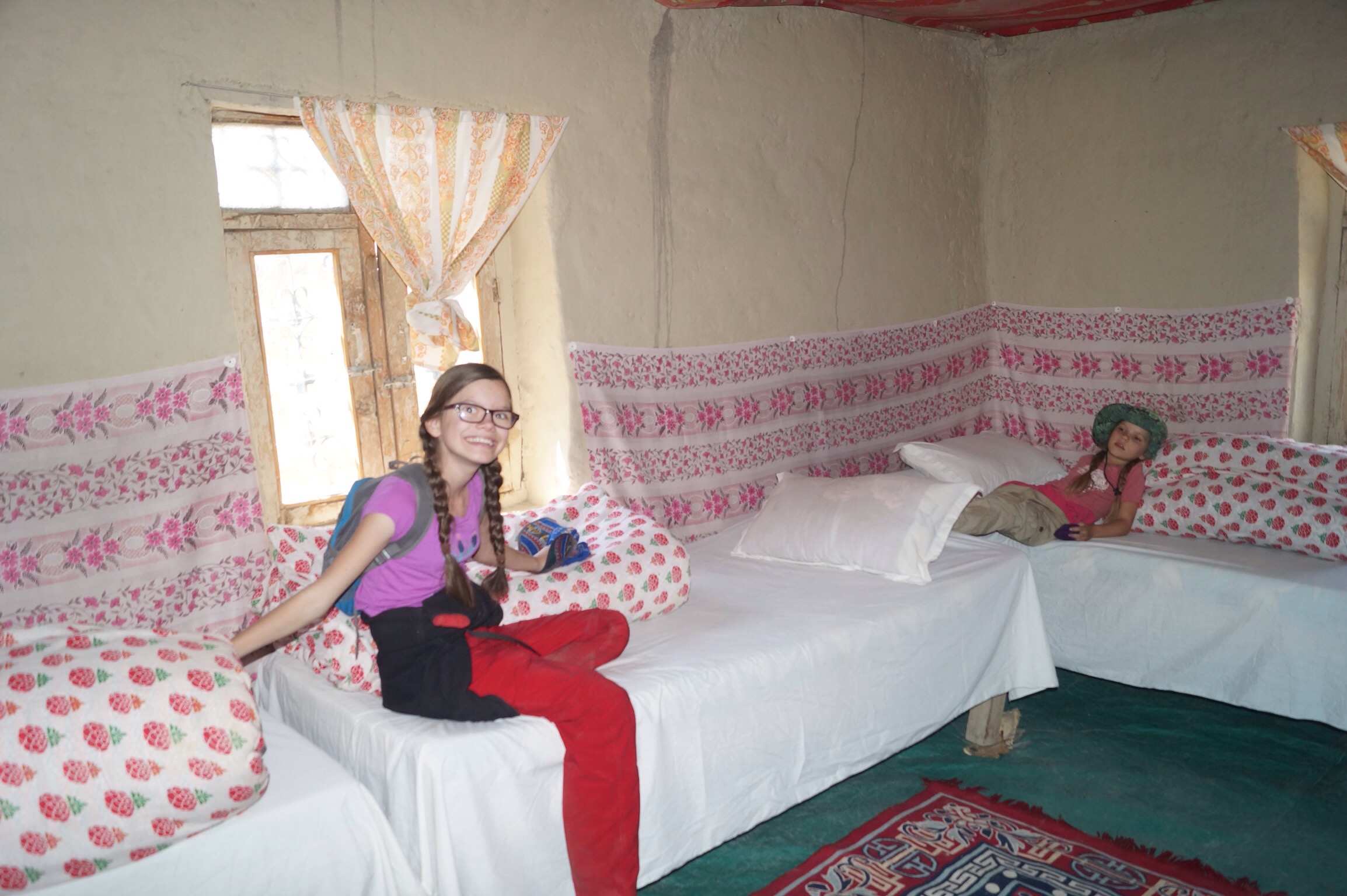
After a short taxi ride it was a stiff climb upwards to our lunch spot where we had to redo our plans. The day was grey so we weren't able to see much of the mountains but we continued to climb after lunch. As we approached the tiny hamlet of Deurali it started to rain. Fortunately there was one room left in the rather ramshackle lodge. This was how both Gilly and I remembered tea house trekking. The room consisted of just three wooden beds with thin mattresses. The partitioning with the next room was wafer thin and where we thought there was a window was just some tarpaulin covering a space through to another room where a trekker was already asleep. It was not going to be a quiet night.
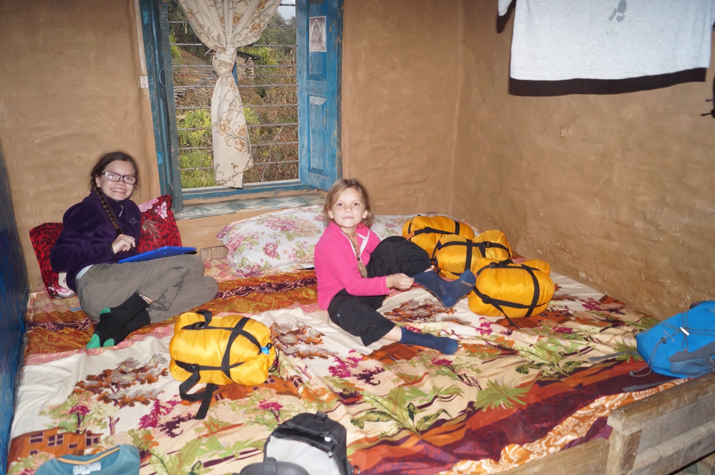
But just as we were settling in the heavens opened, first came rain and then a massive hail storm. We were just glad to have somewhere dry to stay. Downstairs there was a tiny dining room where everyone huddled around the heater watching the hail outside. The lodge was run by a delightful tiny lady who kept hugging everyone as she brought in steaming cups of tea and hearty plates of food later in the evening.
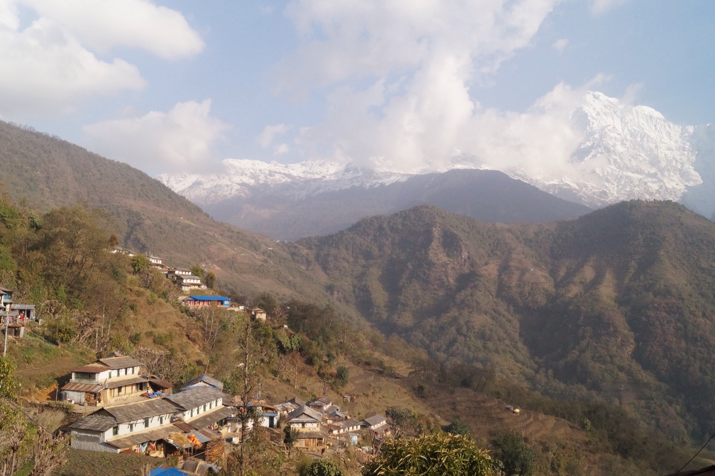
Day Two - Deurali (2150m) to Ghandruk (2050m) - 10kms
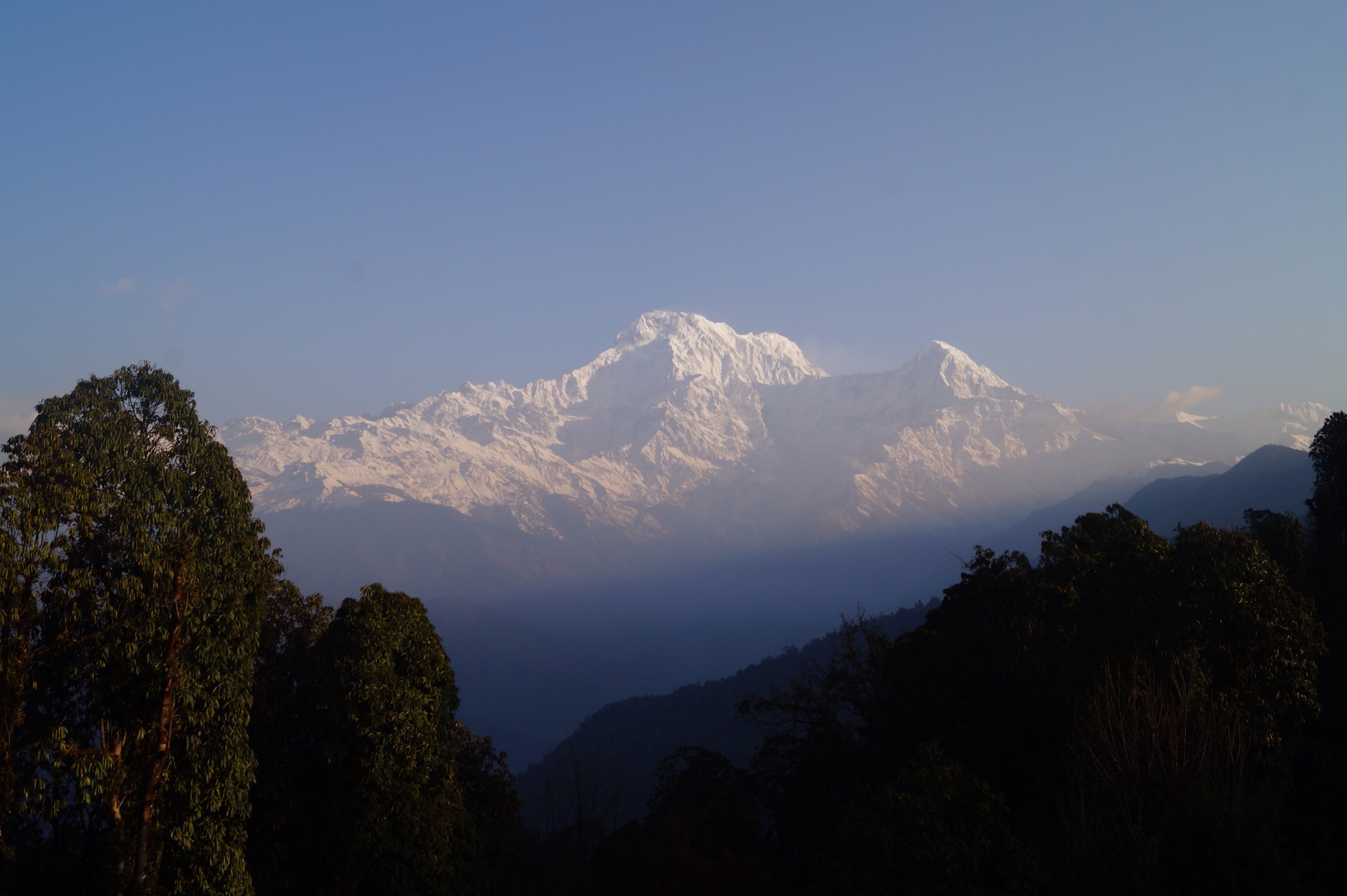
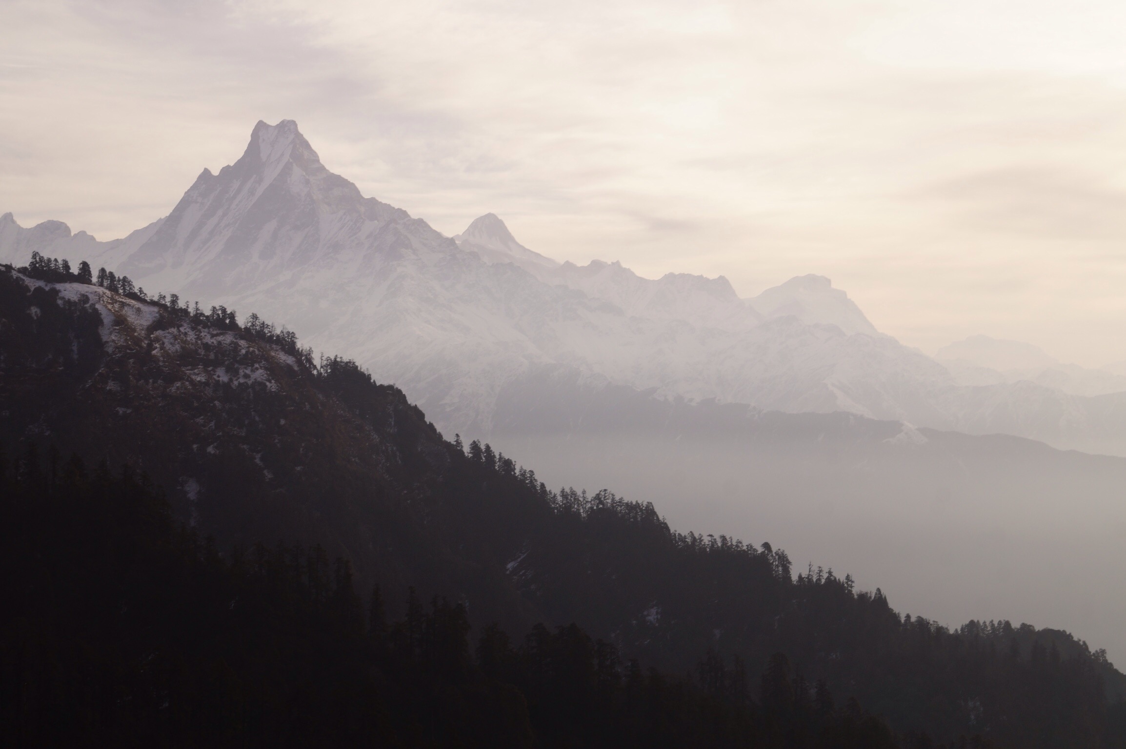
After a noisy night we woke to crystal clear blue skies and from the ridge we were on could see across to the mountains. On one side was Machapachure ("Fish Tail Mountain") and straight in front of us was Annapurna South towering to nearly 8000m. It was cold but stunning.

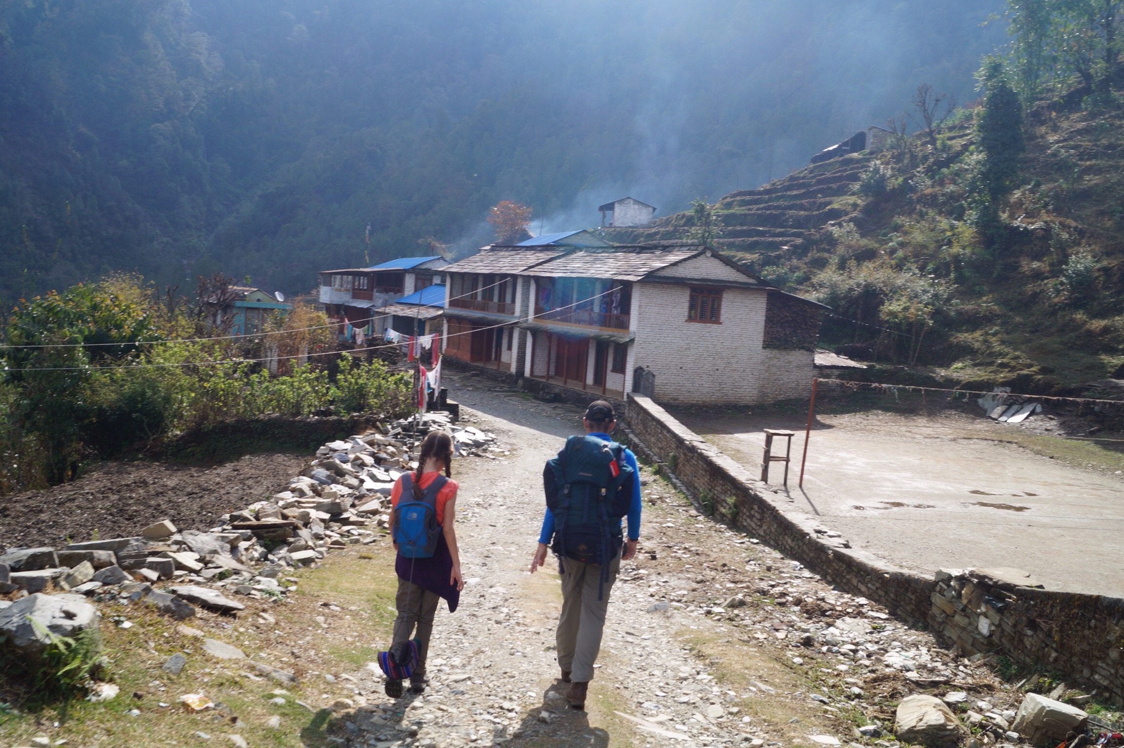
It was a pleasant hike along the ridge before descending nearly 800 metres in to the valley below. The problem with descending 800 metres was that we needed to climb up again and so after lunch it was a tough two hour climb to the second largest Gurung settlement in Nepal, Ghandruk, a pleasant village with narrow stone lanes and views across the valley. Unfortunately the clouds had rolled in so we could not see the high mountains. Mind you this time our lodge came with attached bathroom, not something I remember from 20 years ago. The hot water though didn't seem to last to the fourth person's (my) shower.
Day Three - Ghandruk(2050m) to Deurali (yes another one, it means ridge in Nepali, 3,090m) - 11kms
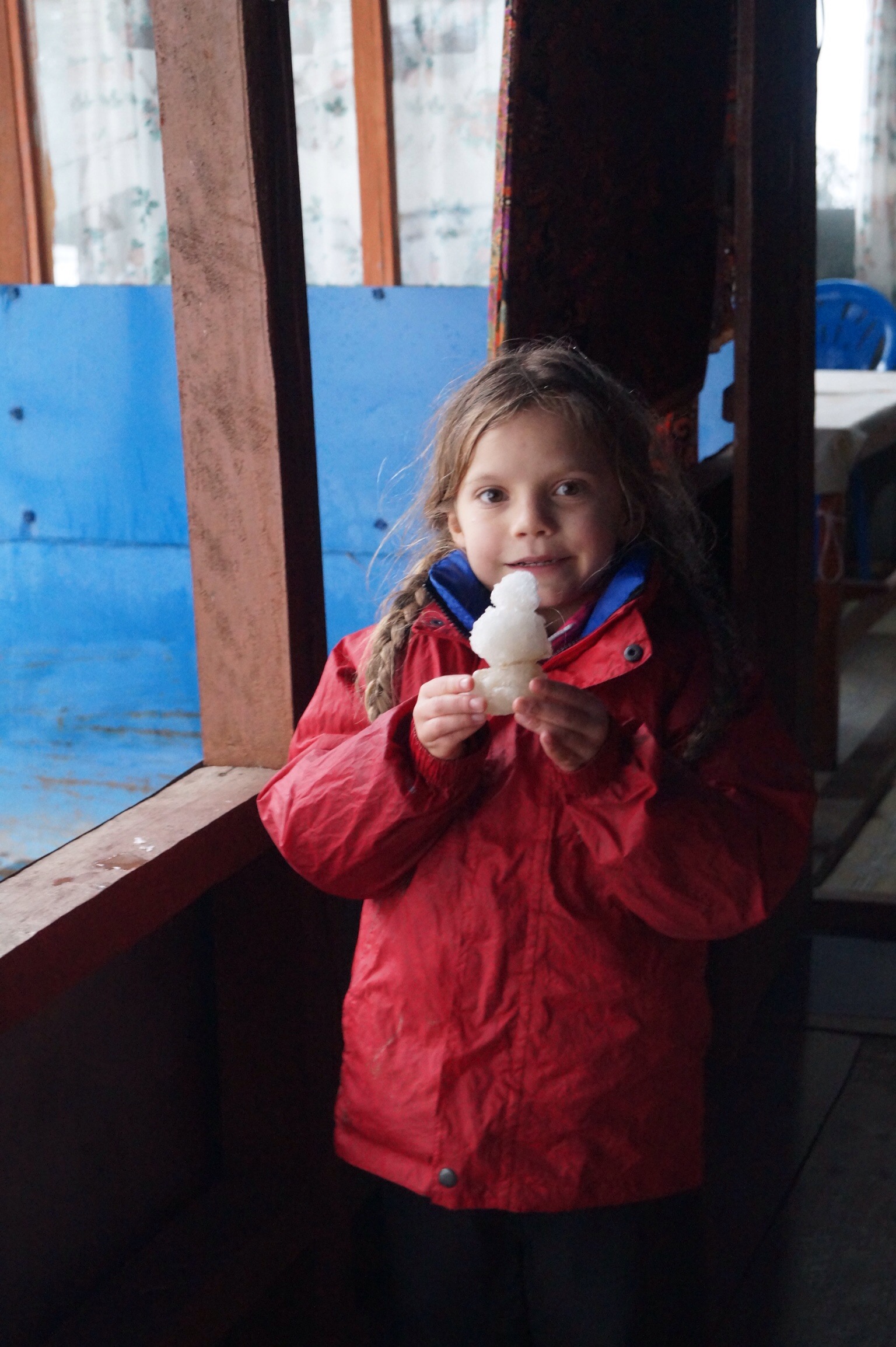
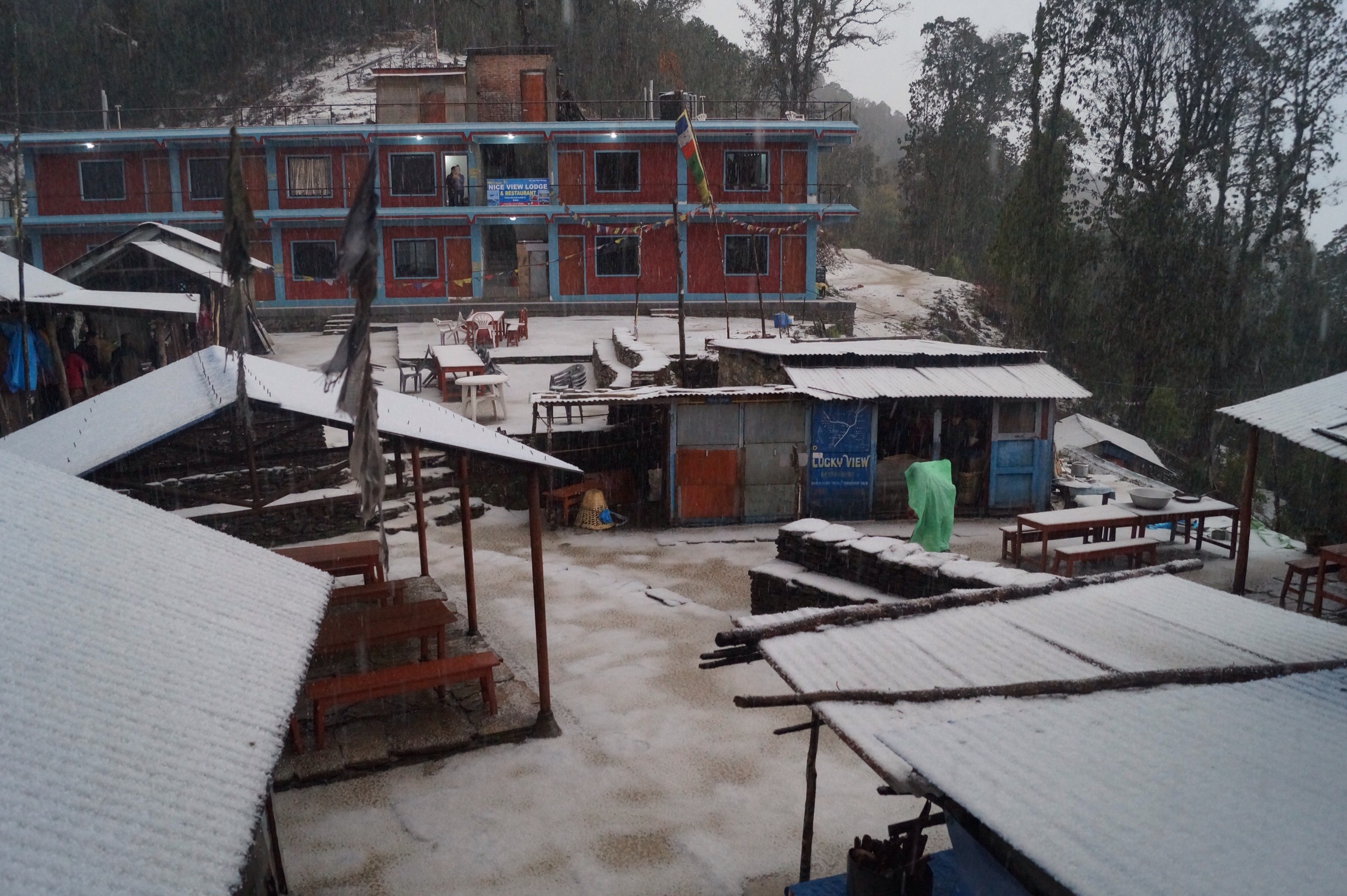
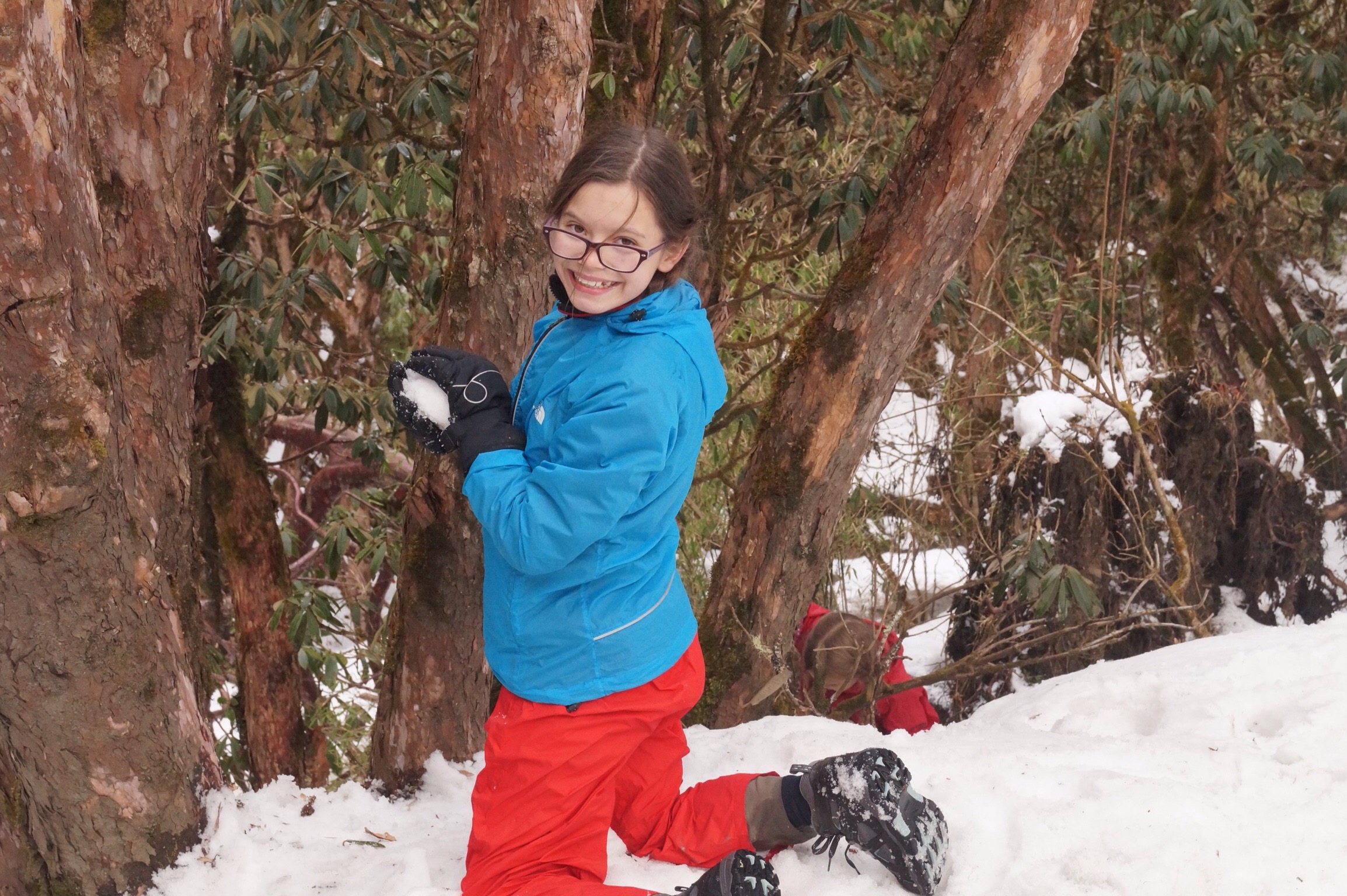
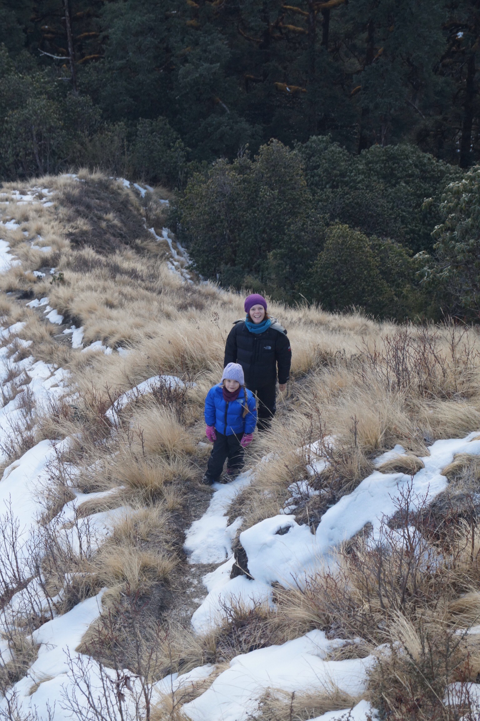
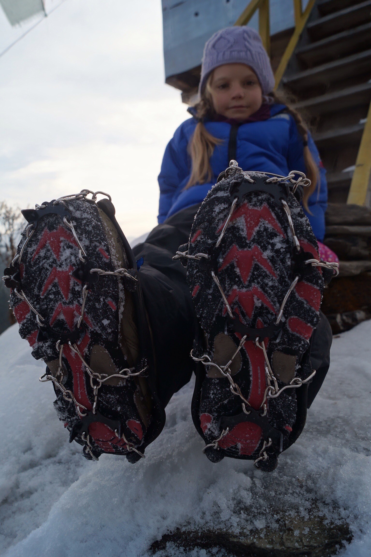
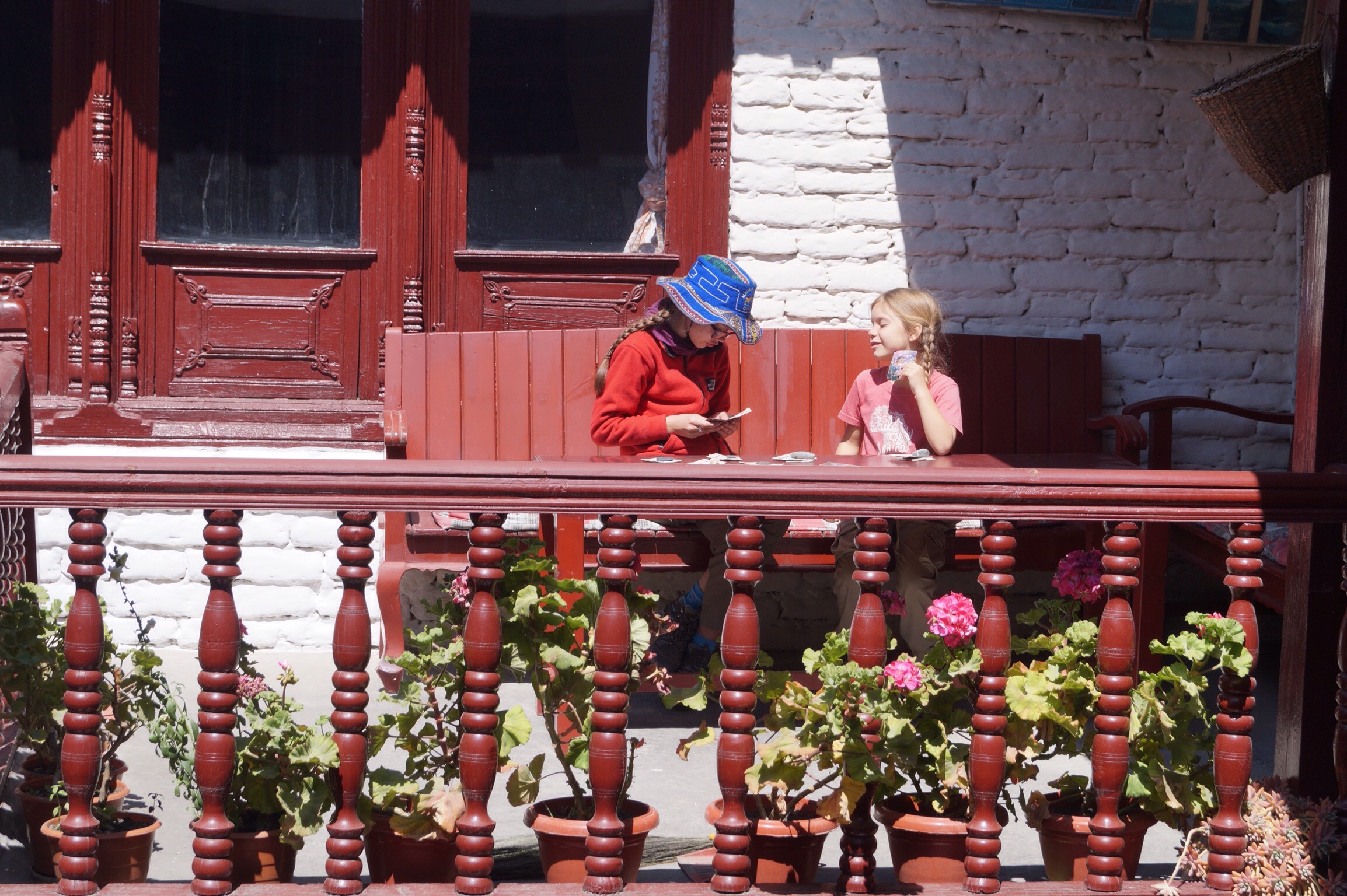
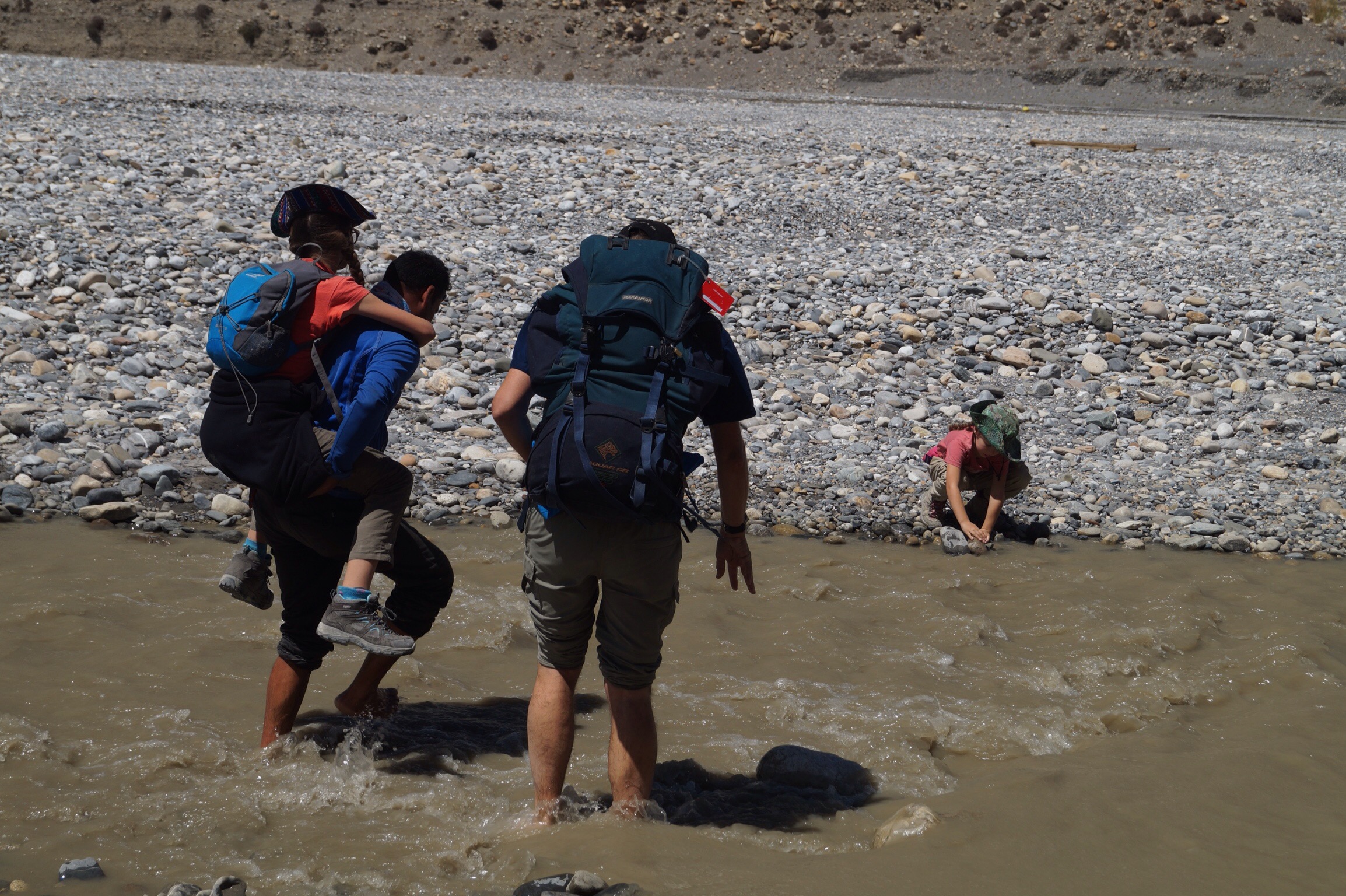
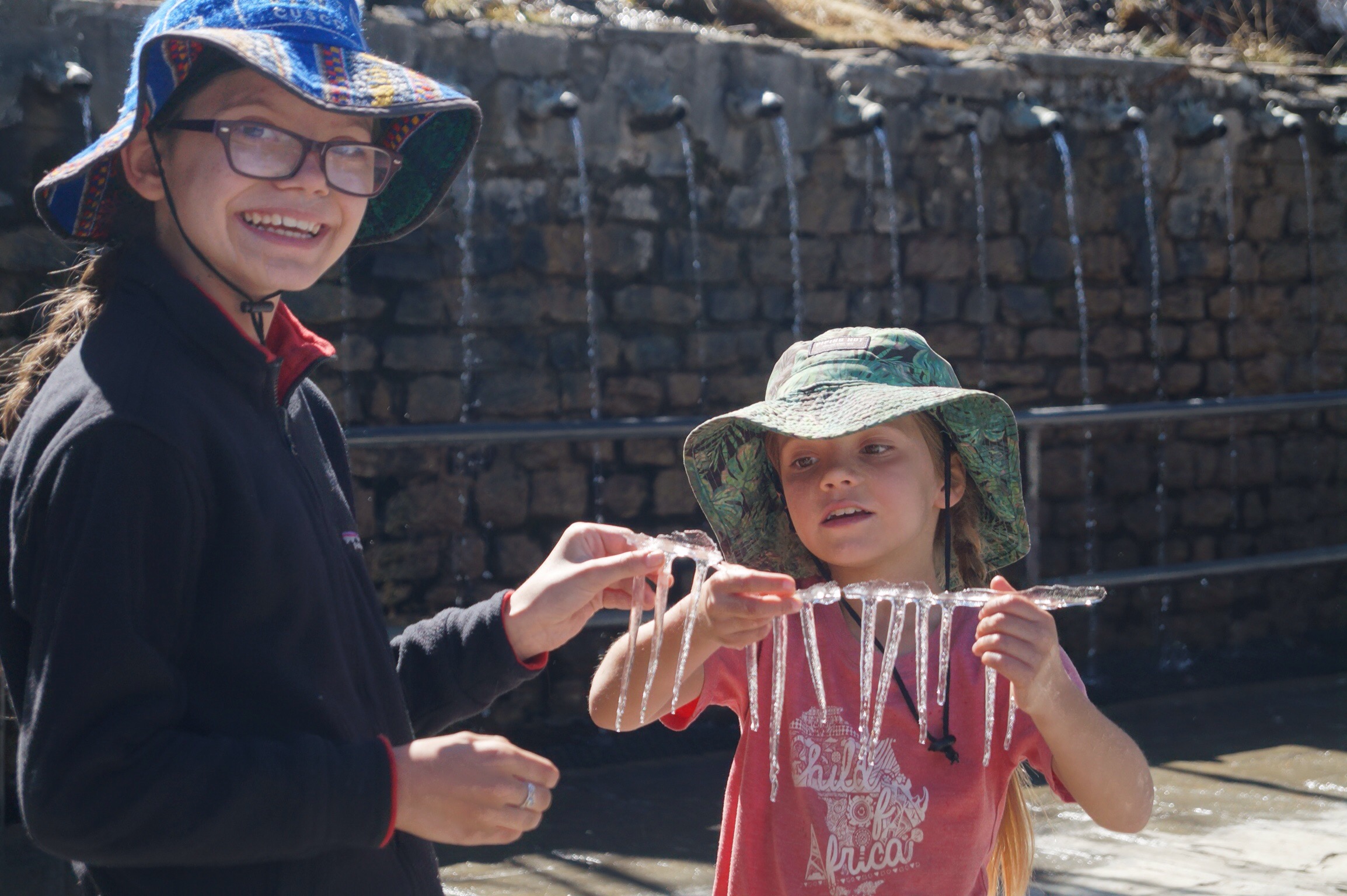
Again we awoke to clear skies and wonderful mountain views but soon after we set off the clouds rolled in. This was becoming a pattern. We were hoping to reach the hamlet of Deurali that night but as we climbed out of another valley it started to snow. Seeing a tea house ahead we dashed in just in time for lunch. As we ate we could see the snow falling heavily and it seemed it would be foolish to head higher. Instead despite our warning to the girls to stay dry they could not resist playing in the snow.
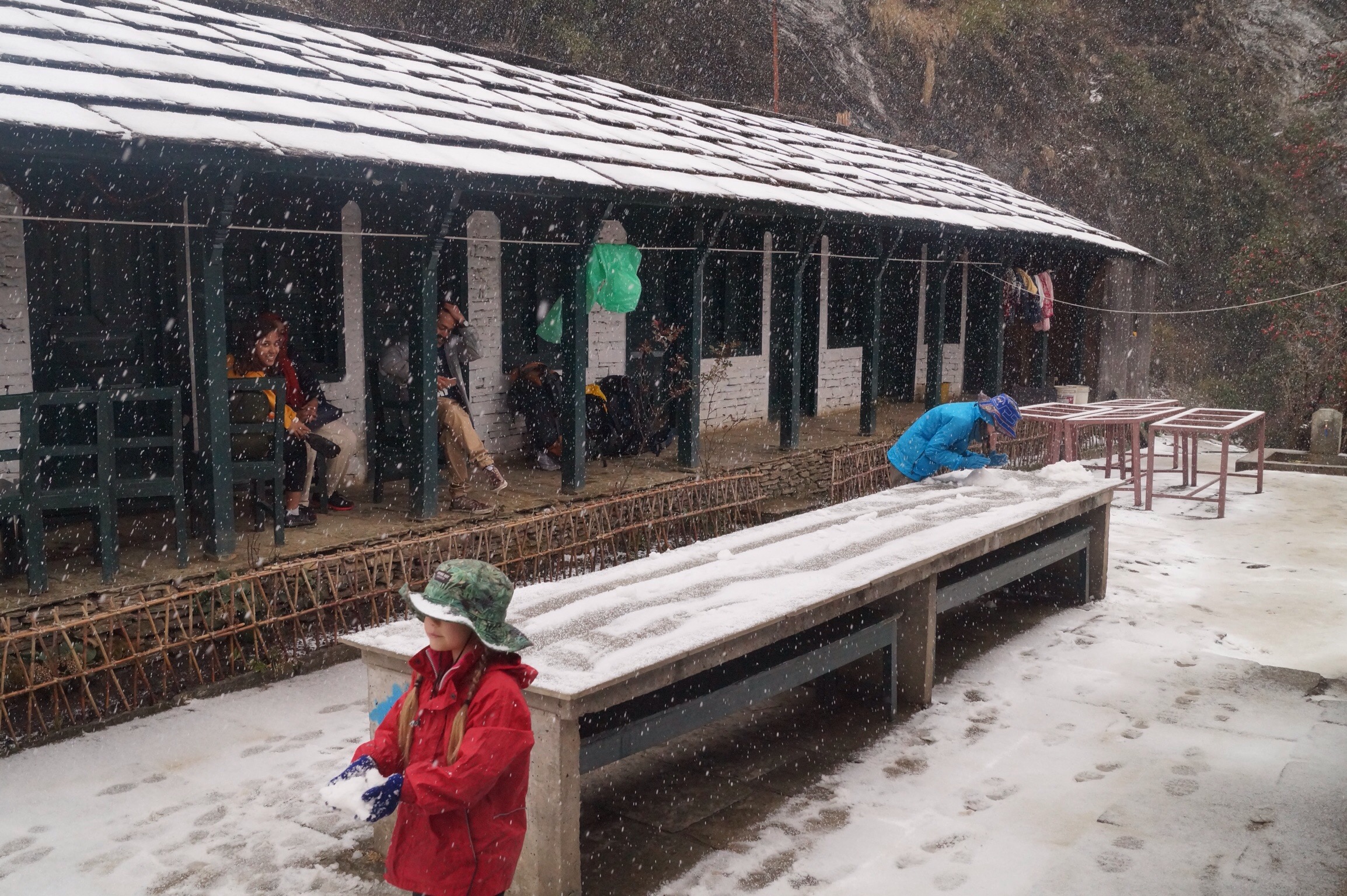

As we finished lunch the snow stopped and we decided we would try to make it up to the top of the ridge. The weather held off and we found a warm tea house to stop in. The girls parked themselves at the top of the trail throwing snowballs at the passing trekkers before retreating to the tea house to watch Hindi movies that were playing on the tv.
Day Four - Deurali (3090m) to Shikha (2100m) - 10kms
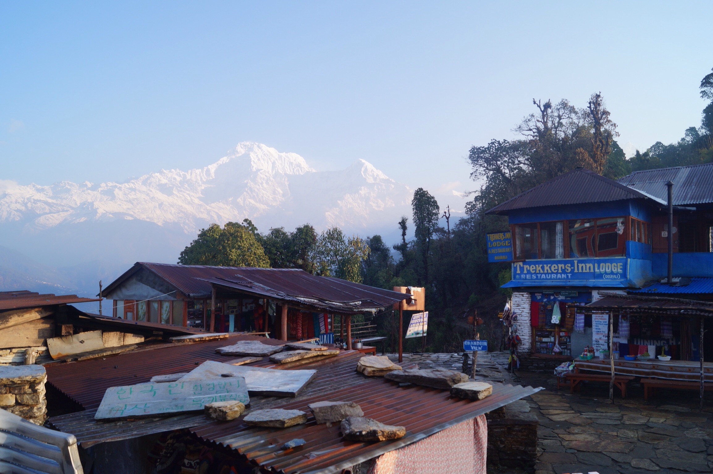
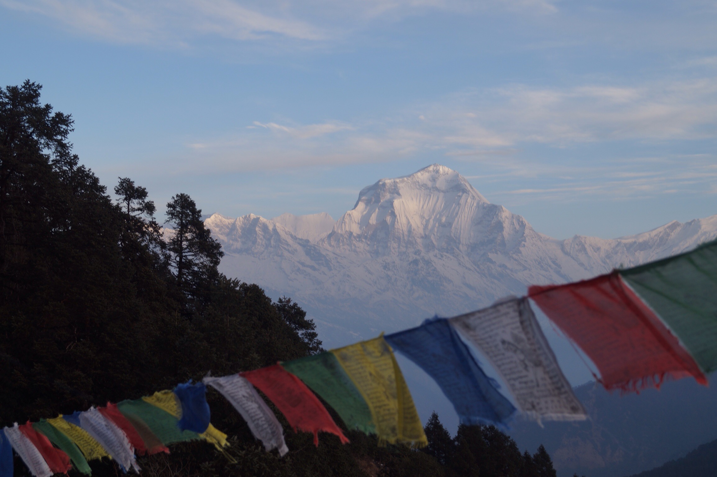
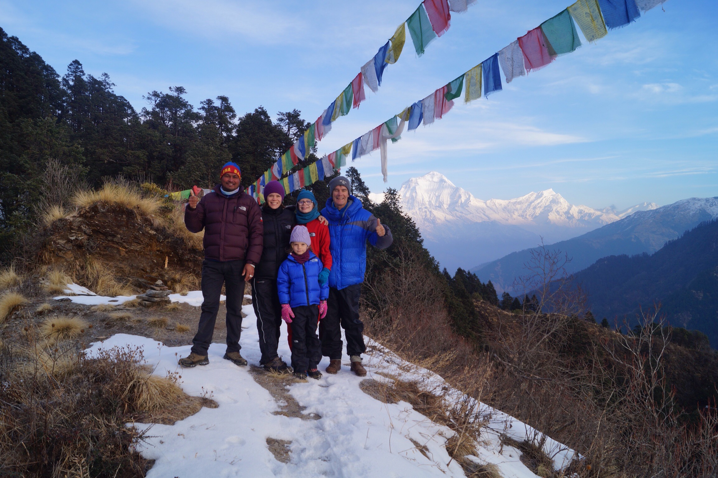
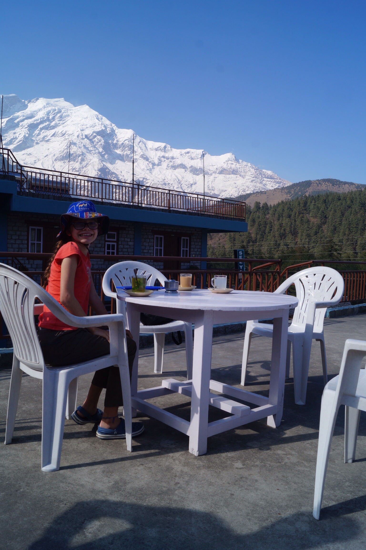
One of the reasons we had wanted to make it to Deurali the previous day was that just a few hundred metres above the lodge was a look out tower that had fantastic views if the weather was good. The views are supposed to be similar to the more famous and much more popular Poon Hill and as it was only a 20 minute walk up instead of over an hour we thought this would be a better choice.
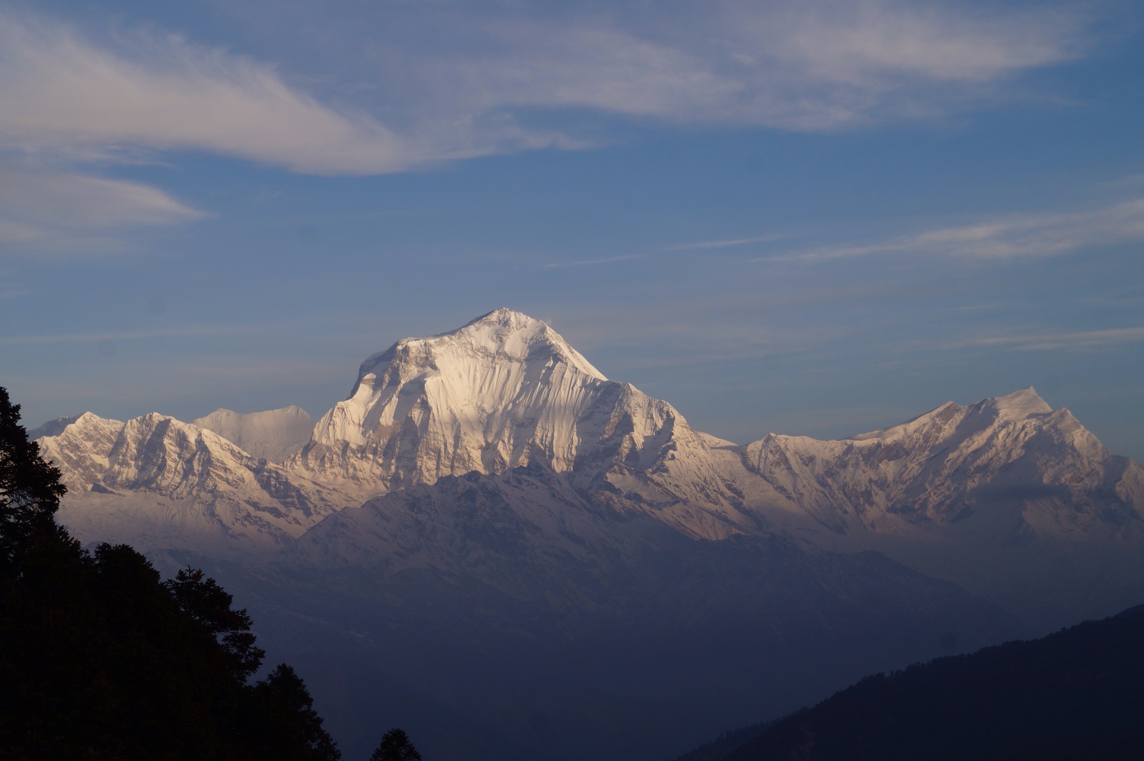
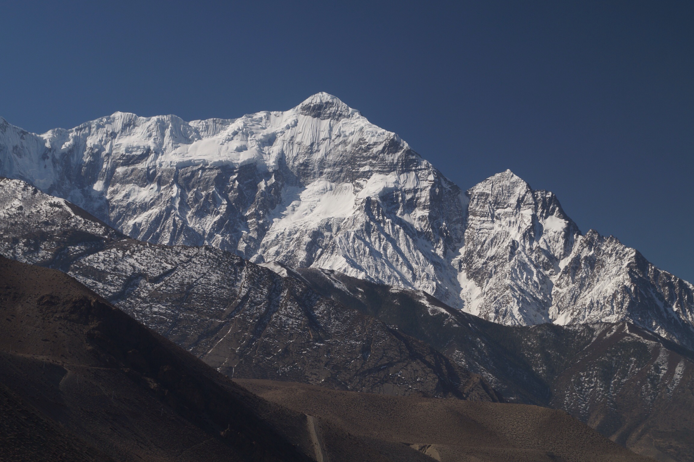
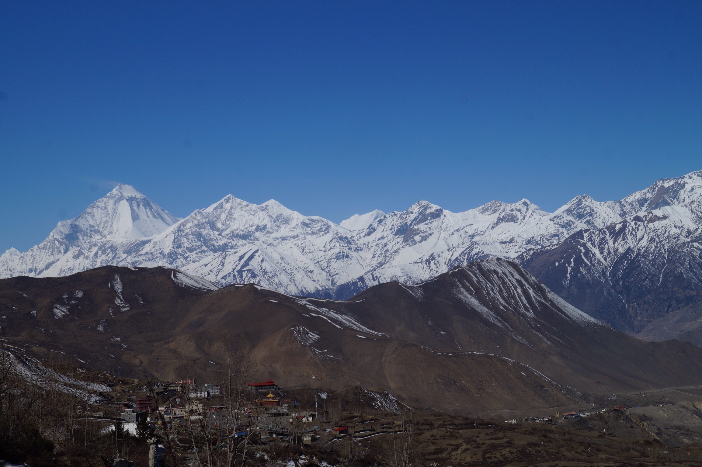
And it didn't disappoint. Although when we woke up there was some clouds in the sky when we reached the top after trudging through the snow the views were spectacular. We could see the whole Annapurna range as well as Dhaulagiri (8167m) set out in front of us. It was a fantastic start to the day.
After descending for breakfast we set out to cross the pass at 3200m before descending to Ghorepani. When Gilly and I had last visited Ghorepani it was made up of windy wooden guest houses. Now there were three story stone hotels. We did not linger long but headed out down the track. Again as lunch approached the rain started to fall so we took an extended break before bracing it out in the drizzle to reach Shikha our stop for the night.
Day Five - Shikha (2100m) to Dana (1750m) - 15kms
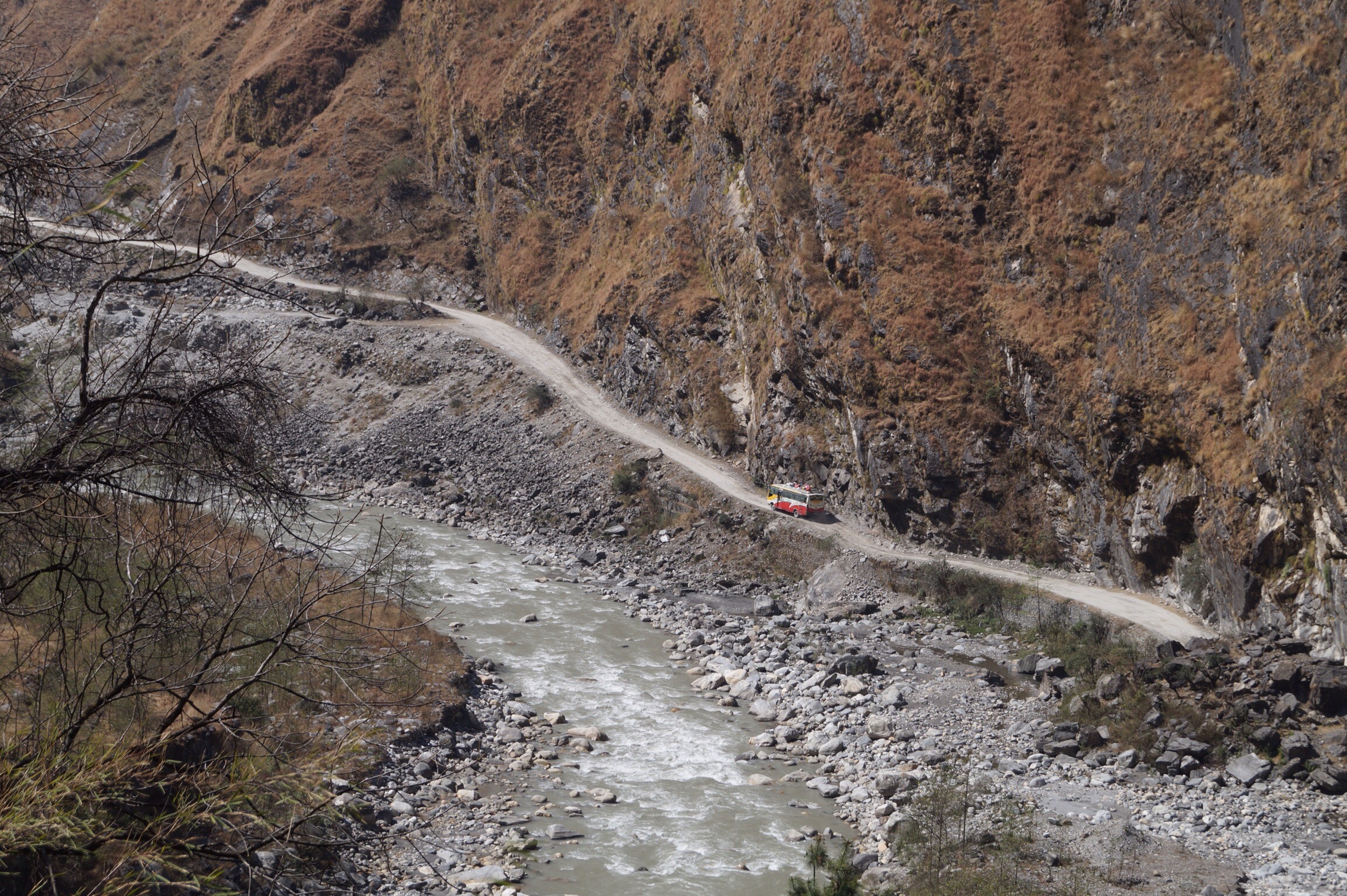
The next day started with an 8km descent to just over 1000m to the town of Tatopani. Tatopani is famous for its hot springs and whilst waiting for lunch Gilly and Lucy could not resist taking the plunge into the hot pools. Tatopani is also where we first hit the new road that had been built up the Kali Gandhiki valley. Not that we noticed it much at first as there was a transport strike or something and in any event we could walk across the other side of the river as we climbed up to the little village of Dana. Mind you about 6pm the road reopened and for about an hour there were plenty of trucks and buses using it.

Day Six - Dana (1750m) to Kalopani (2530m) - 18kms
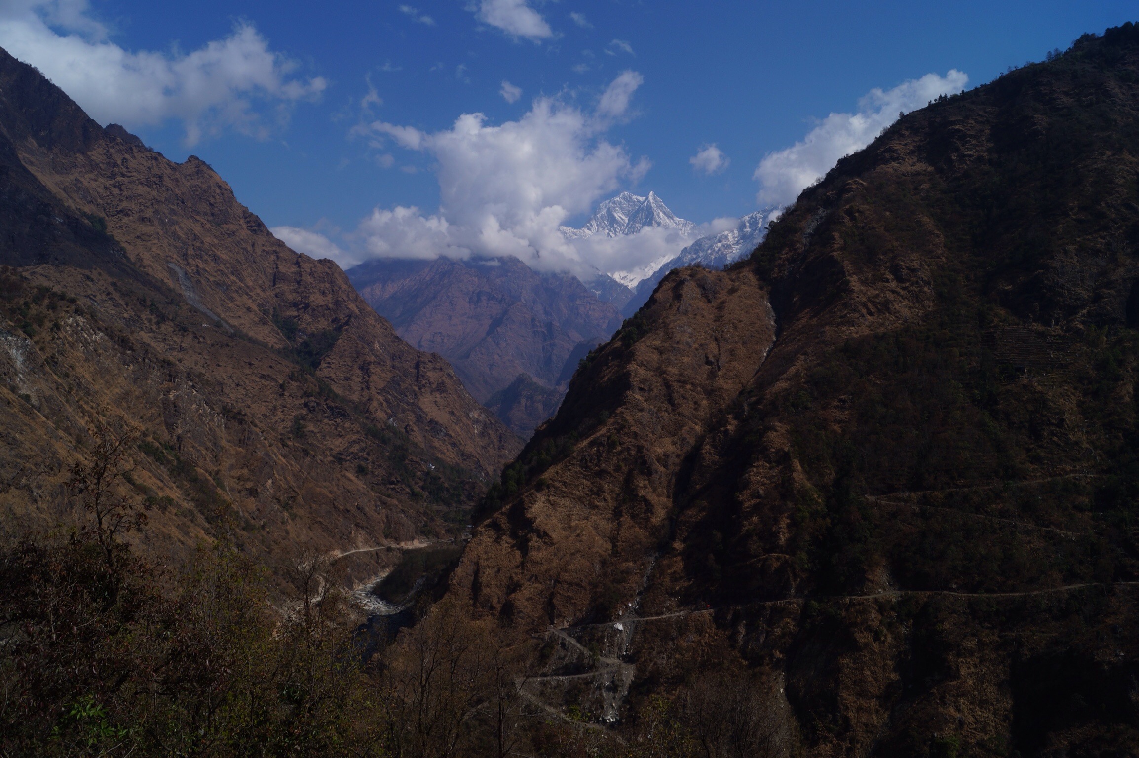
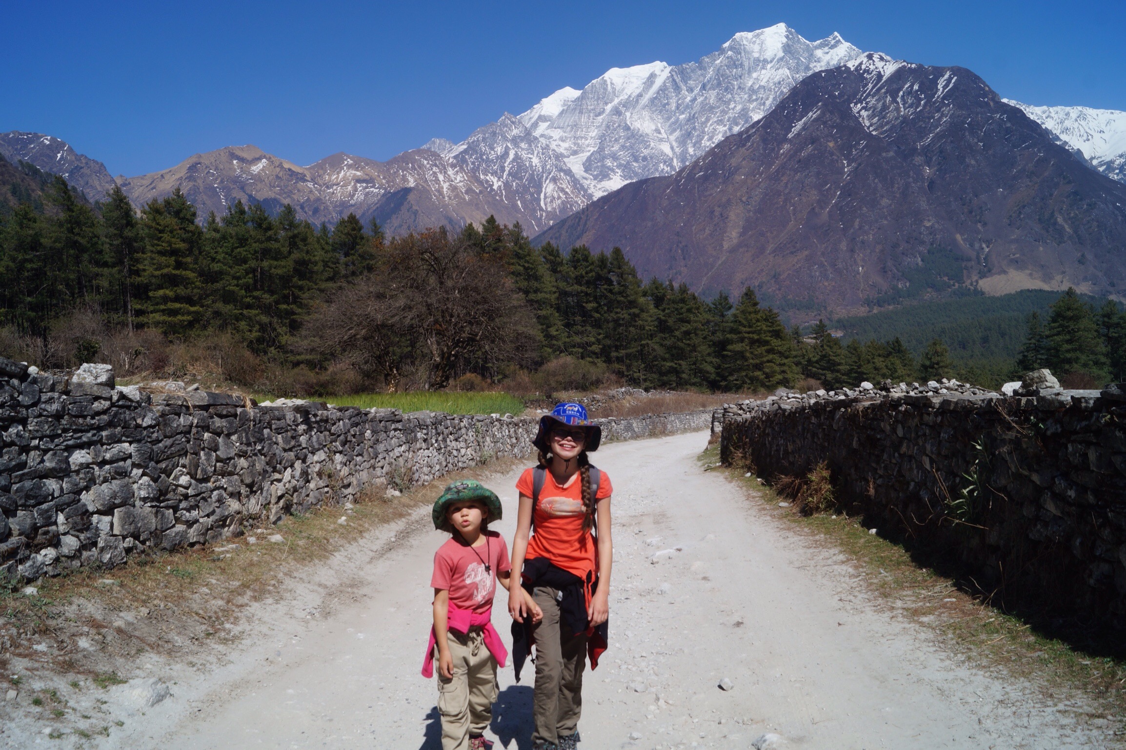
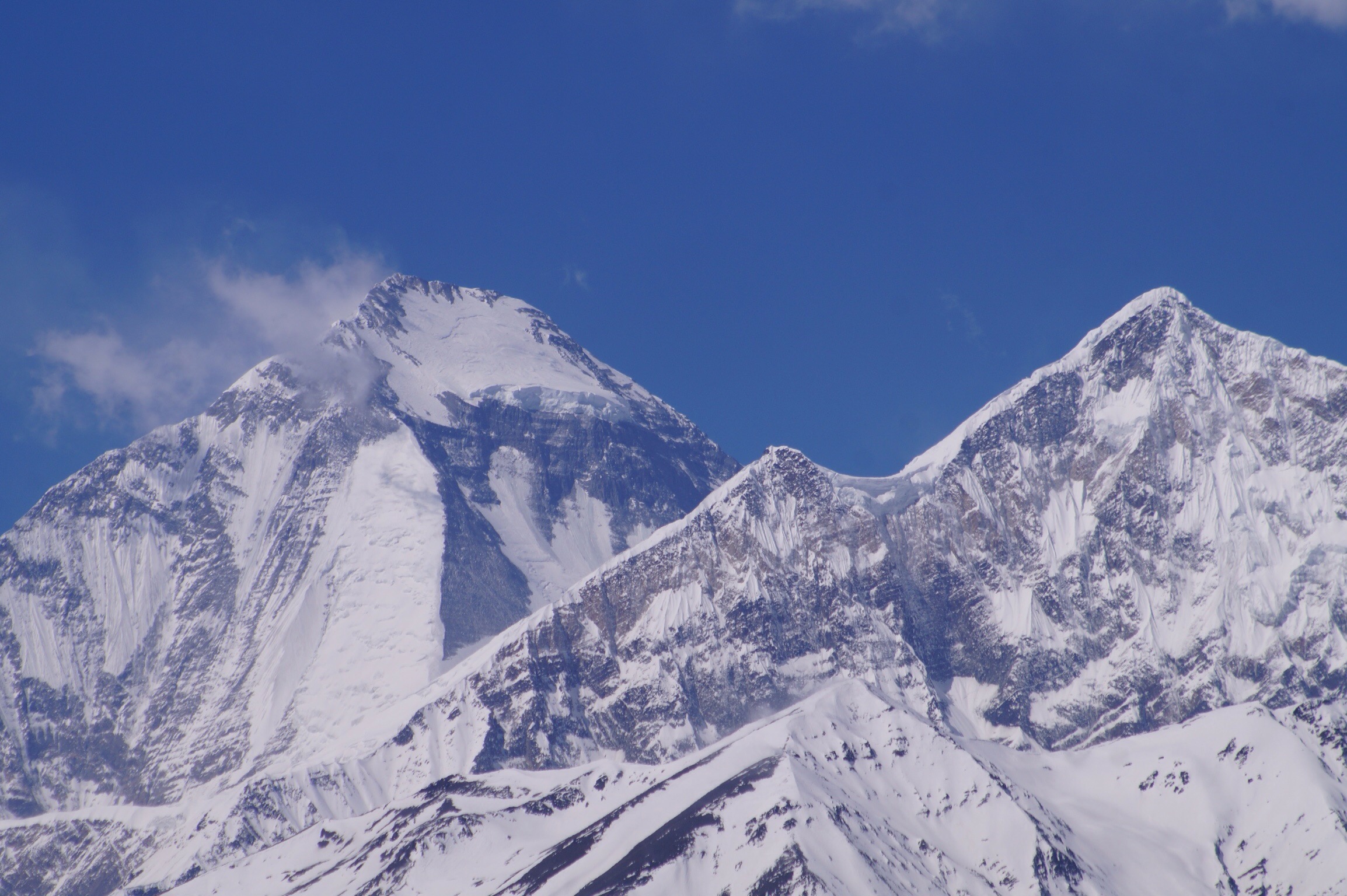
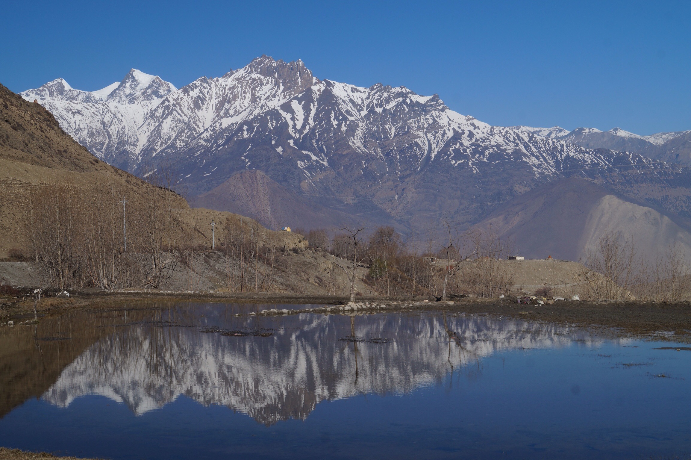
This was a glorious day not just weather wise but also for the stunning views. The road had reopened but traffic was light and again much of the walk was on the other side of the river. As we left Ghasa magnificent views of Dhaulagiri came in to focus. It was amazing and made the walking easy. For a while as it was laid out in front of us we were very happy to be walking towards it rather than down and away from it.


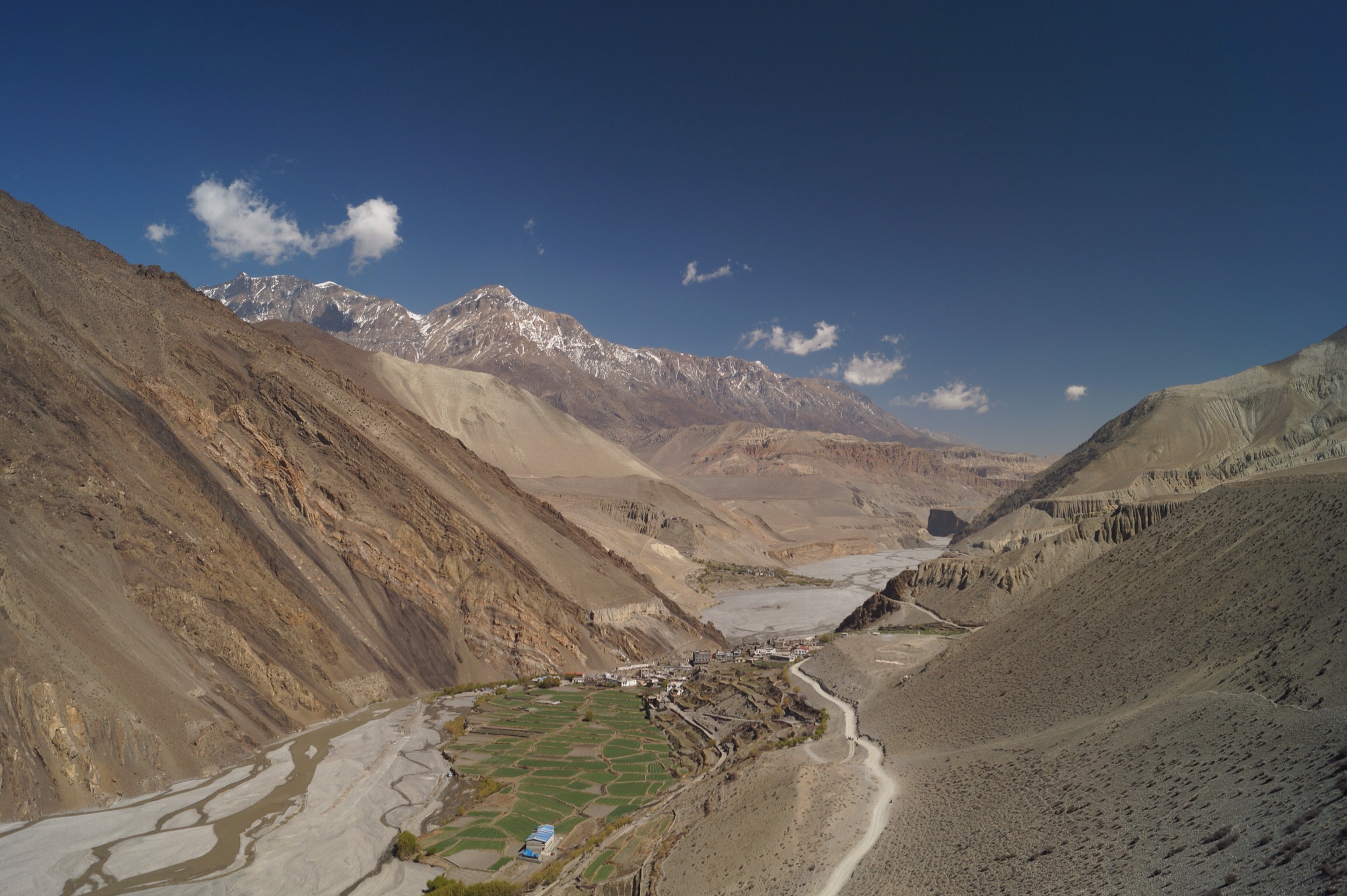
At this point the Kali Gandaki valley is thought to be one of the deepest valleys in the world with the seventh largest mountain, Dhaulagari on one side and the tenth largest mountain, Annapurna 1 on the other side. As we approached the village of Kalopani we could see both the mountains on either side and today the weather remained clear giving us breathtaking views at every turn.
Day Seven - Kalopani (2530m) to Marpha (2680m) - 20kms
Another glorious clear day with blue skies and fantastic mountain views. It may have been a long walk but it was only slightly uphill and the views distracted you all along the way.
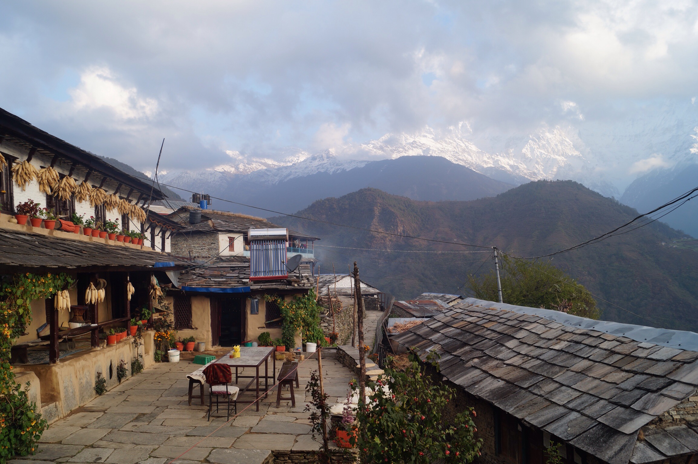
We stopped for lunch in the lovely village of Tukuche. Lunch was in a beautiful Thakali home set around a courtyard with wonderful views from the roof of both the mountains and also the town which didn't look as though it had changed in hundreds of years.
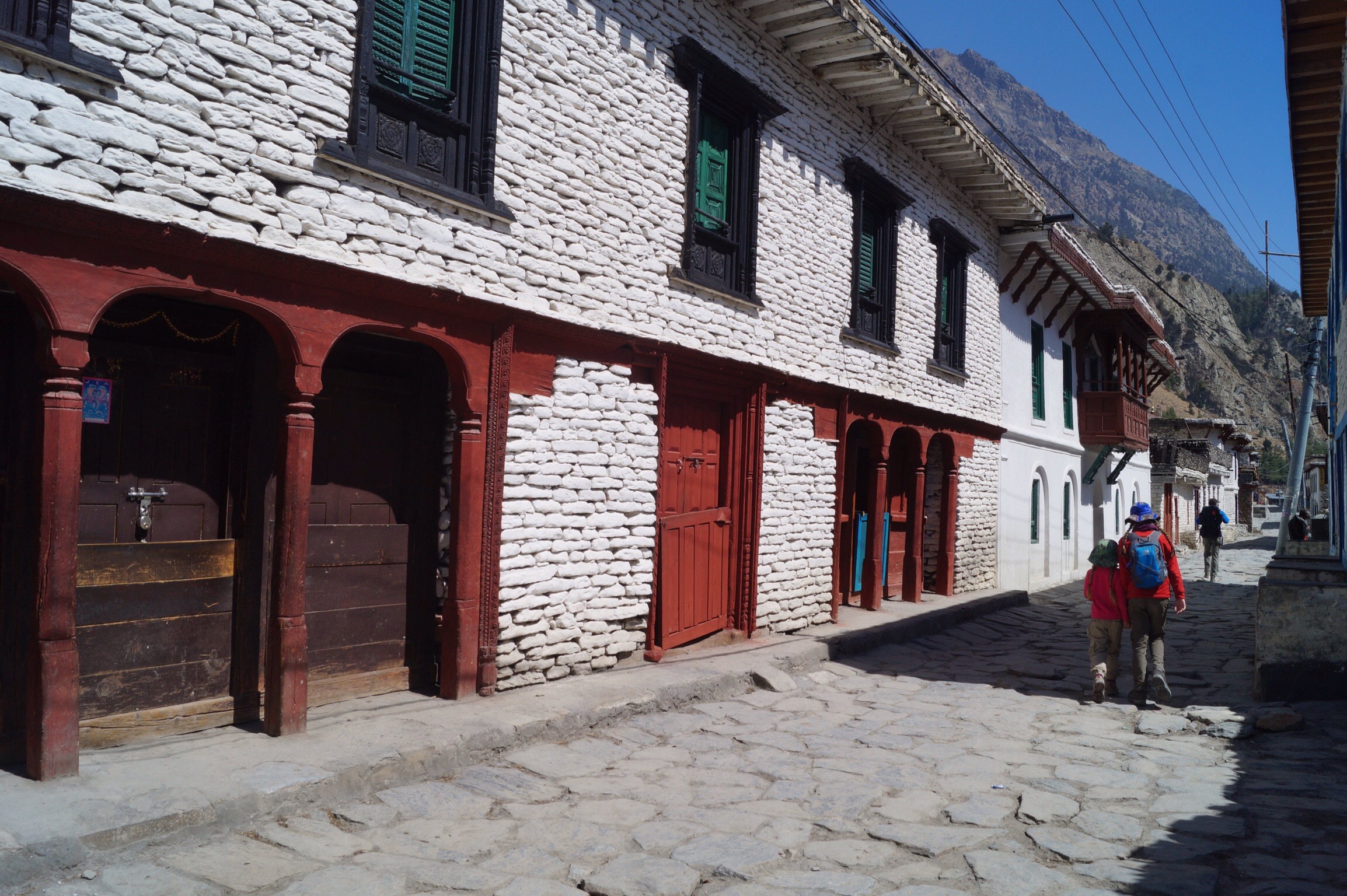
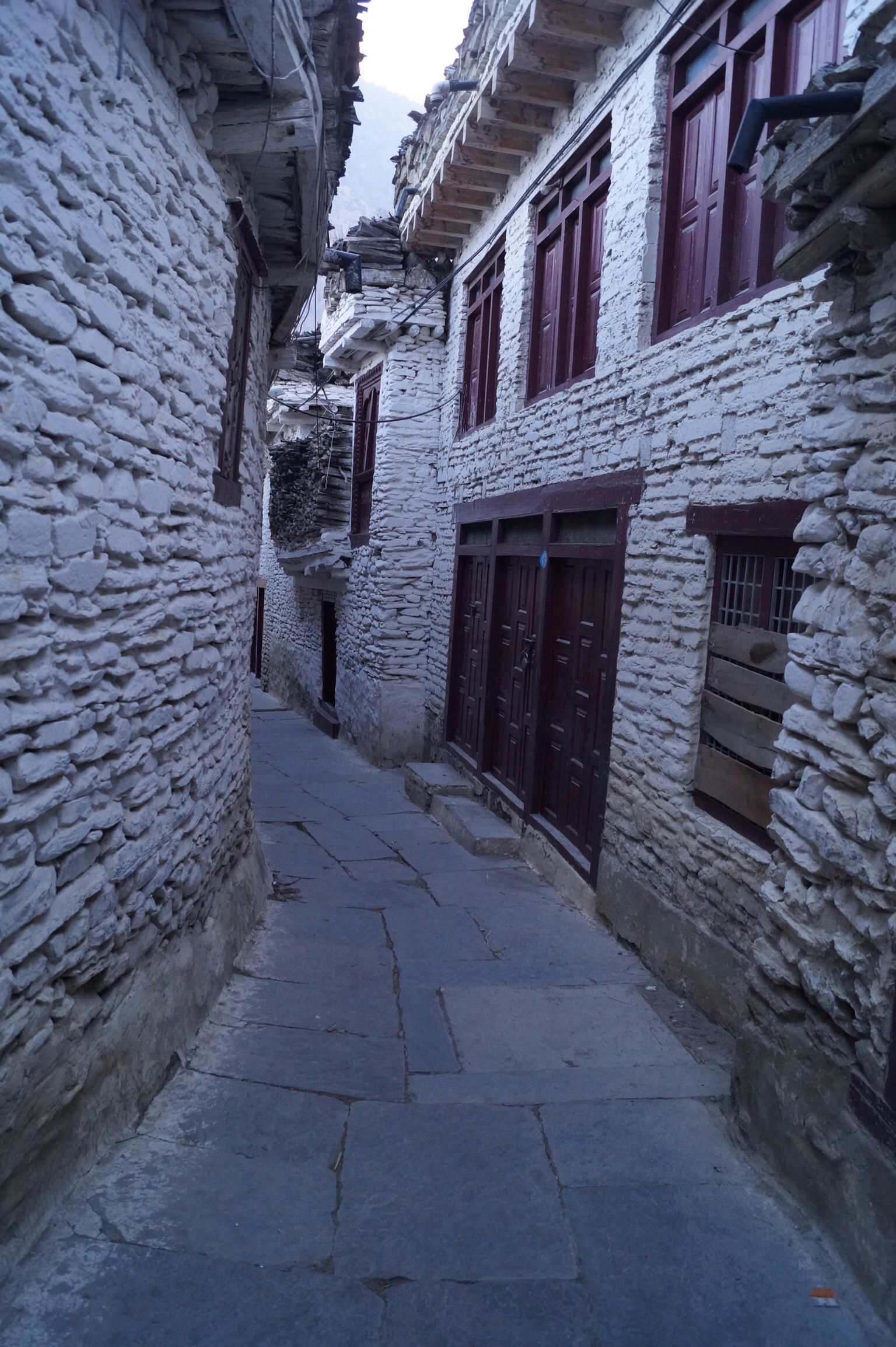
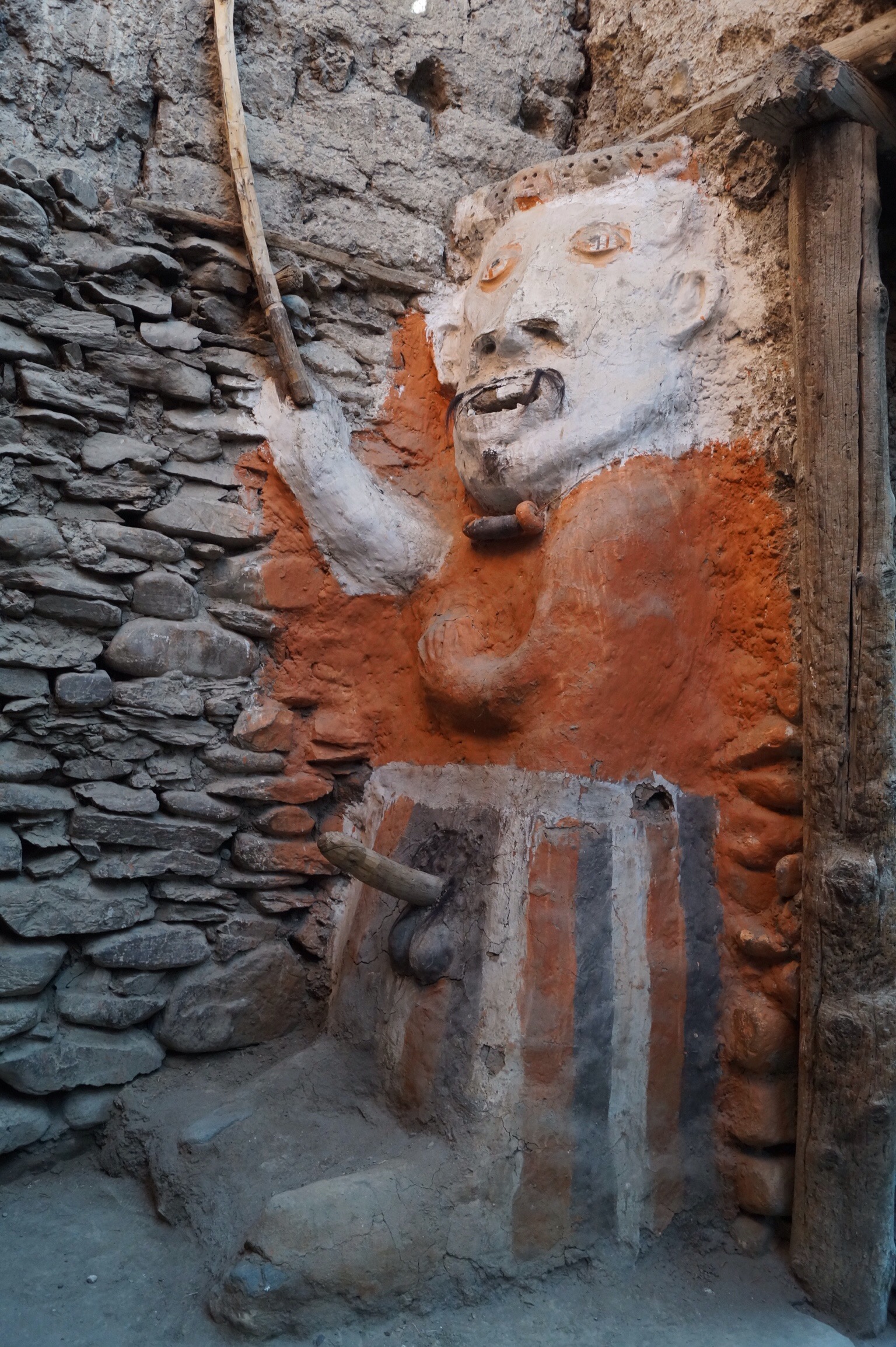
Marpha is also a delightful little town set above the road with flagstone pavings winding there way down the narrow lane and its drainage system running underneath the paving stones. The houses are packed in tight but on the hill was a lovely little monastery. The town is also famous for its apples so it only seemed right that we should tuck into some generous helpings of Apple crumble.

Day Eight - Marpha (2680m) to Kagbeni (2840m) - 18kms
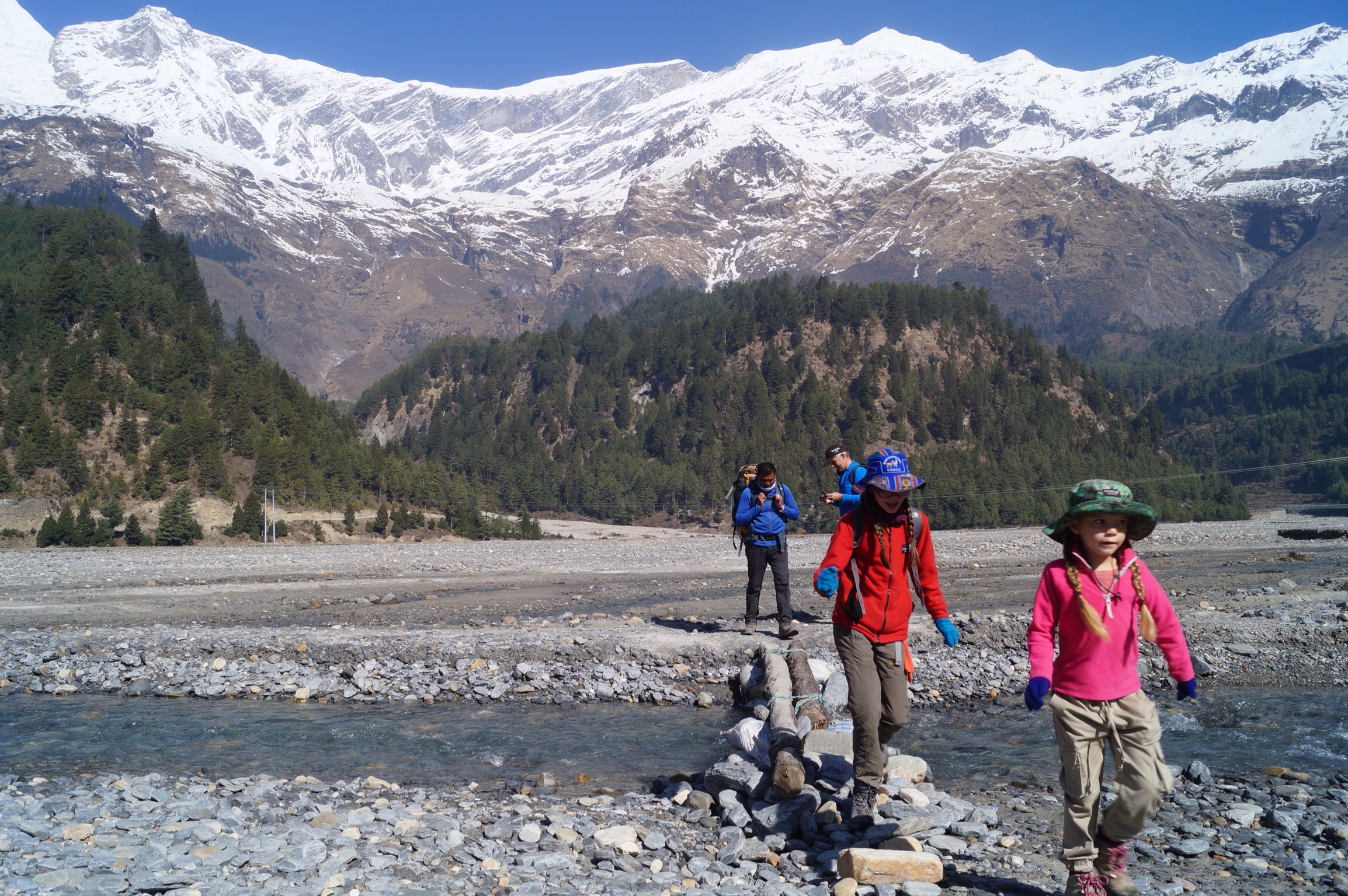
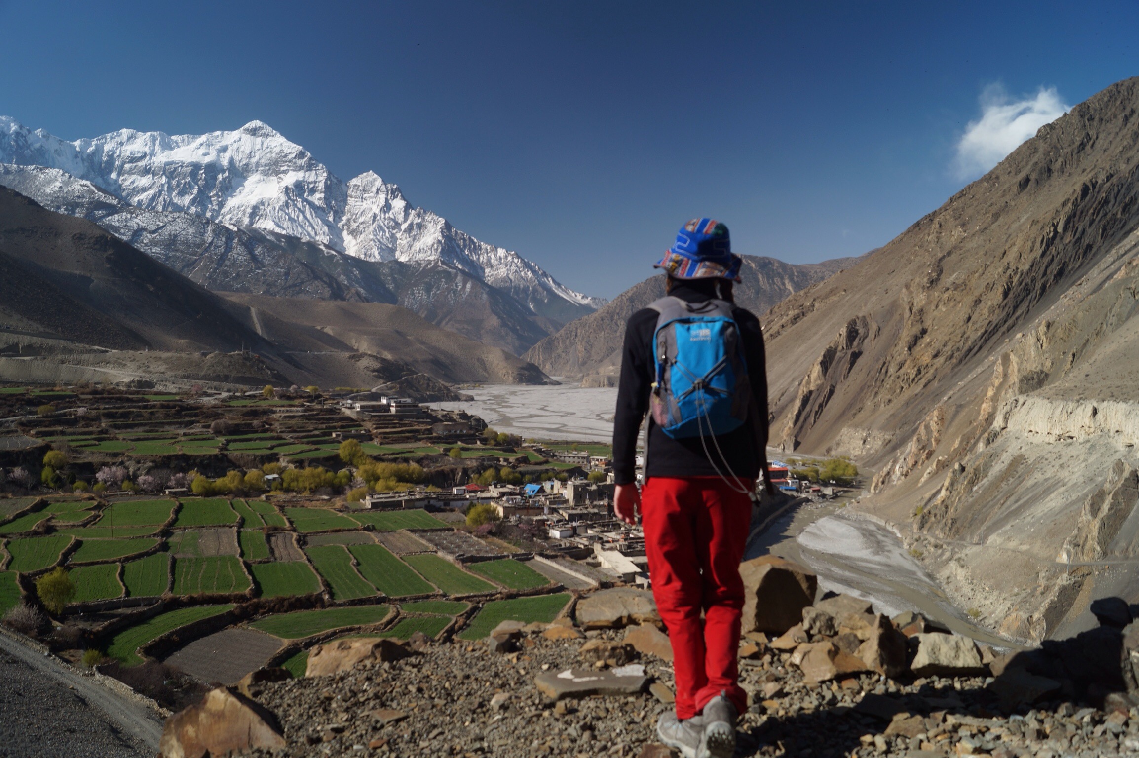
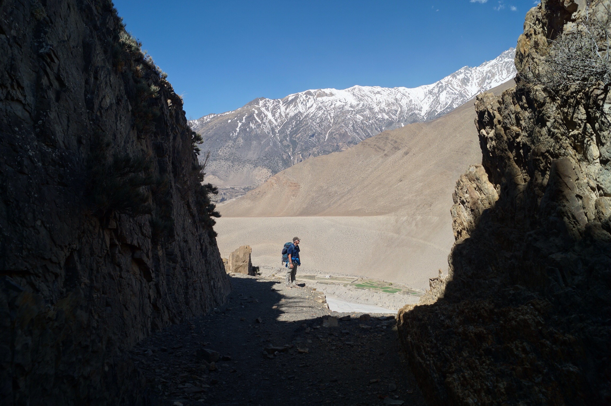
Yet another clear day and another fantastic walk. We stopped off in the now large town of Jomson to book our flights back to Pokhara in a few days before heading into the wind to reach the old village of Kagbeni. As we headed up the valley here it widened and flattened out. Fortunately the notorious headwind was not too strong.

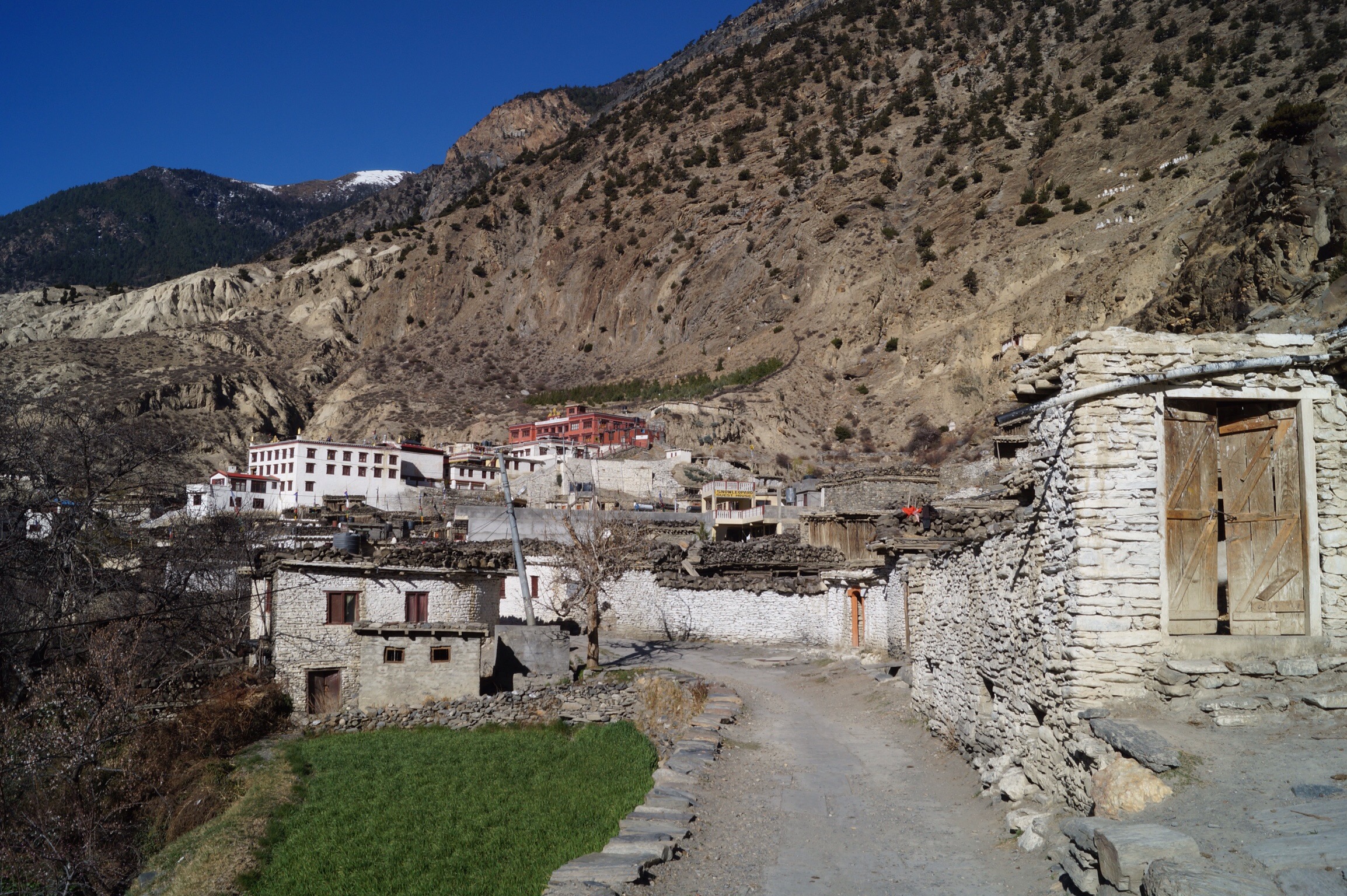
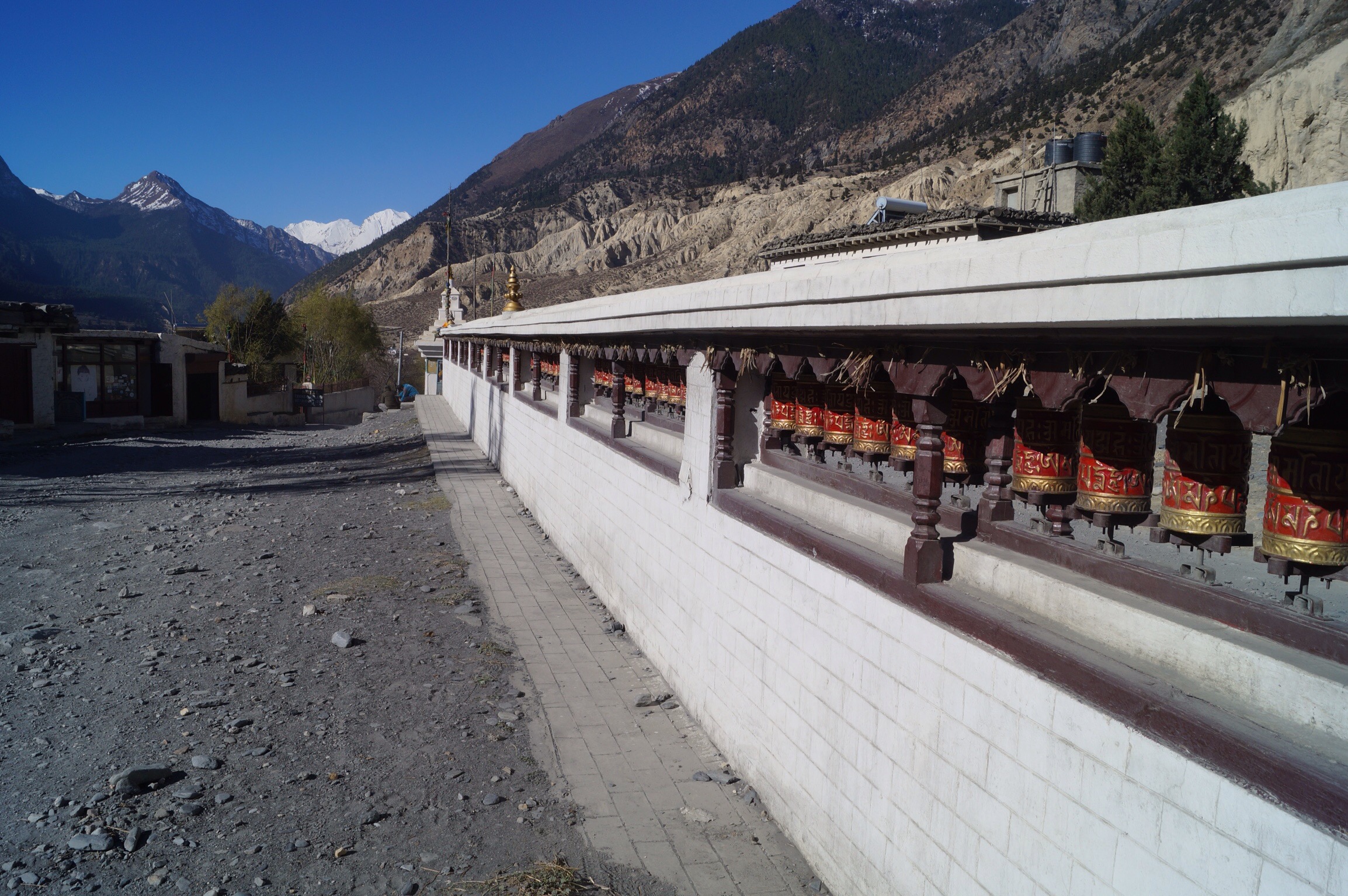
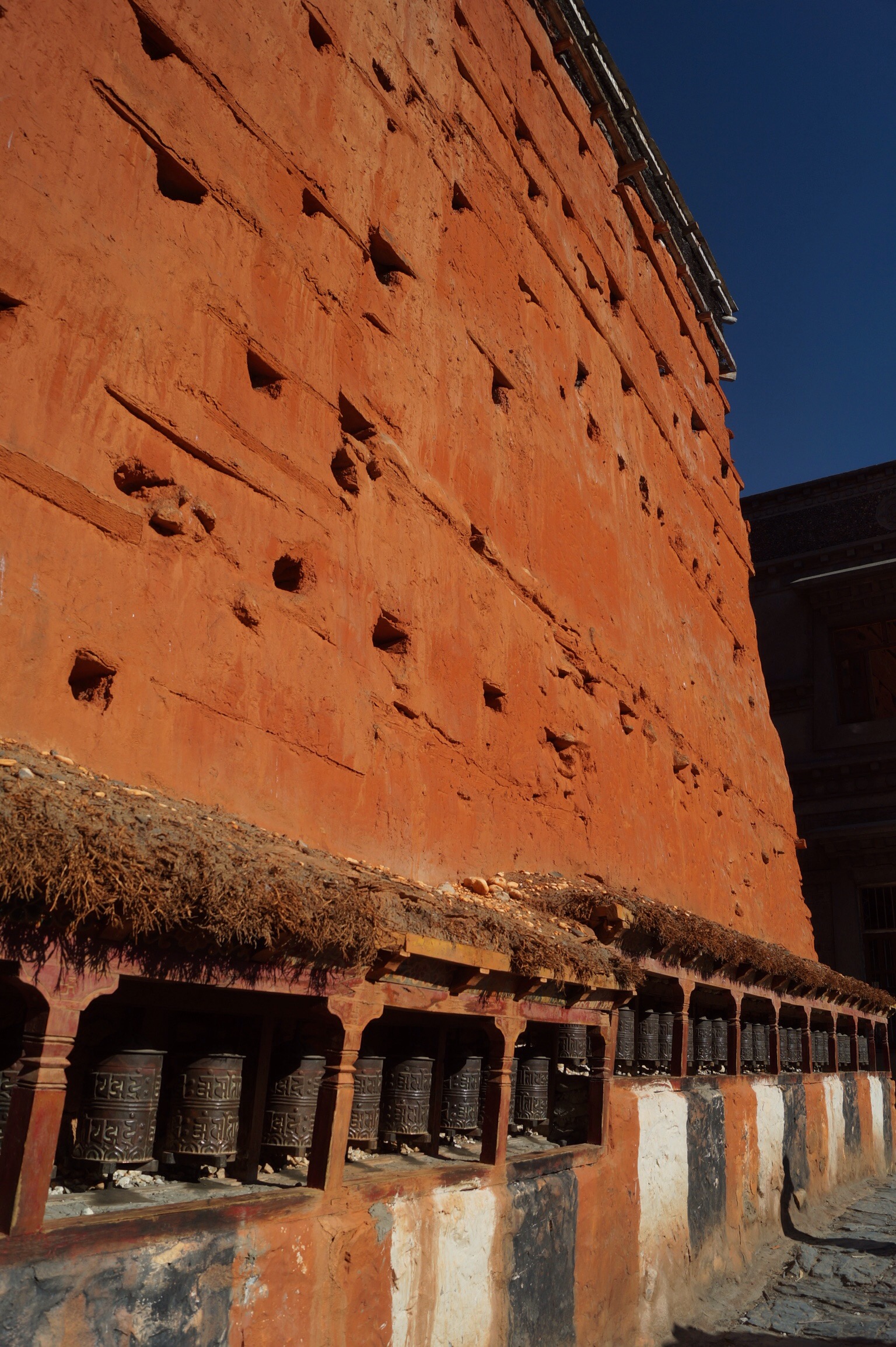
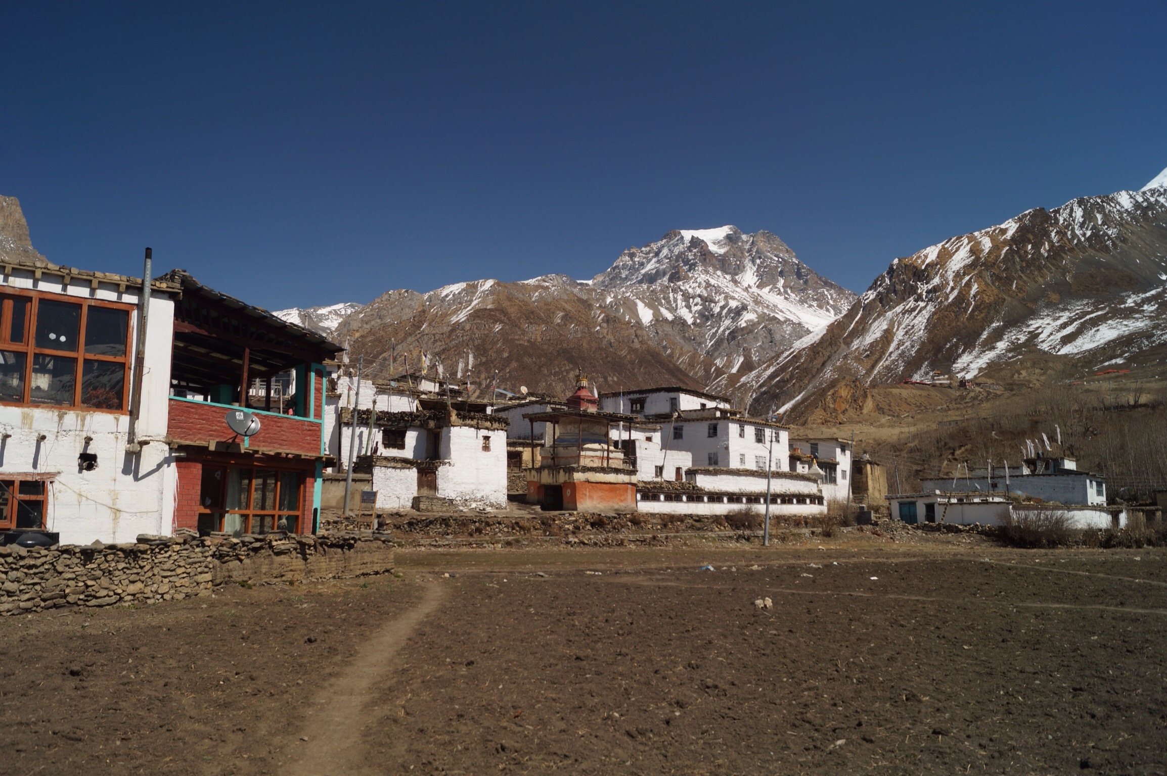
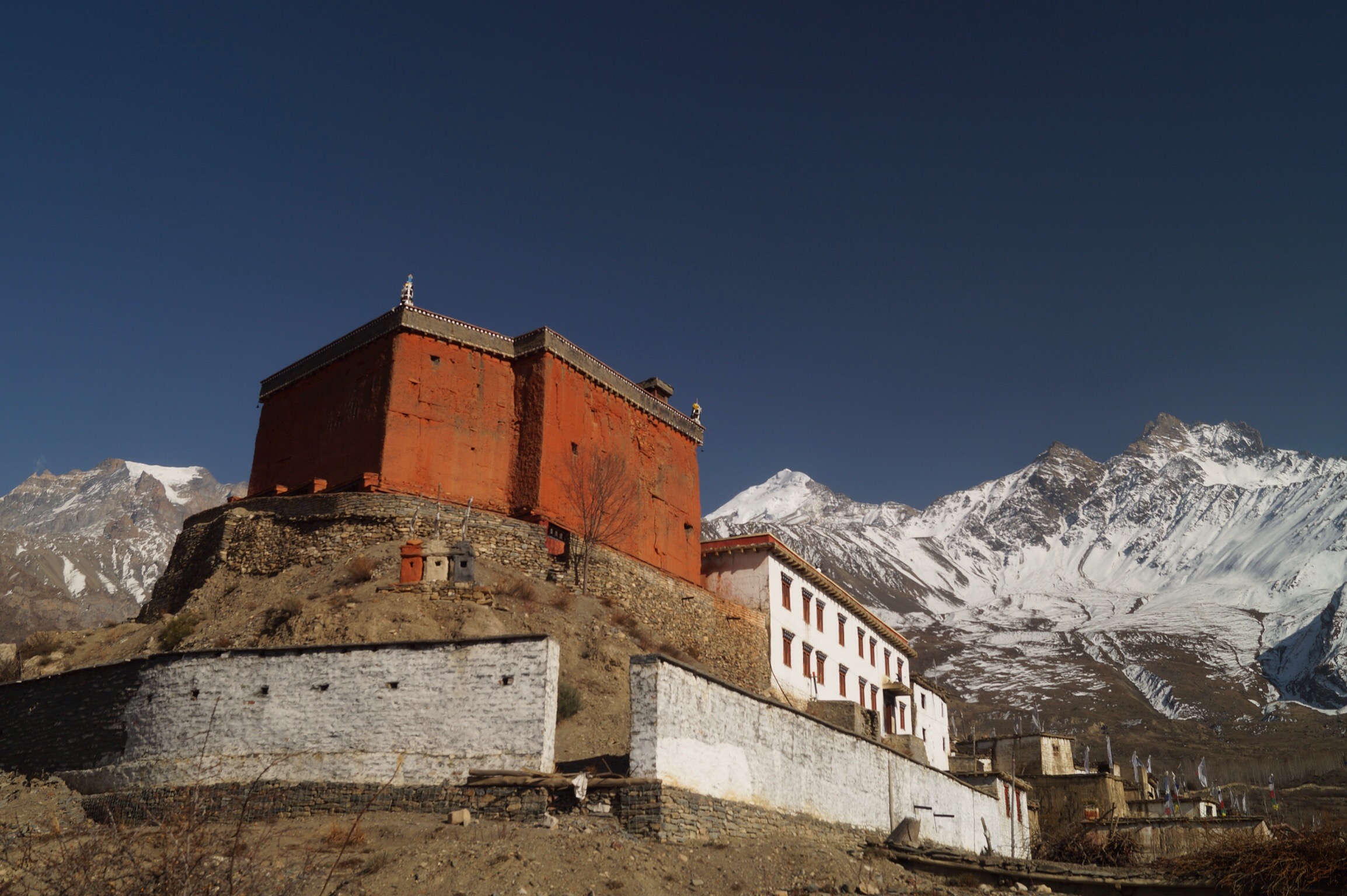
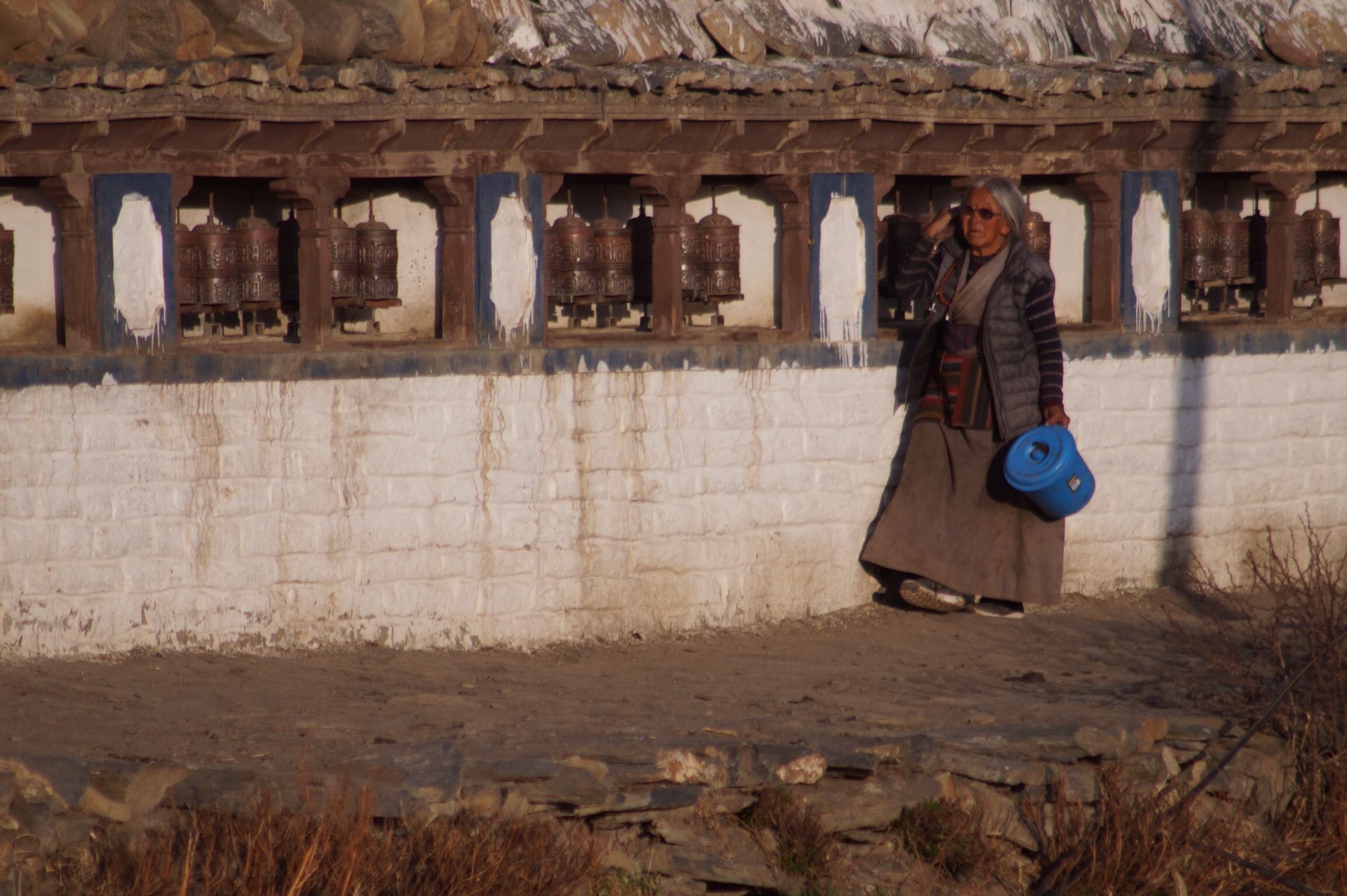
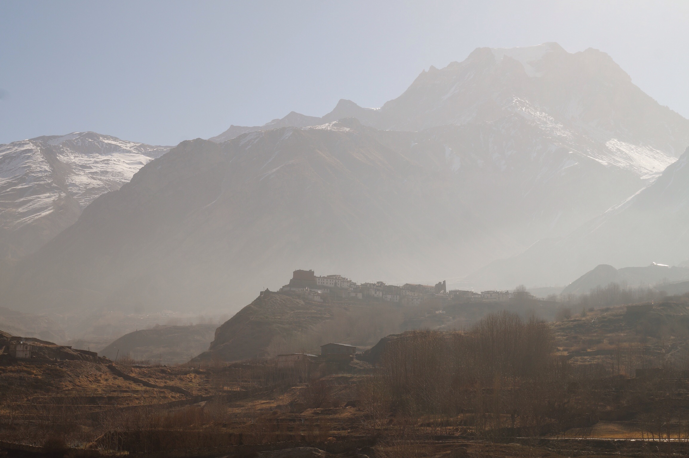
Kagbeni brought back lots of memories for both Gilly and I. It was here that my dad and I had spent our first night trekking 20 years ago. It had left a deep imprint in both our memories. Whilst Kagbeni has certainly seen some development in those 20 years it is still a delightful village with its 500 year old monastery in the middle of town.

On the edge of town you can see up the valley into the restricted kingdom of Mustang. To hike here you needed a special permit. The landscape looked different more like the high plateau than the mountains. Gilly and I looked wistfully, one day we will hike it. Although we might need to be quick as the road was been extended up there too.


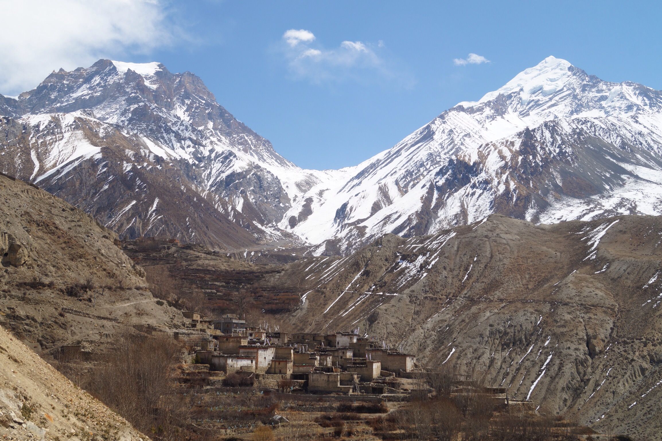
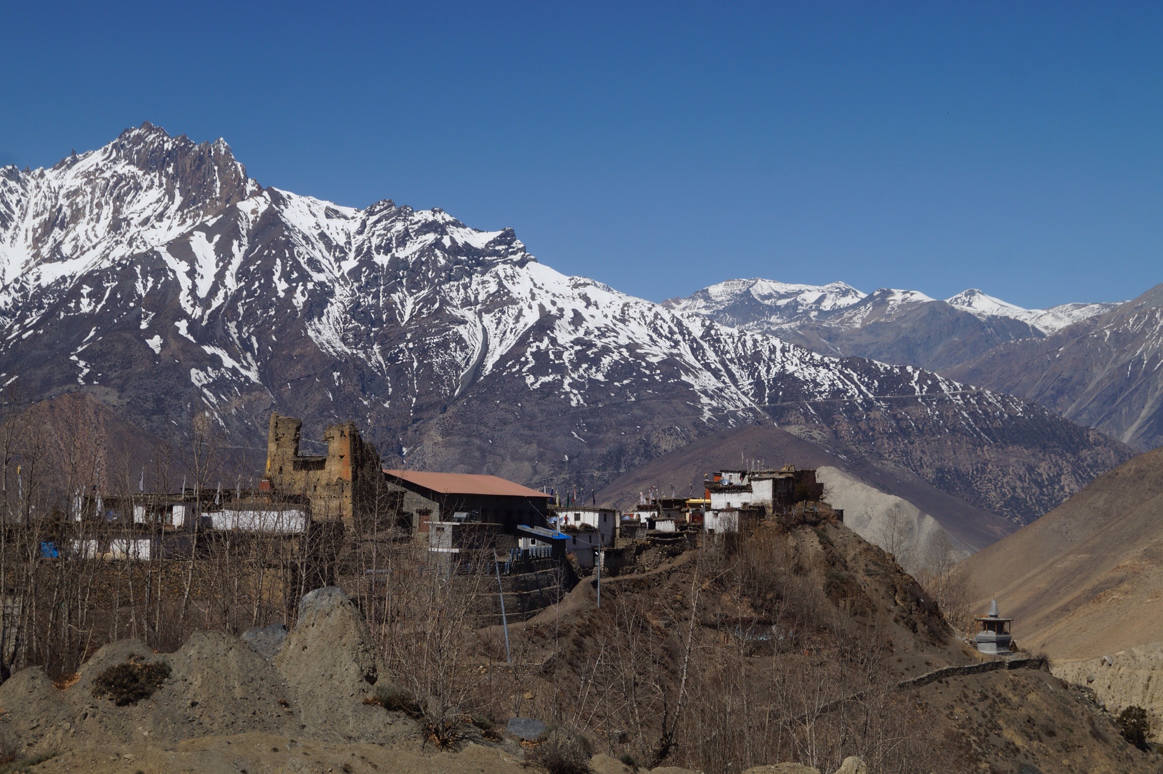
Day Nine - Kagbeni (2840m) to Jhong (3580m) - 9kms
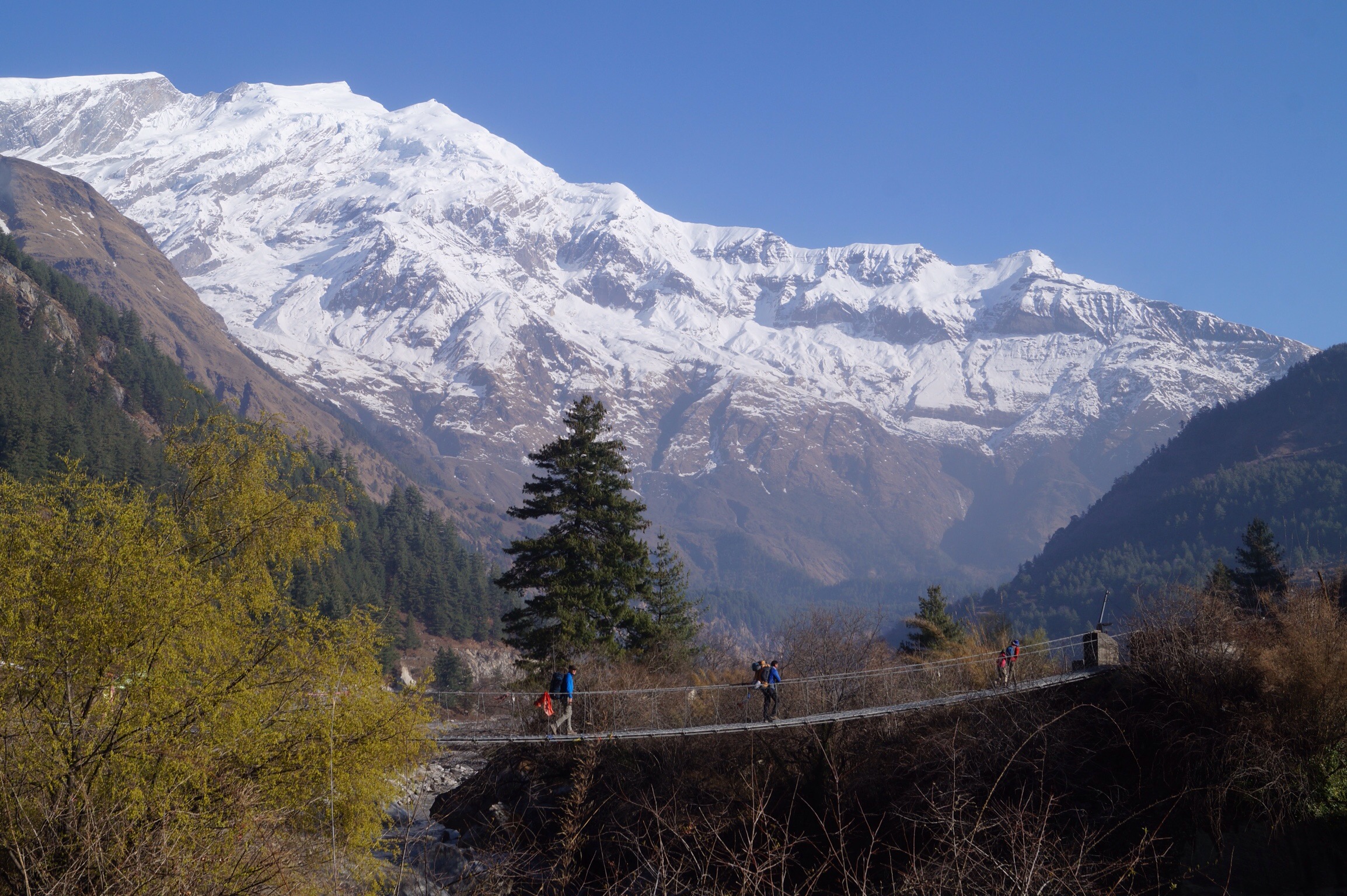
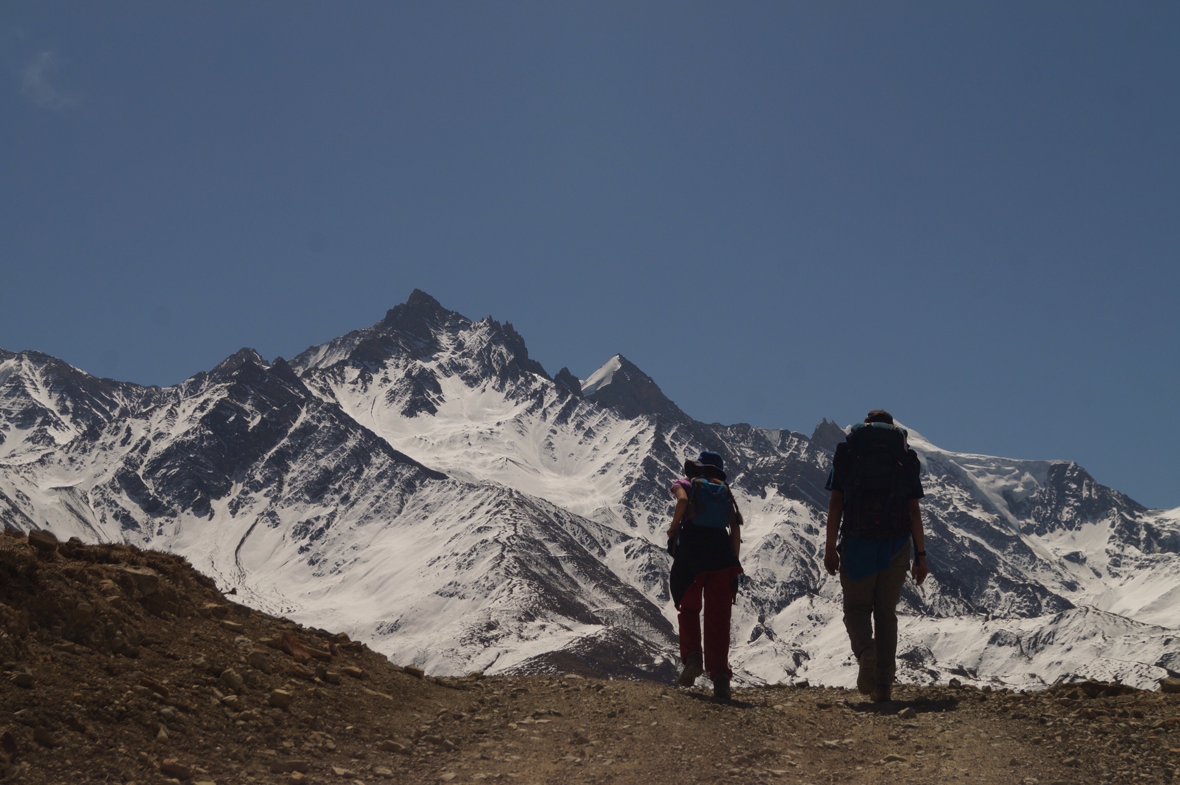
It was a hard slog up to Jhong and you could start to feel the altitude as you walked but again the views both down the valley to Mustang and back across to the mountains were magnificent. We could also see the Thorung La Pass which many people cross when doing a full circuit of the Annapurnas.
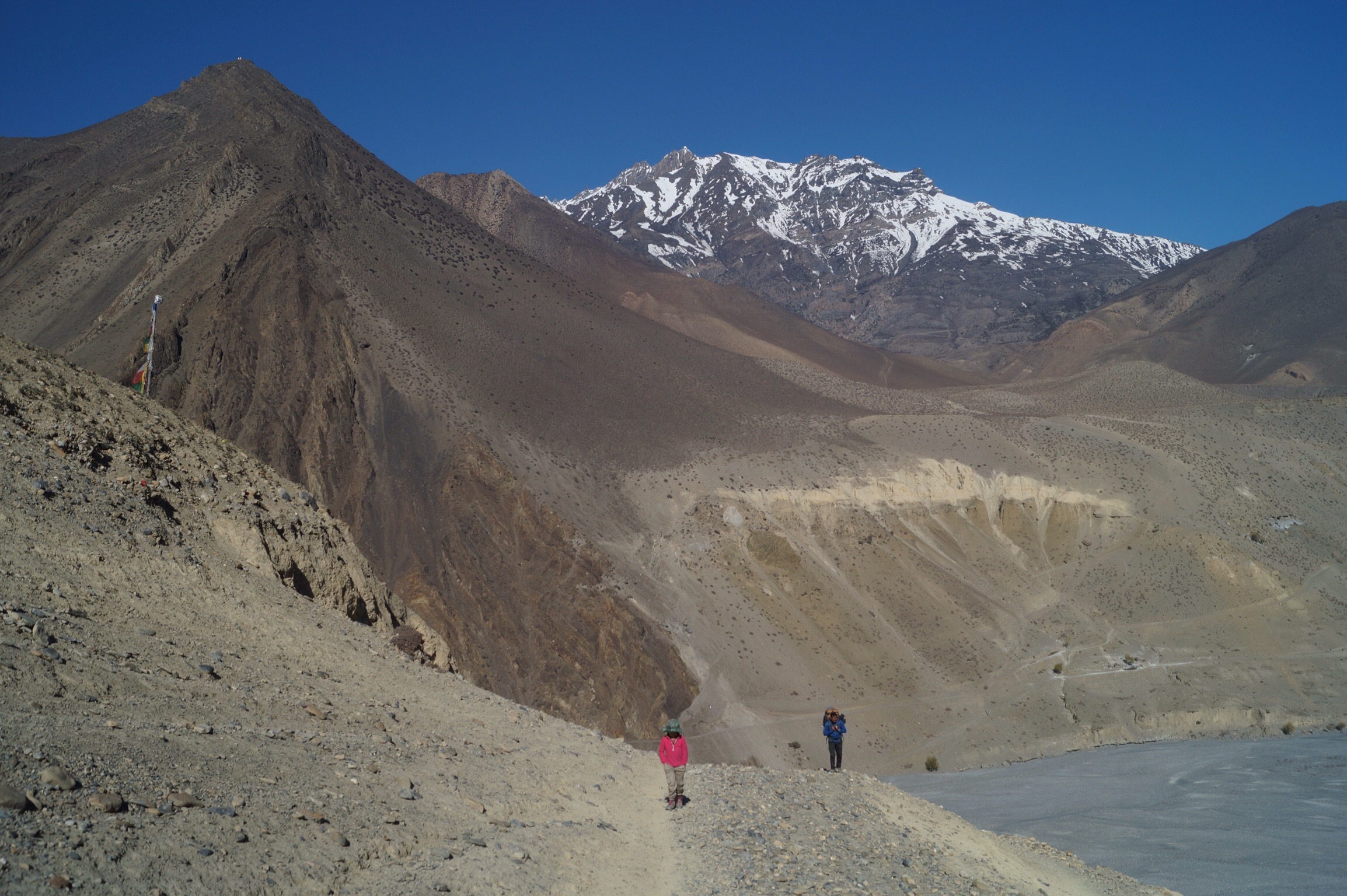
Jhong is off the main route and there were only a few guest houses in town. We found a basic one with a wonderful view but as the sun went down we knew we were in for a cold night.
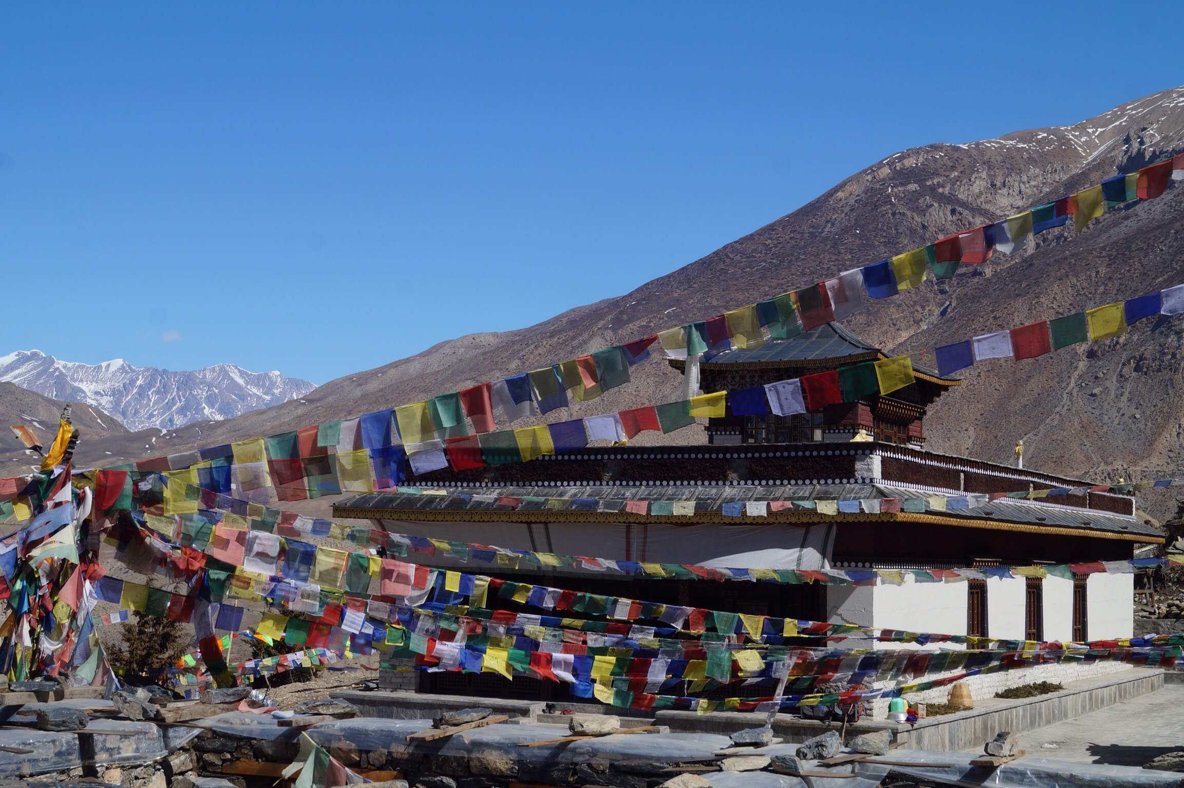
Day Ten - Jhong (3580m) to Jharkot (3500m) via Muktinath (3800m) - 7kms
It was an easy days walk today with the sun shining and the sky clear allowing the snow capped peaks to be perfectly set against the deep blue sky. We walked the short distance to the temples at Muktinath. Here both a Buddhist and a Hindu temple were in the same walled complex. Most of the pilgrims today came by jeep rather than on foot and after the majesty of been on the mountains I was not that impressed with the man made shrines when there was so much natural beauty nearby.

I am not a religious person or particularly spiritual but I can see that a shrine set in a beautiful part of the mountains that takes a long walk to get to has some significance. But building a road so that "pilgrims" can be bused in to stay in unsightly concrete hotels to take selfies of themselves at the shrine seems to me to be some what missing the point, but then what do I know.


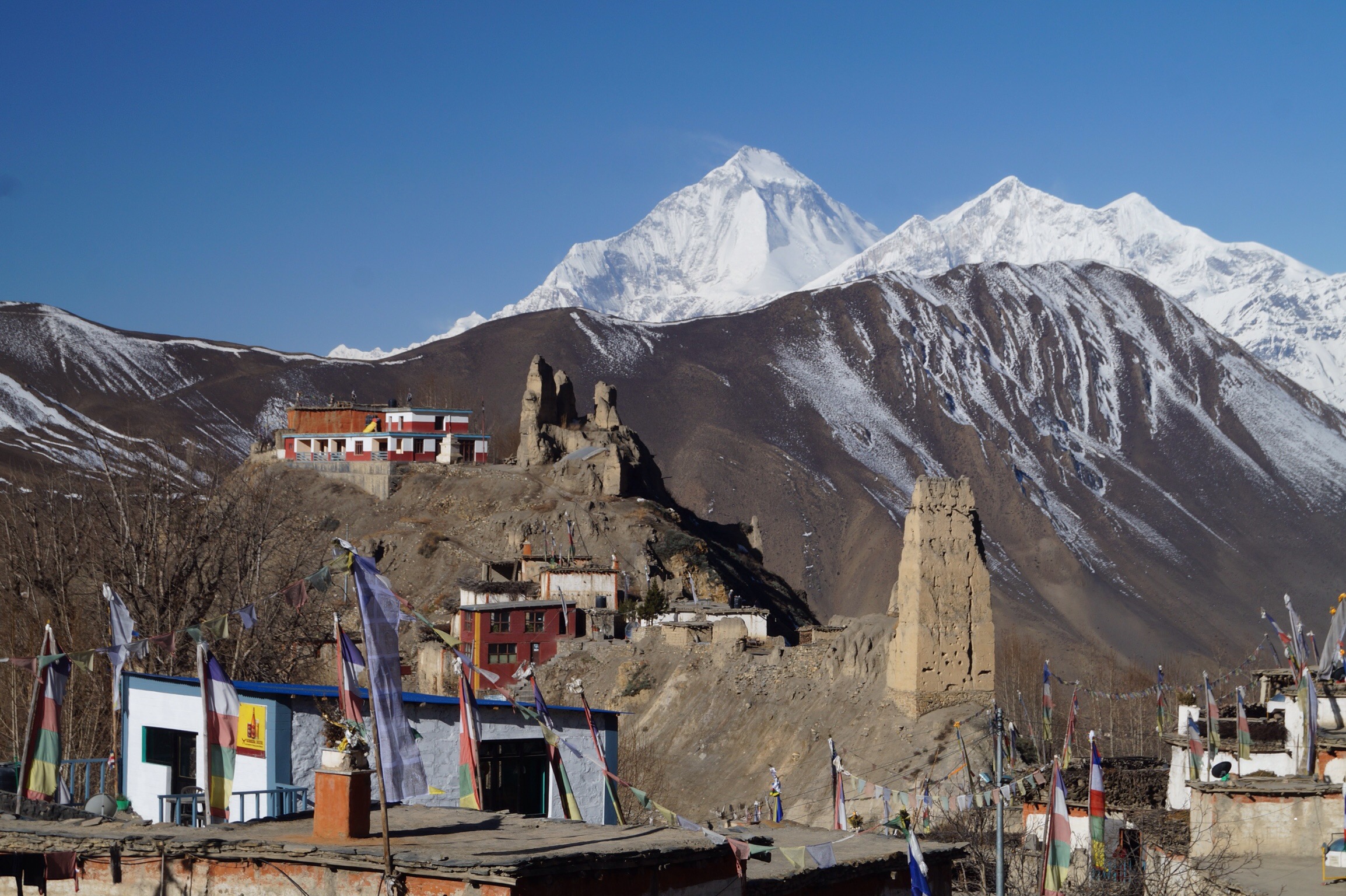
The town of Muktinath is also been developed and we could see lots of new buildings being built so on the recommendation of our guide, Gil, we continued down a short way to the still traditional village of Jharkot which had its own monastery perched on the edge of the valley.
We arrived in time for lunch and decided after our previous days exertions that a relaxing afternoon was in order.
Day Eleven - Jharkot (3500m) to Jomsom (2760m) - 18kms
The weather held for our last day of walking. As we walked back down the valley we were rewarded with more spectacular views. Unfortunately most of the walk back was along the new road and it was dusty with the work lorries and the buses and jeeps, so not the most pleasant walk we have had.
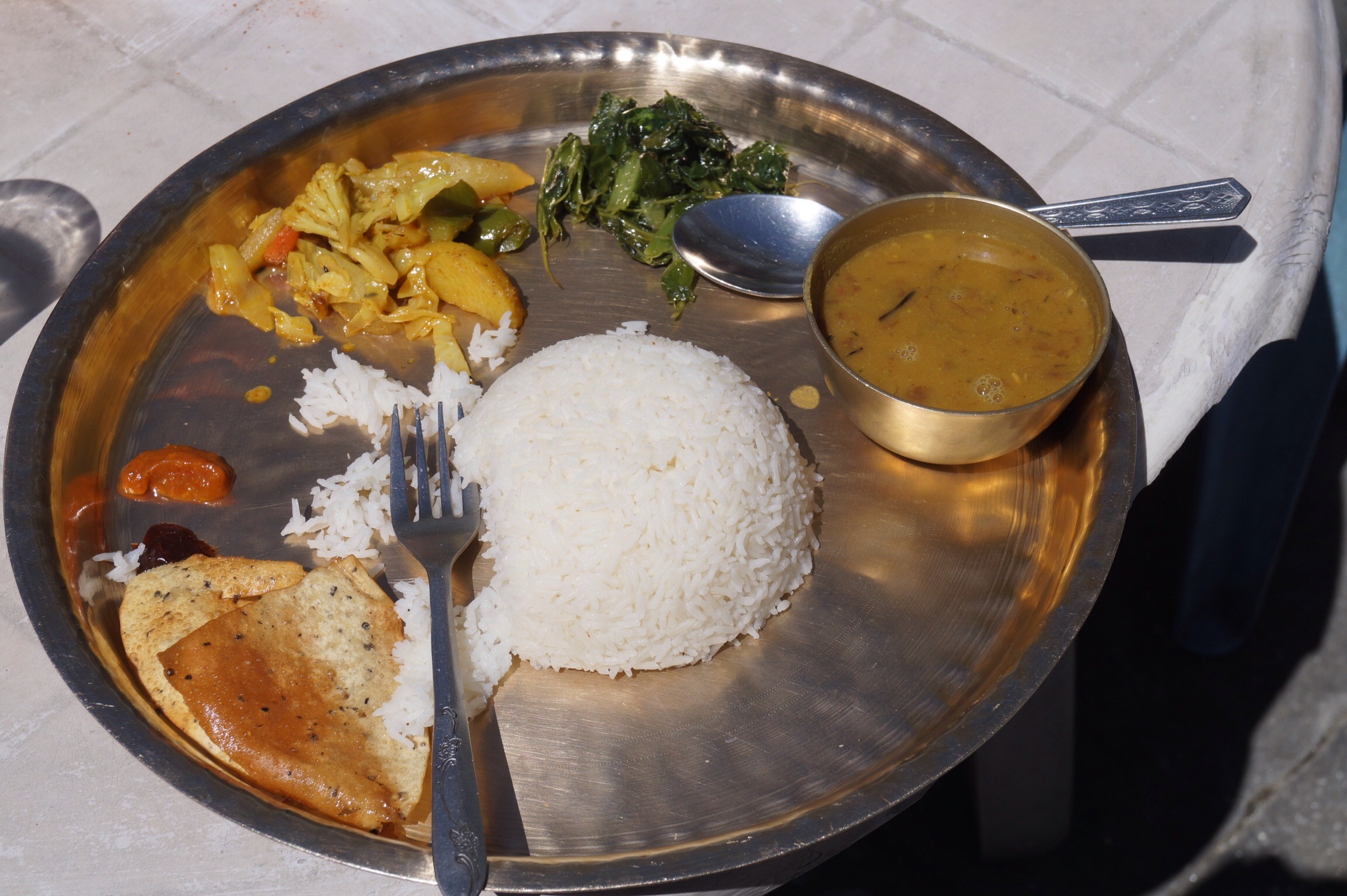
As the wind was blowing up the valley we decided to do the whole walk before lunch. Arriving in Jomsom, the bustling little town with an airport was quite a shock after all the time in tiny hamlets in the mountains but we were still able to have one last Dahl Baht for lunch before a well earned hot shower.
Day Twelve - Jomsom to Pokhara by plane
After hiking up the valley for 11 days it only took 20 minutes to fly back the way we had come to Pokhara. Just chance for one last look at the mountains before they disappeared behind the clouds and we descended into Pokhara.
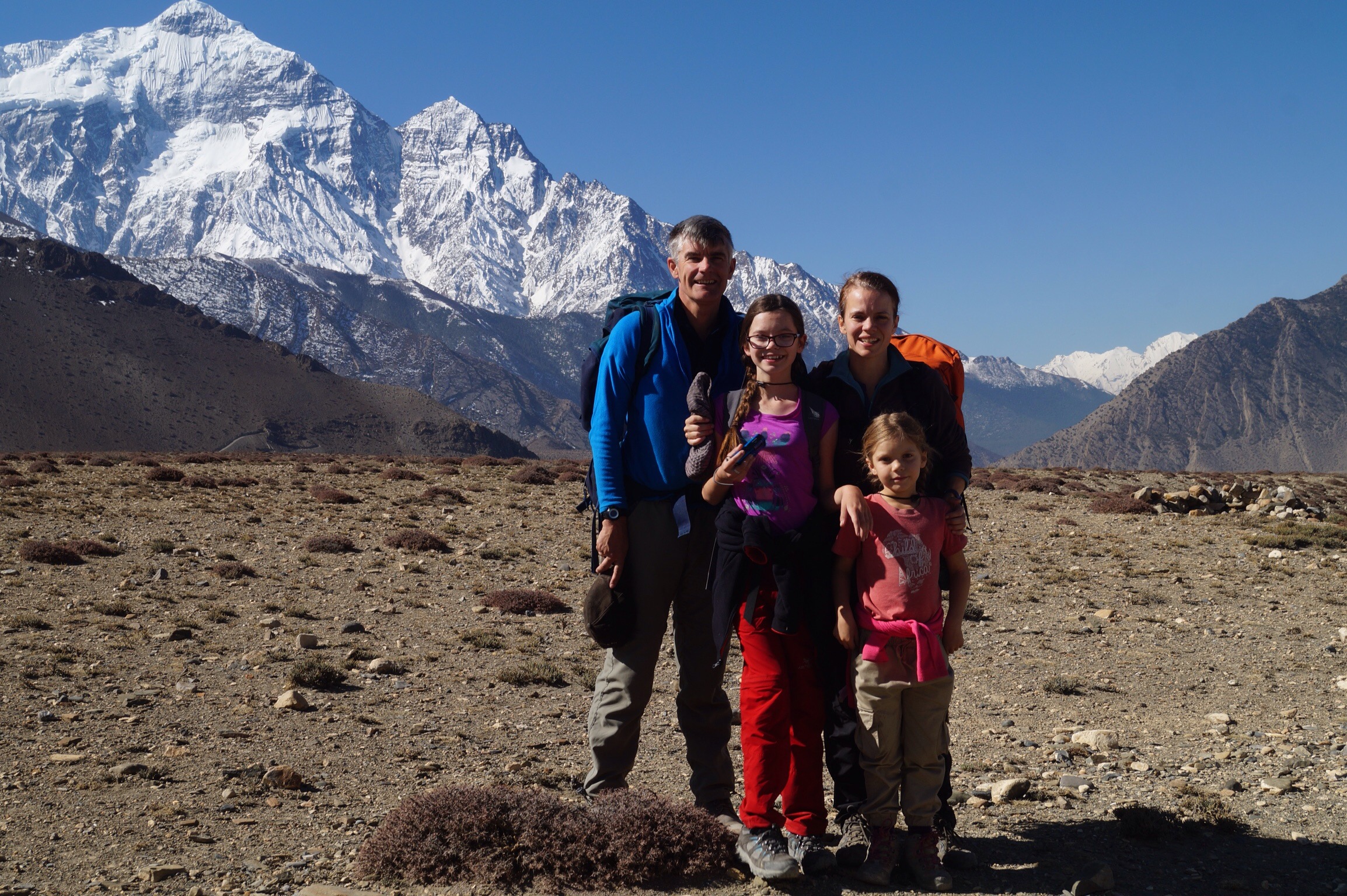
We had all thoroughly enjoyed our mountain trek. Gilly and I were amazed at how well both Alisha and Lucy had walked and how they had enjoyed staying in the quirky tea houses, chatting with other trekkers and just the whole experience. The views along the way were spectacular and simply took your breath away and whilst these will be the enduring memories we also loved seeing traditional Nepali life in the small mountain hamlets.
Both Gilly and I enjoyed partially retracing a route we both had happy memories of taking many years before. Whilst the views and some of the ancient villages were unchanged its clear development is on its way and that the road is changing things quickly. For the locals most of this change is for the better, they are able to receive more money for their produce and bringing goods in is cheaper. Also medical care is now much closer to them. For the walking tourist it's not so good although the road can be avoided in most places. In a few years time though I think it will have changed significantly.
We arrived back in Pokhara very happy after a wonderful trip. Now back to some more mundane things like sorting out the dirty washing and deciding just how we were going to get out of the Indian subcontinent.
So many great memories refreshed when reading your post ! It once again points out that we abslolutely want to go back to this wonderful country Nepal with the kids. We’ll still wait for a while, since Yan has not really been in the mood for travelling in the past months (13, real teenager…) but he’s slowly changing : he enjoyed a lot spending a few days in Marakech with his father 2 weeks ago.
Almost 3 years after being back to France from Latine America, we (father and mother) need to move again !! Maybe we’ll cross you on your way back ?
Enjoy every single moment of your overlanding life !
Carine, Andreas and co.
Great to hear from you. We loved trekking, so much that we are hoping to go again tomorrow for a week. We will try and head a little higher as we are heading to Tibet so need to see how everyone is. We will also be back in Europe in a few months. I am sure settling back in will be strange.
Steve, Happy Birthday to You !!!! When is your stop in Prague ? Peter Chrenko
Many thanks Peter. We might make it to Prague right at the end of our trip in August!
Great blog Steve, lots of memories for me. I too did the flight from Jomson to Pokhara after about 18 days trekking and coming over the high pass at 5420 metres on 5 October 2014 at 8:13am (it is still on my watch as the highest point I have trekked). Tiring and beautiful at the same time. Great effort by Alisha and Lucy to walk at altitude.
Thanks Noel. The pass didn’t look that bad in the sunlight but I can imagine it was quite some feat getting across. Well worth remembering the achievement. Good luck with your Camino walk.